TopoQuest Logo
Do you find TopoQuest useful?
Help keep TopoQuest running and adding new maps/features by donating!
Bitcoin:  19c7KJd3qBynnjoSw5npx9KScwjBe4ifkT
Litecoin:  LXs6TkuXGGXo1vDsWCkWVdjQX94eUKd6ui
Home View Maps Find Maps Find Places Resources & Links


Loganton, Pennsylvania Topographic Map

USGS Map Title: Loganton, PA
USGS Map MRC: 41077A3
DRG (GeoTIFF) Download: o41077a3.tif


Neighboring USGS Topographic Map Quads:


  Lock Haven, PA  
41077B4
 

  Jersey Shore, PA  
41077B3
 

  Linden, PA  
41077B2
 

  Mill Hall, PA  
41077A4
 

  Loganton, PA  
41077A3
 

  Carroll, PA  
41077A2
 

  Millheim, PA  
40077H4
 

  Woodward, PA  
40077H3
 

  Hartleton, PA  
40077H2


Map MRC Location:

N42°
W78°
N42°
W77°
H8 H7 H6 H5 H4 H3 H2 H1
G8 G7 G6 G5 G4 G3 G2 G1
F8 F7 F6 F5 F4 F3 F2 F1
E8 E7 E6 E5 E4 E3 E2 E1
D8 D7 D6 D5 D4 D3 D2 D1
C8 C7 C6 C5 C4 C3 C2 C1
B8 B7 B6 B5 B4 B3 B2 B1
A8 A7 A6 A5 A4 A3 A2 A1
N41°
W78°
N41°
W77°

Loganton, PA USGS 1:24K Topographic Map Preview:
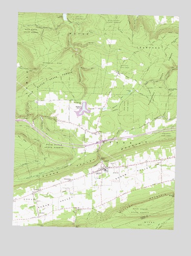
Loganton, PA USGS Topographic Map
Click on map above to begin viewing in our Map Viewer.

This topographic map contains these locations and features:
Feature Name Type Latitude Longitude GNIS ID View Map
Blue SpringSpringN41.0204°W77.3302°1196769View Map
Boiler TrailTrailN41.0456°W77.3666°1169952View Map
BoonevillePopulated PlaceN41.0201°W77.3575°1169997View Map
Borough of LogantonCivilN41.0338°W77.3023°1215117View Map
Bull RunStreamN41.0103°W77.3280°1170650View Map
Chestnut FlatFlatN41.0951°W77.3528°1171703View Map
Cooper RunStreamN41.0634°W77.3541°1172422View Map
East Kammerdiner RunStreamN41.1209°W77.3378°1173826View Map
Erron TrailTrailN41.0834°W77.3500°1174313View Map
Fairview Evangelical CemeteryCemeteryN41.0364°W77.2984°1174496View Map
Game Refuge TrailTrailN41.0403°W77.3389°1206933View Map
Gardner TrailTrailN41.0812°W77.3583°1175443View Map
GreenburrPopulated PlaceN41.0059°W77.3544°1176138View Map
Hall HollowValleyN41.0100°W77.3131°1176394View Map
Hall Spring (historical)SpringN41.0023°W77.2978°1196772View Map
Hopple HollowValleyN41.0479°W77.3080°1177410View Map
Jamison RunStreamN41.0678°W77.3161°1177986View Map
Kammerdiner Cross Line TrailTrailN41.1084°W77.3550°1178210View Map
Kemmerer SchoolSchoolN41.0245°W77.2744°1196771View Map
Kemmerer SpringSpringN41.0292°W77.3136°1196770View Map
Kemmerer TrailTrailN41.0056°W77.2752°1206922View Map
Kettle TrailTrailN41.0448°W77.3489°1178428View Map
Kyler TrailTrailN41.1117°W77.2741°1178722View Map
Lerch TrailTrailN41.1173°W77.2800°1179210View Map
LogantonPopulated PlaceN41.0342°W77.3066°1179828View Map
Loganton Post OfficePost OfficeN41.0333°W77.3098°2772800View Map
Lucus RunStreamN41.1195°W77.3330°1180065View Map
Matter RunStreamN41.0937°W77.3261°1180554View Map
Mill CreekStreamN41.0301°W77.3022°1181128View Map
Miller TrailTrailN41.0956°W77.2627°1181239View Map
Mount Pleasant ChurchChurchN41.0556°W77.3125°1181821View Map
Mount Zion ChurchChurchN41.0917°W77.2953°1181933View Map
Nittany Mountain TrailTrailN41.0901°W77.3447°1182482View Map
Old Schracktown CemeteryCemeteryN41.0220°W77.3342°1182937View Map
Parker Shanty TrailTrailN41.1070°W77.2586°1183321View Map
Pepper RunStreamN41.0615°W77.3528°1183572View Map
Rockey School (historical)SchoolN41.0651°W77.2522°1196768View Map
RosecransPopulated PlaceN41.0559°W77.3114°1185465View Map
Rosecrans Bog Natural AreaAreaN41.0792°W77.2914°1201567View Map
SchracktownPopulated PlaceN41.0273°W77.3319°1187123View Map
Smeltz Pond TrailTrailN41.0920°W77.3330°1187846View Map
Snead Hol TrailTrailN41.0590°W77.3591°1187937View Map
Spring RunStreamN41.1059°W77.3319°1188262View Map
Spruce RunStreamN41.0645°W77.3639°1188348View Map
Sugar Grove SchoolSchoolN41.0109°W77.3247°1188939View Map
Sugar Valley Area School (historical)SchoolN41.0342°W77.3033°1188979View Map
Sugar Valley Volunteer Fire Company Station 13BuildingN41.0353°W77.3082°2644808View Map
Sulphur SpringSpringN41.0403°W77.3072°1189012View Map
Township of CrawfordCivilN41.1066°W77.2523°1216258View Map
Township of GreeneCivilN41.0446°W77.2671°1216262View Map
Tunis RunStreamN41.0040°W77.2594°1189919View Map
Warren H Ohl DamDamN41.0734°W77.3197°1195247View Map
Warren H Ohl ReservoirReservoirN41.0688°W77.3225°1180706View Map
Washburn RunStreamN41.0634°W77.3544°1190618View Map

Note: Coordinates in the location and feature list above are referenced to NAD83 datum.


Copyright (C) 2008-2024 Ryan Niemi / Sunset Dynamics ... All Rights Reserved