TopoQuest Logo
Do you find TopoQuest useful?
Help keep TopoQuest running and adding new maps/features by donating!
Bitcoin:  19c7KJd3qBynnjoSw5npx9KScwjBe4ifkT
Litecoin:  LXs6TkuXGGXo1vDsWCkWVdjQX94eUKd6ui
Home View Maps Find Maps Find Places Resources & Links


Herscher, Illinois Topographic Map

USGS Map Title: Herscher, IL
USGS Map MRC: 41088A1
DRG (GeoTIFF) Download: o41088a1.tif


Neighboring USGS Topographic Map Quads:


  Essex, IL  
41088B2
 

  Bonfield, IL  
41088B1
 

  Bourbonnais, IL  
41087B8
 

  Buckingham, IL  
41088A2
 

  Herscher, IL  
41088A1
 

  West Kankakee, IL  
41087A8
 

  Cabery, IL  
40088H2
 

  Piper City NE, IL  
40088H1
 

  Clifton, IL  
40087H8


Map MRC Location:

N42°
W89°
N42°
W88°
H8 H7 H6 H5 H4 H3 H2 H1
G8 G7 G6 G5 G4 G3 G2 G1
F8 F7 F6 F5 F4 F3 F2 F1
E8 E7 E6 E5 E4 E3 E2 E1
D8 D7 D6 D5 D4 D3 D2 D1
C8 C7 C6 C5 C4 C3 C2 C1
B8 B7 B6 B5 B4 B3 B2 B1
A8 A7 A6 A5 A4 A3 A2 A1
N41°
W89°
N41°
W88°

Herscher, IL USGS 1:24K Topographic Map Preview:
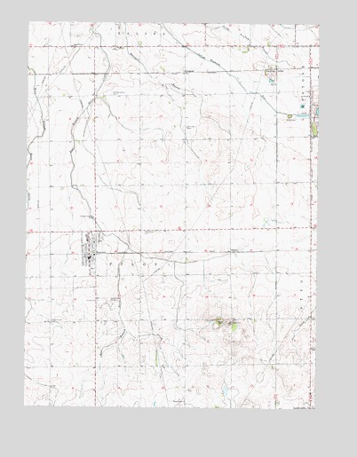
Herscher, IL USGS Topographic Map
Click on map above to begin viewing in our Map Viewer.

This topographic map contains these locations and features:
Feature Name Type Latitude Longitude GNIS ID View Map
DickeysPopulated PlaceN41.0509°W88.0373°422625View Map
GoodrichPopulated PlaceN41.1089°W88.0581°409153View Map
Grand Prairie CemeteryCemeteryN41.0278°W88.1139°409260View Map
Grand Prairie United CemeteryCemeteryN41.1164°W88.1052°1810631View Map
Grand Prairie United Methodist ChurchChurchN41.1167°W88.1051°409262View Map
HerscherPopulated PlaceN41.0492°W88.0978°410110View Map
Herscher Christian ChurchChurchN41.0508°W88.0936°2096429View Map
Herscher Elementary SchoolSchoolN41.0542°W88.0984°1810642View Map
Herscher High SchoolSchoolN41.0550°W88.0987°1810643View Map
Herscher Police DepartmentBuildingN41.0513°W88.0953°2756773View Map
Herscher Post OfficePost OfficeN41.0477°W88.0973°2788310View Map
Herscher United Methodist ChurchChurchN41.0525°W88.1003°1810644View Map
LehighPopulated PlaceN41.1103°W88.0181°422906View Map
Mount Hope CemeteryCemeteryN41.0911°W88.0564°413980View Map
Pilot - Herscher Township Fire Protection DistrictBuildingN41.0502°W88.0973°2682088View Map
Pilot Center (historical)Populated PlaceN41.0575°W88.0759°1810673View Map
Pilot Center CemeteryCemeteryN41.0571°W88.0750°415677View Map
Pilot HillSummitN41.0281°W88.0387°415682View Map
Saint Margaret Mary Roman Catholic ChurchChurchN41.0545°W88.0975°1810688View Map
Saint Peter and Paul CemeteryCemeteryN41.1014°W88.0889°1934656View Map
Township of PilotCivilN41.0581°W88.0755°429564View Map
Trinity CemeteryCemeteryN41.0346°W88.0939°419854View Map
Trinity Lutheran ChurchChurchN41.0536°W88.0956°1810702View Map
Village of HerscherCivilN41.0493°W88.1005°2398494View Map
Zion Lutheran CemeteryCemeteryN41.1164°W88.0865°1810706View Map
Zion Lutheran ChurchChurchN41.1167°W88.0870°421659View Map

Note: Coordinates in the location and feature list above are referenced to NAD83 datum.


Copyright (C) 2008-2025 Ryan Niemi / Sunset Dynamics ... All Rights Reserved