TopoQuest Logo
Do you find TopoQuest useful?
Help keep TopoQuest running and adding new maps/features by donating!
Bitcoin:  19c7KJd3qBynnjoSw5npx9KScwjBe4ifkT
Litecoin:  LXs6TkuXGGXo1vDsWCkWVdjQX94eUKd6ui
Home View Maps Find Maps Find Places Resources & Links


West of Eastman, Georgia Topographic Map

USGS Map Title: West of Eastman, GA
USGS Map MRC: 32083B3
DRG (GeoTIFF) Download: o32083b3.tif


Neighboring USGS Topographic Map Quads:


  Hawkinsville, GA  
32083C4
 

  Empire, GA  
32083C3
 

  Yonkers, GA  
32083C2
 

  Finleyson East, GA  
32083B4
 

  West of Eastman, GA  
32083B3
 

  Eastman, GA  
32083B2
 

  Pineview East, GA  
32083A4
 

  Abbeville North, GA  
32083A3
 

  Lake Cypress, GA  
32083A2


Map MRC Location:

N33°
W84°
N33°
W83°
H8 H7 H6 H5 H4 H3 H2 H1
G8 G7 G6 G5 G4 G3 G2 G1
F8 F7 F6 F5 F4 F3 F2 F1
E8 E7 E6 E5 E4 E3 E2 E1
D8 D7 D6 D5 D4 D3 D2 D1
C8 C7 C6 C5 C4 C3 C2 C1
B8 B7 B6 B5 B4 B3 B2 B1
A8 A7 A6 A5 A4 A3 A2 A1
N32°
W84°
N32°
W83°

West of Eastman, GA USGS 1:24K Topographic Map Preview:
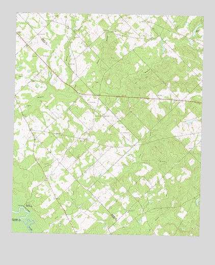
West of Eastman, GA USGS Topographic Map
Click on map above to begin viewing in our Map Viewer.

This topographic map contains these locations and features:
Feature Name Type Latitude Longitude GNIS ID View Map
Bennett PondReservoirN32.2304°W83.2761°341218View Map
Bennett Pond DamDamN32.2302°W83.2765°341217View Map
Coody CemeteryCemeteryN32.2416°W83.3393°348112View Map
Cross CreekStreamN32.1271°W83.3538°313159View Map
Daniels CemeteryCemeteryN32.1999°W83.3243°313292View Map
Franklin PondReservoirN32.1904°W83.2574°336243View Map
Franklin Pond DamDamN32.1902°W83.2599°336242View Map
Goody CemeteryCemeteryN32.2252°W83.3560°356049View Map
Hadden LakeReservoirN32.2105°W83.3494°341130View Map
Hadden Lake DamDamN32.2102°W83.3516°341129View Map
Hanley BranchStreamN32.2054°W83.3390°315088View Map
Hardy LakeReservoirN32.2235°W83.3526°341128View Map
Hardy Lake DamDamN32.2202°W83.3516°341127View Map
Harmony ChurchChurchN32.1813°W83.3457°315141View Map
Harrell CemeteryCemeteryN32.1635°W83.3521°315171View Map
Hogpen BranchStreamN32.2127°W83.3254°315525View Map
Jumps CemeteryCemeteryN32.2360°W83.3315°316308View Map
Lake SteeleReservoirN32.2430°W83.2547°323555View Map
Lake Steele DamDamN32.2385°W83.2565°336238View Map
Lampkin CemeteryCemeteryN32.1924°W83.3163°316605View Map
Lancaster CemeteryCemeteryN32.2377°W83.3596°316608View Map
Lowe CemeteryCemeteryN32.2254°W83.3599°317458View Map
McAlister CemeteryCemeteryN32.2210°W83.3343°317832View Map
Midway ChurchChurchN32.1785°W83.3271°318116View Map
Mount Annis ChurchChurchN32.1674°W83.2768°318553View Map
Mount Cilla ChurchChurchN32.1971°W83.3663°318623View Map
New Salem ChurchChurchN32.1385°W83.2977°319533View Map
Pittman CemeteryCemeteryN32.1921°W83.3146°320761View Map
Rozier CemeteryCemeteryN32.2399°W83.3102°321983View Map
Salem ChurchChurchN32.2138°W83.3724°322354View Map
Sandy HammockIslandN32.1404°W83.3660°322485View Map
Simmons CemeteryCemeteryN32.1832°W83.3015°323005View Map
Zion Hill ChurchChurchN32.2399°W83.3121°325694View Map

Note: Coordinates in the location and feature list above are referenced to NAD83 datum.


Copyright (C) 2008-2025 Ryan Niemi / Sunset Dynamics ... All Rights Reserved