TopoQuest Logo
Do you find TopoQuest useful?
Help keep TopoQuest running and adding new maps/features by donating!
Bitcoin:  19c7KJd3qBynnjoSw5npx9KScwjBe4ifkT
Litecoin:  LXs6TkuXGGXo1vDsWCkWVdjQX94eUKd6ui
Home View Maps Find Maps Find Places Resources & Links


Bowdon East, Georgia Topographic Map

USGS Map Title: Bowdon East, GA
USGS Map MRC: 33085E2
DRG (GeoTIFF) Download: o33085e2.tif


Neighboring USGS Topographic Map Quads:


  Tallapoosa South, GA  
33085F3
 

  Bremen, GA  
33085F2
 

  Temple, GA  
33085F1
 

  Bowdon West, GA  
33085E3
 

  Bowdon East, GA  
33085E2
 

  Carrollton, GA  
33085E1
 

  Graham, AL  
33085D3
 

  Roopville, GA  
33085D2
 

  Lowell, GA  
33085D1


Map MRC Location:

N34°
W86°
N34°
W85°
H8 H7 H6 H5 H4 H3 H2 H1
G8 G7 G6 G5 G4 G3 G2 G1
F8 F7 F6 F5 F4 F3 F2 F1
E8 E7 E6 E5 E4 E3 E2 E1
D8 D7 D6 D5 D4 D3 D2 D1
C8 C7 C6 C5 C4 C3 C2 C1
B8 B7 B6 B5 B4 B3 B2 B1
A8 A7 A6 A5 A4 A3 A2 A1
N33°
W86°
N33°
W85°

Bowdon East, GA USGS 1:24K Topographic Map Preview:
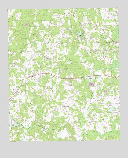
Bowdon East, GA USGS Topographic Map
Click on map above to begin viewing in our Map Viewer.

This topographic map contains these locations and features:
Feature Name Type Latitude Longitude GNIS ID View Map
Anderson LakeReservoirN33.5589°W85.1608°310525View Map
Antioch Baptist ChurchChurchN33.5615°W85.2002°354357View Map
Antioch CemeteryCemeteryN33.5618°W85.2008°350055View Map
Antioch School (historical)SchoolN33.5482°W85.2091°350057View Map
Bethel ChurchChurchN33.5932°W85.1816°311192View Map
Bowdon DivisionCivilN33.5333°W85.2484°1936123View Map
Boyles BranchStreamN33.5723°W85.1741°311693View Map
Brock Bridge (historical)BridgeN33.5059°W85.2341°350081View Map
Buck CreekStreamN33.5701°W85.1297°311960View Map
Buffalo CreekStreamN33.5065°W85.1680°311990View Map
BurwellPopulated PlaceN33.5793°W85.2063°354917View Map
Camp CreekStreamN33.5746°W85.1469°312215View Map
Camp Creek CemeteryCemeteryN33.5854°W85.1647°350085View Map
Camp Creek ChurchChurchN33.5848°W85.1644°354964View Map
Carroll County Fire / Rescue Station 6BuildingN33.5455°W85.2408°2603982View Map
Carroll LakeReservoirN33.6034°W85.2333°339349View Map
Cole LakeReservoirN33.5484°W85.1466°339648View Map
Cole Lake DamDamN33.5484°W85.1466°339647View Map
Double BranchesPopulated PlaceN33.5648°W85.1263°350130View Map
Eureka CemeteryCemeteryN33.5943°W85.1680°350135View Map
Eureka ChurchChurchN33.6101°W85.1677°355726View Map
Fairview (historical)Populated PlaceN33.5307°W85.1958°350137View Map
Farmers HighPopulated PlaceN33.5326°W85.1883°355779View Map
Flying W Farms AirportAirportN33.5045°W85.1829°2442659View Map
Garrett CreekStreamN33.5551°W85.1599°314522View Map
Garrett CreekStreamN33.5129°W85.2305°355979View Map
Inman DamDamN33.5418°W85.2349°339351View Map
Inman LakeReservoirN33.5422°W85.2346°339352View Map
John Tanner State ParkParkN33.5968°W85.1683°356337View Map
John Tanner State Park Lake AReservoirN33.6007°W85.1692°339646View Map
John Tanner State Park Lake BReservoirN33.5980°W85.1662°339650View Map
John Tanner State Park Lake Dam ADamN33.6001°W85.1666°339645View Map
John Tanner State Park Lake Dam BDamN33.5968°W85.1649°339649View Map
JonesvillePopulated PlaceN33.5601°W85.2316°332119View Map
Jonesville Middle SchoolSchoolN33.5638°W85.2290°2545512View Map
Jumpin In CreekStreamN33.5876°W85.2322°316304View Map
Lake ClydeReservoirN33.5159°W85.2410°312777View Map
Lake Clyde DamDamN33.5146°W85.2447°336022View Map
Lake FrankReservoirN33.5148°W85.2473°314346View Map
Lake Frank DamDamN33.5157°W85.2480°336036View Map
Lake WoodfinLakeN33.5488°W85.1449°342342View Map
Lees ChapelChurchN33.5198°W85.1427°316747View Map
Lees Chapel CemeteryCemeteryN33.5198°W85.1422°349618View Map
Lovvorns Mill (historical)LocaleN33.5029°W85.1672°349624View Map
Luckie (historical)Populated PlaceN33.6146°W85.2402°349628View Map
Maple BranchStreamN33.6068°W85.2483°317672View Map
Moon LakeReservoirN33.6088°W85.2494°339350View Map
Mount Zion Elementary SchoolSchoolN33.6024°W85.1488°349656View Map
Nessinger Lake DamDamN33.5818°W85.1866°336020View Map
New BridgeBridgeN33.5348°W85.1599°349659View Map
New Hope CemeteryCemeteryN33.5973°W85.1402°349661View Map
New Hope ChurchChurchN33.5965°W85.1402°319421View Map
Old Camp CemeteryCemeteryN33.5570°W85.1341°349673View Map
Old Camp ChurchChurchN33.5573°W85.1347°319951View Map
Pine Tucky BranchStreamN33.5721°W85.1741°320647View Map
Pine Tucky ChurchChurchN33.5921°W85.1908°320648View Map
Pine Tucky School (historical)SchoolN33.5918°W85.1908°349685View Map
Pinetucky CemeteryCemeteryN33.5920°W85.1897°349686View Map
Plowshare (historical)Populated PlaceN33.5987°W85.1380°349692View Map
Possum BranchStreamN33.5868°W85.1302°321078View Map
Rolling Acres Memory GardensCemeteryN33.5632°W85.2238°321882View Map
Sackville School (historical)SchoolN33.5590°W85.1874°349705View Map
Salem Baptist ChurchChurchN33.5387°W85.1719°322364View Map
Salem CemeteryCemeteryN33.5393°W85.1722°349710View Map
Sand Creek School (historical)SchoolN33.5851°W85.1513°349711View Map
Shadinger LakeReservoirN33.5459°W85.1403°339654View Map
Shadinger Lake DamDamN33.5468°W85.1399°339653View Map
Shiloh CemeteryCemeteryN33.5754°W85.2044°349719View Map
Shiloh ChurchChurchN33.5782°W85.2055°322887View Map
Simonton Mill (historical)LocaleN33.5607°W85.1469°349723View Map
Smith ChapelChurchN33.6012°W85.2194°323122View Map
Smith Chapel CemeteryCemeteryN33.6007°W85.2194°349724View Map
South Branch Turkey CreekStreamN33.5771°W85.2355°323235View Map
Swins Lake AReservoirN33.6162°W85.1298°336049View Map
Swins Lake BReservoirN33.6163°W85.1363°339652View Map
Swins Lake Dam ADamN33.6151°W85.1283°336048View Map
Swins Lake Dam BDamN33.6151°W85.1366°339651View Map
Tallapoosa CemeteryCemeteryN33.5440°W85.1391°349735View Map
Tallapoosa ChurchChurchN33.5437°W85.1388°323892View Map
Tallapoosa School (historical)SchoolN33.5504°W85.1283°349736View Map
Tanners LakeReservoirN33.5980°W85.1662°349738View Map
VictoryPopulated PlaceN33.5112°W85.2102°333331View Map
Victory ChurchChurchN33.5157°W85.2052°349753View Map
W Walkers DamDamN33.5318°W85.1316°336040View Map
W Walkers LakeReservoirN33.5305°W85.1317°336041View Map
Walkers DamDamN33.5265°W85.1355°336042View Map
Walkers LakeReservoirN33.5288°W85.1345°324791View Map
Wessinger DamDamN33.5184°W85.2483°336038View Map
Wessinger LakeReservoirN33.5830°W85.1876°336021View Map
Wessinger LakeReservoirN33.5177°W85.2495°336039View Map
Words CreekStreamN33.5021°W85.1949°325562View Map

Note: Coordinates in the location and feature list above are referenced to NAD83 datum.


Copyright (C) 2008-2025 Ryan Niemi / Sunset Dynamics ... All Rights Reserved