TopoQuest Logo
Do you find TopoQuest useful?
Help keep TopoQuest running and adding new maps/features by donating!
Bitcoin:  19c7KJd3qBynnjoSw5npx9KScwjBe4ifkT
Litecoin:  LXs6TkuXGGXo1vDsWCkWVdjQX94eUKd6ui
Home View Maps Find Maps Find Places Resources & Links


Bragg City, Arkansas Topographic Map

USGS Map Title: Bragg City, AR
USGS Map MRC: 33092F8
DRG (GeoTIFF) Download: o33092f8.tif


Neighboring USGS Topographic Map Quads:


  Reader, AR  
33093G1
 

  Tates Bluff, AR  
33092G8
 

  Ouachita, AR  
33092G7
 

  Chidester, AR  
33093F1
 

  Bragg City, AR  
33092F8
 

  Harmony Grove, AR  
33092F7
 

  Troy, AR  
33093E1
 

  Camden SW, AR  
33092E8
 

  Camden, AR  
33092E7


Map MRC Location:

N34°
W93°
N34°
W92°
H8 H7 H6 H5 H4 H3 H2 H1
G8 G7 G6 G5 G4 G3 G2 G1
F8 F7 F6 F5 F4 F3 F2 F1
E8 E7 E6 E5 E4 E3 E2 E1
D8 D7 D6 D5 D4 D3 D2 D1
C8 C7 C6 C5 C4 C3 C2 C1
B8 B7 B6 B5 B4 B3 B2 B1
A8 A7 A6 A5 A4 A3 A2 A1
N33°
W93°
N33°
W92°

Bragg City, AR USGS 1:24K Topographic Map Preview:
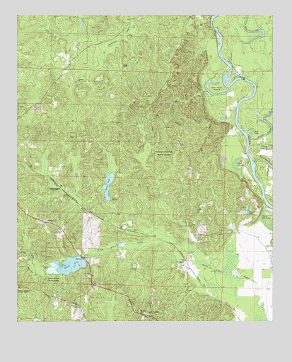
Bragg City, AR USGS Topographic Map
Click on map above to begin viewing in our Map Viewer.

This topographic map contains these locations and features:
Feature Name Type Latitude Longitude GNIS ID View Map
Bell Chapel United Methodist ChurchChurchN33.6323°W92.9721°76291View Map
Bragg CemeteryCemeteryN33.7295°W92.9485°46908View Map
Bragg CityPopulated PlaceN33.6657°W92.9860°57427View Map
Bragg LakeReservoirN33.6478°W92.9737°80264View Map
Bragg Lake DamDamN33.6501°W92.9668°80263View Map
Bragg Mill CreekStreamN33.6568°W92.9221°46909View Map
Capernaum ChurchChurchN33.7232°W92.9707°47457View Map
Ecore Fabre BayouStreamN33.6318°W92.8829°48812View Map
Green CemeteryCemeteryN33.7051°W92.9515°49626View Map
LesterPopulated PlaceN33.6487°W92.9202°58060View Map
Lester JunctionPopulated PlaceN33.6279°W92.9371°57090View Map
Lower Old BrakeLakeN33.6654°W92.8793°75006View Map
Moon LakeLakeN33.7019°W92.8851°75031View Map
Mount Willie ChurchChurchN33.6287°W92.9399°52436View Map
Old River IslandIslandN33.7204°W92.9029°53020View Map
Poison Springs BranchStreamN33.6459°W92.9866°53649View Map
Saxon LakeReservoirN33.6755°W92.9556°80262View Map
Saxon Lake DamDamN33.6751°W92.9552°80261View Map
Shiloh ChurchChurchN33.6326°W92.9343°54787View Map
Tate CemeteryCemeteryN33.7459°W92.9090°55440View Map
Tate LakeLakeN33.7399°W92.8848°75165View Map
Township of BethesdaCivilN33.7401°W92.9470°68910View Map
Township of RiverCivilN33.6620°W92.9065°68923View Map
Tulip CreekStreamN33.7009°W92.8874°55691View Map
Upper Old BrakeLakeN33.6871°W92.8923°75192View Map
Van Wagoner (historical)Populated PlaceN33.6840°W92.9857°64414View Map
Wise (historical)Populated PlaceN33.6593°W92.9321°64417View Map
Wyloe (historical)Populated PlaceN33.7484°W92.9454°64418View Map

Note: Coordinates in the location and feature list above are referenced to NAD83 datum.


Copyright (C) 2008-2025 Ryan Niemi / Sunset Dynamics ... All Rights Reserved