TopoQuest Logo
Do you find TopoQuest useful?
Help keep TopoQuest running and adding new maps/features by donating!
Bitcoin:  19c7KJd3qBynnjoSw5npx9KScwjBe4ifkT
Litecoin:  LXs6TkuXGGXo1vDsWCkWVdjQX94eUKd6ui
Home View Maps Find Maps Find Places Resources & Links


Camden SW, Arkansas Topographic Map

USGS Map Title: Camden SW, AR
USGS Map MRC: 33092E8
DRG (GeoTIFF) Download: o33092e8.tif


Neighboring USGS Topographic Map Quads:


  Chidester, AR  
33093F1
 

  Bragg City, AR  
33092F8
 

  Harmony Grove, AR  
33092F7
 

  Troy, AR  
33093E1
 

  Camden SW, AR  
33092E8
 

  Camden, AR  
33092E7
 

  Stephens, AR  
33093D1
 

  Buena Vista, AR  
33092D8
 

  Louann, AR  
33092D7


Map MRC Location:

N34°
W93°
N34°
W92°
H8 H7 H6 H5 H4 H3 H2 H1
G8 G7 G6 G5 G4 G3 G2 G1
F8 F7 F6 F5 F4 F3 F2 F1
E8 E7 E6 E5 E4 E3 E2 E1
D8 D7 D6 D5 D4 D3 D2 D1
C8 C7 C6 C5 C4 C3 C2 C1
B8 B7 B6 B5 B4 B3 B2 B1
A8 A7 A6 A5 A4 A3 A2 A1
N33°
W93°
N33°
W92°

Camden SW, AR USGS 1:24K Topographic Map Preview:
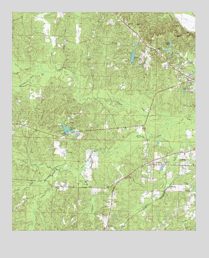
Camden SW, AR USGS Topographic Map
Click on map above to begin viewing in our Map Viewer.

This topographic map contains these locations and features:
Feature Name Type Latitude Longitude GNIS ID View Map
Arkansas Noname 85 DamDamN33.6034°W92.8852°80267View Map
Buena Vista Volunteer Fire Department Station 2BuildingN33.5326°W92.9198°2116202View Map
Darby Lake DamDamN33.5368°W92.8985°80274View Map
Eternal Rest CemeteryCemeteryN33.6071°W92.9279°48919View Map
Fellowship ChurchChurchN33.5226°W92.8782°49021View Map
FinnswitchLocaleN33.5251°W92.8938°76924View Map
First Union Baptist ChurchChurchN33.6176°W92.9216°76925View Map
Greenings LakeReservoirN33.5561°W92.9624°80273View Map
Greenings Lake DamDamN33.5568°W92.9585°80272View Map
Hale CreekStreamN33.5287°W92.9774°49763View Map
Harvey PondReservoirN33.5996°W92.9179°80269View Map
Harvey Pond DamDamN33.5968°W92.9185°80268View Map
Hawkins CemeteryCemeteryN33.6040°W92.9013°49950View Map
Howell BranchStreamN33.5346°W92.9518°50366View Map
Jerdon CreekStreamN33.5343°W92.9710°50626View Map
Kennedy PondReservoirN33.6068°W92.8919°80266View Map
Kennedy Pond DamDamN33.6068°W92.8918°80265View Map
Kingdom HallChurchN33.6037°W92.9027°64394View Map
Lake DarbyReservoirN33.5360°W92.8983°80275View Map
Lewis BayouStreamN33.5909°W92.9768°51076View Map
Lufra (historical)Populated PlaceN33.5293°W92.9943°64399View Map
Mount Olive CemeteryCemeteryN33.5265°W92.8796°52327View Map
Mount Olive Missionary Baptist ChurchChurchN33.5409°W92.9082°77726View Map
Mount Zion ChurchChurchN33.5609°W92.9591°52457View Map
North BayouStreamN33.5618°W92.8910°52803View Map
Ouachita CountyCivilN33.5934°W92.8819°69170View Map
Panther CreekStreamN33.5343°W92.9710°53154View Map
Pleasant Hill CemeteryCemeteryN33.5390°W92.8971°53556View Map
Pleasant Ridge ChurchChurchN33.5379°W92.8982°53592View Map
Ross CreekStreamN33.5540°W92.8988°54223View Map
Saint James Baptist ChurchChurchN33.5801°W92.8802°78235View Map
South BayouStreamN33.5618°W92.8910°55009View Map
Sweet Home Baptist ChurchChurchN33.5026°W92.9349°78510View Map
Township of BraggCivilN33.5956°W92.9631°68912View Map
Turner LakeReservoirN33.5802°W92.8836°75183View Map
Two Bayou ChurchChurchN33.5448°W92.9624°55762View Map
Two Bayou ChurchChurchN33.5554°W92.9643°55763View Map
Two Bayou Volunteer Fire DepartmentBuildingN33.5586°W92.9878°2117236View Map
Two Bayou Volunteer Fire Department SubstationBuildingN33.5871°W92.8805°2117237View Map

Note: Coordinates in the location and feature list above are referenced to NAD83 datum.


Copyright (C) 2008-2025 Ryan Niemi / Sunset Dynamics ... All Rights Reserved