TopoQuest Logo
Do you find TopoQuest useful?
Help keep TopoQuest running and adding new maps/features by donating!
Bitcoin:  19c7KJd3qBynnjoSw5npx9KScwjBe4ifkT
Litecoin:  LXs6TkuXGGXo1vDsWCkWVdjQX94eUKd6ui
Home View Maps Find Maps Find Places Resources & Links


Brandy Camp, Pennsylvania Topographic Map

USGS Map Title: Brandy Camp, PA
USGS Map MRC: 41078C6
DRG (GeoTIFF) Download: o41078c6.tif


Neighboring USGS Topographic Map Quads:


  Portland Mills, PA  
41078D7
 

  Ridgway, PA  
41078D6
 

  Saint Marys, PA  
41078D5
 

  Carman, PA  
41078C7
 

  Brandy Camp, PA  
41078C6
 

  Kersey, PA  
41078C5
 

  Falls Creek, PA  
41078B7
 

  Sabula, PA  
41078B6
 

  Penfield, PA  
41078B5


Map MRC Location:

N42°
W79°
N42°
W78°
H8 H7 H6 H5 H4 H3 H2 H1
G8 G7 G6 G5 G4 G3 G2 G1
F8 F7 F6 F5 F4 F3 F2 F1
E8 E7 E6 E5 E4 E3 E2 E1
D8 D7 D6 D5 D4 D3 D2 D1
C8 C7 C6 C5 C4 C3 C2 C1
B8 B7 B6 B5 B4 B3 B2 B1
A8 A7 A6 A5 A4 A3 A2 A1
N41°
W79°
N41°
W78°

Brandy Camp, PA USGS 1:24K Topographic Map Preview:
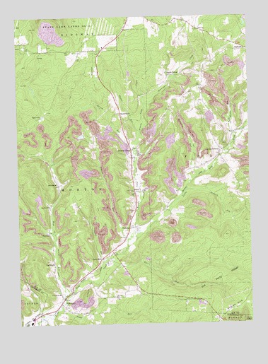
Brandy Camp, PA USGS Topographic Map
Click on map above to begin viewing in our Map Viewer.

This topographic map contains these locations and features:
Feature Name Type Latitude Longitude GNIS ID View Map
Bear RunStreamN41.2748°W78.7031°1168925View Map
Beech GrovePopulated PlaceN41.3356°W78.6931°1169103View Map
Benninger CreekStreamN41.3392°W78.6792°1169254View Map
Boggy RunStreamN41.2562°W78.7272°1169942View Map
Brandy CampPopulated PlaceN41.3209°W78.6875°1170161View Map
Brandy Camp CreekStreamN41.2856°W78.6889°1170162View Map
BrockportPopulated PlaceN41.2598°W78.7267°1170306View Map
Brockport Post OfficePost OfficeN41.2593°W78.7273°2772617View Map
CartwrightPopulated PlaceN41.2745°W78.7309°1171287View Map
ChallengePopulated PlaceN41.2887°W78.6889°1171532View Map
DrummondPopulated PlaceN41.3067°W78.7281°1173490View Map
ElbonPopulated PlaceN41.3039°W78.6861°1174072View Map
Helen MillsPopulated PlaceN41.2770°W78.7045°1176788View Map
Holy Cross CemeteryCemeteryN41.3041°W78.6862°1177254View Map
Horton CityPopulated PlaceN41.2984°W78.7325°1177474View Map
Horton Township Volunteer Fire Department Company 7BuildingN41.2610°W78.7255°2644748View Map
Hyde LakeLakeN41.3350°W78.7363°1177664View Map
Johnson RunStreamN41.2845°W78.6906°1198951View Map
Karnes RunStreamN41.3192°W78.6850°1178235View Map
Kyler MineMineN41.3451°W78.6322°1200832View Map
Kyler RunStreamN41.3270°W78.6322°1178721View Map
Kylers CornersPopulated PlaceN41.3209°W78.6389°1178724View Map
Limestone RunStreamN41.3276°W78.6300°1179366View Map
McCauley RunStreamN41.3103°W78.6528°1180621View Map
Mead RunStreamN41.2601°W78.7250°1198093View Map
Mountain ChurchChurchN41.2612°W78.6975°1181949View Map
Oyster RunStreamN41.2748°W78.7028°1183171View Map
Phalen RunStreamN41.3281°W78.6822°1183651View Map
Ridge SchoolSchoolN41.3462°W78.6511°1200831View Map
Sawmill RunStreamN41.3037°W78.6584°1187038View Map
ShawmutPopulated PlaceN41.2873°W78.7334°1187401View Map
Shawmut ReservoirReservoirN41.3306°W78.7406°1200833View Map
ShelveyPopulated PlaceN41.3698°W78.6500°1204633View Map
Squab HollowPopulated PlaceN41.3514°W78.6672°1188363View Map
TobyPopulated PlaceN41.3276°W78.6320°1193537View Map
Township of HortonCivilN41.2964°W78.7291°1216401View Map

Note: Coordinates in the location and feature list above are referenced to NAD83 datum.


Copyright (C) 2008-2025 Ryan Niemi / Sunset Dynamics ... All Rights Reserved