TopoQuest Logo
Do you find TopoQuest useful?
Help keep TopoQuest running and adding new maps/features by donating!
Bitcoin:  19c7KJd3qBynnjoSw5npx9KScwjBe4ifkT
Litecoin:  LXs6TkuXGGXo1vDsWCkWVdjQX94eUKd6ui
Home View Maps Find Maps Find Places Resources & Links


Sabula, Pennsylvania Topographic Map

USGS Map Title: Sabula, PA
USGS Map MRC: 41078B6
DRG (GeoTIFF) Download: o41078b6.tif


Neighboring USGS Topographic Map Quads:


  Carman, PA  
41078C7
 

  Brandy Camp, PA  
41078C6
 

  Kersey, PA  
41078C5
 

  Falls Creek, PA  
41078B7
 

  Sabula, PA  
41078B6
 

  Penfield, PA  
41078B5
 

  Du Bois, PA  
41078A7
 

  Luthersburg, PA  
41078A6
 

  Elliott Park, PA  
41078A5


Map MRC Location:

N42°
W79°
N42°
W78°
H8 H7 H6 H5 H4 H3 H2 H1
G8 G7 G6 G5 G4 G3 G2 G1
F8 F7 F6 F5 F4 F3 F2 F1
E8 E7 E6 E5 E4 E3 E2 E1
D8 D7 D6 D5 D4 D3 D2 D1
C8 C7 C6 C5 C4 C3 C2 C1
B8 B7 B6 B5 B4 B3 B2 B1
A8 A7 A6 A5 A4 A3 A2 A1
N41°
W79°
N41°
W78°

Sabula, PA USGS 1:24K Topographic Map Preview:
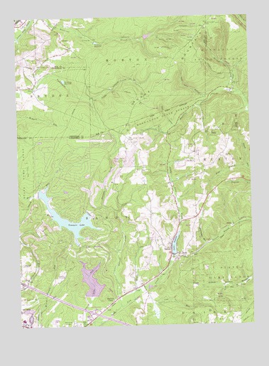
Sabula, PA USGS Topographic Map
Click on map above to begin viewing in our Map Viewer.

This topographic map contains these locations and features:
Feature Name Type Latitude Longitude GNIS ID View Map
Boone MountainSummitN41.2470°W78.6467°1169991View Map
Boone Mountain Fire TowerTowerN41.2389°W78.6472°1206469View Map
Brockway ReservoirReservoirN41.2243°W78.7243°1170308View Map
Brockway ReservoirReservoirN41.2397°W78.7068°1170309View Map
Browns School (historical)SchoolN41.1867°W78.6692°1206472View Map
Bundy CemeteryCemeteryN41.1995°W78.6881°1170668View Map
Coal RunStreamN41.1406°W78.6831°1172068View Map
Conway CemeteryCemeteryN41.1936°W78.6382°1172376View Map
Finley HollowValleyN41.2058°W78.6657°1174763View Map
Free Methodist ChurchChurchN41.1701°W78.6642°1206686View Map
Gravel Lick DamDamN41.1351°W78.7114°1195293View Map
Greenwood CemeteryCemeteryN41.1504°W78.7484°1176196View Map
Hickory School (historical)SchoolN41.1895°W78.6453°1206468View Map
Hoyt BranchStreamN41.1887°W78.6267°1177526View Map
Lake SabulaReservoirN41.1578°W78.6662°1185674View Map
Lambskin HollowValleyN41.2248°W78.6345°1201684View Map
McCracken RunStreamN41.1581°W78.6492°1180670View Map
Morningside CemeteryCemeteryN41.1256°W78.7206°1181563View Map
Mountain Lick CreekStreamN41.2203°W78.6359°1181953View Map
Muddy RunStreamN41.1392°W78.6875°1192995View Map
Narrows CreekPopulated PlaceN41.1348°W78.7003°1182168View Map
Narrows CreekStreamN41.1331°W78.6959°1182169View Map
Pete Buck HollowValleyN41.2160°W78.6489°1183618View Map
Pine Grove SchoolSchoolN41.1964°W78.6836°1206470View Map
Reformed ChurchChurchN41.1892°W78.6822°1206471View Map
SabulaPopulated PlaceN41.1564°W78.6686°1193240View Map
Sabula Fire Company Station 39BuildingN41.1514°W78.6695°2644992View Map
Storage DamDamN41.2417°W78.6797°1195388View Map
Township of SandyCivilN41.1447°W78.7296°1216249View Map
Treasure LakePopulated PlaceN41.1734°W78.7159°1867510View Map
Treasure LakeReservoirN41.1690°W78.7236°1184895View Map
Treasure Lake Census Designated PlaceCensusN41.1713°W78.7173°2390401View Map
Treasure Lake Volunteer Fire Company Station 35BuildingN41.1490°W78.7035°2645007View Map
WalshPopulated PlaceN41.1651°W78.6334°1204895View Map
WDBA-FM (Du Bois)TowerN41.1912°W78.6906°1200289View Map
Whetstone BranchStreamN41.2498°W78.7400°1191225View Map

Note: Coordinates in the location and feature list above are referenced to NAD83 datum.


Copyright (C) 2008-2025 Ryan Niemi / Sunset Dynamics ... All Rights Reserved