TopoQuest Logo
Do you find TopoQuest useful?
Help keep TopoQuest running and adding new maps/features by donating!
Bitcoin:  19c7KJd3qBynnjoSw5npx9KScwjBe4ifkT
Litecoin:  LXs6TkuXGGXo1vDsWCkWVdjQX94eUKd6ui
Home View Maps Find Maps Find Places Resources & Links


Broseley, Missouri Topographic Map

USGS Map Title: Broseley, MO
USGS Map MRC: 36090F2
DRG (GeoTIFF) Download: o36090f2.tif


Neighboring USGS Topographic Map Quads:


  Rombauer, MO  
36090G3
 

  Fisk, MO  
36090G2
 

  Dudley, MO  
36090G1
 

  Hanleyville, MO  
36090F3
 

  Broseley, MO  
36090F2
 

  Powe, MO  
36090F1
 

  Oglesville, MO  
36090E3
 

  Glennonville, MO  
36090E2
 

  Valley Ridge, MO  
36090E1


Map MRC Location:

N37°
W91°
N37°
W90°
H8 H7 H6 H5 H4 H3 H2 H1
G8 G7 G6 G5 G4 G3 G2 G1
F8 F7 F6 F5 F4 F3 F2 F1
E8 E7 E6 E5 E4 E3 E2 E1
D8 D7 D6 D5 D4 D3 D2 D1
C8 C7 C6 C5 C4 C3 C2 C1
B8 B7 B6 B5 B4 B3 B2 B1
A8 A7 A6 A5 A4 A3 A2 A1
N36°
W91°
N36°
W90°

Broseley, MO USGS 1:24K Topographic Map Preview:
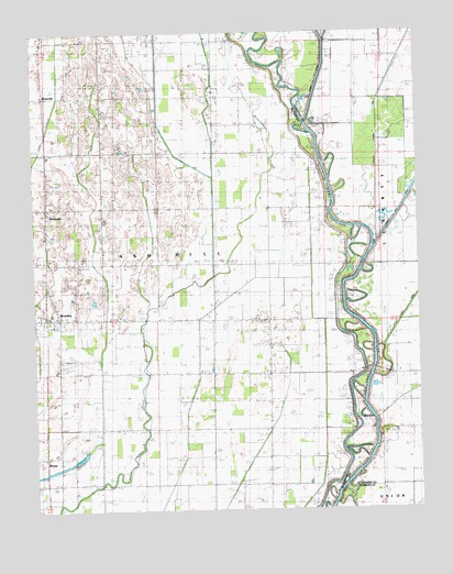
Broseley, MO USGS Topographic Map
Click on map above to begin viewing in our Map Viewer.

This topographic map contains these locations and features:
Feature Name Type Latitude Longitude GNIS ID View Map
BatesvillePopulated PlaceN36.6989°W90.2462°713732View Map
BroseleyPopulated PlaceN36.6751°W90.2418°735532View Map
Broseley Post OfficePost OfficeN36.6755°W90.2465°2782883View Map
Browns CemeteryCemeteryN36.6617°W90.2426°714804View Map
Browns ChapelChurchN36.6617°W90.2434°714805View Map
Butler County Fire Protection District Twin Rivers StationBuildingN36.7091°W90.2452°2621261View Map
Depoyster ChurchChurchN36.7256°W90.1776°716843View Map
Depoyster SchoolSchoolN36.7256°W90.1776°716844View Map
Ditch Number 18CanalN36.7328°W90.1926°755068View Map
Ditch Number 20CanalN36.6976°W90.2115°755076View Map
Ditch Number 21CanalN36.6520°W90.2287°755078View Map
Ditch Number 22CanalN36.6417°W90.1765°755080View Map
Ditch Number 23CanalN36.6484°W90.2018°755082View Map
Elk Church (historical)ChurchN36.6628°W90.1740°746865View Map
Elk SchoolSchoolN36.6706°W90.1743°746863View Map
Hicoria SpurPopulated PlaceN36.6648°W90.1743°740133View Map
Higginbothams FerryLocaleN36.6617°W90.1340°719510View Map
Lick CreekStreamN36.6937°W90.1393°721025View Map
Little Dump ChurchChurchN36.7192°W90.2462°721226View Map
Little Vine ChurchChurchN36.6889°W90.2284°721349View Map
Lone Oak ChurchChurchN36.6387°W90.2473°746862View Map
Lower ShoalsBarN36.7101°W90.1482°721647View Map
MarshallLocaleN36.7439°W90.2470°740137View Map
MenorkanutPopulated PlaceN36.7039°W90.1734°740303View Map
Menorkenut Slough Number 19StreamN36.6776°W90.2129°755316View Map
Middle ShoalsBarN36.7173°W90.1515°722289View Map
NyssaPopulated PlaceN36.6398°W90.2426°740009View Map
Pleasant Hill ChurchChurchN36.7192°W90.2223°724521View Map
Pleasant Hill School (historical)SchoolN36.7192°W90.2218°746860View Map
QuercusPopulated PlaceN36.6314°W90.2495°739596View Map
River School (historical)SchoolN36.6620°W90.1440°746864View Map
RossvillePopulated PlaceN36.7331°W90.2465°725585View Map
Township of Ash HillCivilN36.6822°W90.2451°766348View Map
Upper ShoalsBarN36.7226°W90.1570°728078View Map
Vale CemeteryCemeteryN36.7037°W90.2095°728096View Map
Webb ChurchChurchN36.6309°W90.2009°728458View Map
Whittles Ferry (historical)CrossingN36.6401°W90.1440°746866View Map
Wilcox School (historical)SchoolN36.6895°W90.2179°746861View Map

Note: Coordinates in the location and feature list above are referenced to NAD83 datum.


Copyright (C) 2008-2025 Ryan Niemi / Sunset Dynamics ... All Rights Reserved