TopoQuest Logo
Do you find TopoQuest useful?
Help keep TopoQuest running and adding new maps/features by donating!
Bitcoin:  19c7KJd3qBynnjoSw5npx9KScwjBe4ifkT
Litecoin:  LXs6TkuXGGXo1vDsWCkWVdjQX94eUKd6ui
Home View Maps Find Maps Find Places Resources & Links


Brownlee Dam, Oregon Topographic Map

USGS Map Title: Brownlee Dam, OR
USGS Map MRC: 44116G8
DRG (GeoTIFF) Download: o44116g8.tif


Neighboring USGS Topographic Map Quads:


  Halfway, OR  
44117H1
 

  McLain Gulch, OR  
44116H8
 

  Oxbow, OR  
44116H7
 

  Posy Valley, OR  
44117G1
 

  Brownlee Dam, OR  
44116G8
 

  Cuddy Mountain, ID  
44116G7
 

  Sturgill Creek, ID  
44117F1
 

  Neil Gulch, ID  
44116F8
 

  Advent Gulch, ID  
44116F7


Map MRC Location:

N45°
W117°
N45°
W116°
H8 H7 H6 H5 H4 H3 H2 H1
G8 G7 G6 G5 G4 G3 G2 G1
F8 F7 F6 F5 F4 F3 F2 F1
E8 E7 E6 E5 E4 E3 E2 E1
D8 D7 D6 D5 D4 D3 D2 D1
C8 C7 C6 C5 C4 C3 C2 C1
B8 B7 B6 B5 B4 B3 B2 B1
A8 A7 A6 A5 A4 A3 A2 A1
N44°
W117°
N44°
W116°

Brownlee Dam, OR USGS 1:24K Topographic Map Preview:
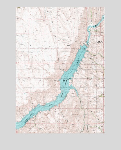
Brownlee Dam, OR USGS Topographic Map
Click on map above to begin viewing in our Map Viewer.

This topographic map contains these locations and features:
Feature Name Type Latitude Longitude GNIS ID View Map
Black CanyonValleyN44.8563°W116.8916°1138186View Map
Board GulchValleyN44.8249°W116.9038°377970View Map
BrownleePopulated PlaceN44.8115°W116.9343°1133435View Map
Brownlee CreekStreamN44.7865°W116.9121°378276View Map
Brownlee DamDamN44.8360°W116.9010°1118133View Map
Brownlee Post Office (historical)Post OfficeN44.8115°W116.9343°1164971View Map
Brownlee ReservoirReservoirN44.7642°W116.9850°378278View Map
Cave CreekStreamN44.7721°W116.9732°379058View Map
Cave CreekStreamN44.7757°W116.9768°1116556View Map
Cow CreekStreamN44.7579°W116.9721°379949View Map
Densley SpringSpringN44.7782°W116.9954°1116555View Map
Dukes CreekStreamN44.8329°W116.9068°380927View Map
Eagle Island (historical)IslandN44.8640°W116.8766°397350View Map
Eagle Island (historical)LocaleN44.8679°W116.8754°1167763View Map
East Brownlee CreekStreamN44.7604°W116.9043°381024View Map
Ferry CanyonValleyN44.8027°W116.9413°1129565View Map
Flat CreekStreamN44.7788°W116.9079°395390View Map
Grade CreekStreamN44.7749°W116.9079°382479View Map
HeathPopulated PlaceN44.7560°W116.8821°395456View Map
McCornick CampgroundLocaleN44.8571°W116.8946°1167123View Map
Middle Brownlee CreekStreamN44.7571°W116.8996°386781View Map
Officer ButteSummitN44.8638°W116.9982°1116568View Map
Oregon IslandIslandN44.8568°W116.8899°1129564View Map
Retrah (historical)LocaleN44.8482°W116.8977°1167813View Map
Road CanyonValleyN44.8121°W116.9329°1116569View Map
Road MountainSummitN44.8360°W116.9241°1116570View Map
Romeo (historical)LocaleN44.7774°W116.9577°1167817View Map
Spring CreekStreamN44.7785°W116.9457°375207View Map
West Brownlee CreekStreamN44.7599°W116.9043°393020View Map
Wildhorse RapidsRapidsN44.8548°W116.8975°375900View Map
Wildhorse RiverStreamN44.8513°W116.8966°400174View Map

Note: Coordinates in the location and feature list above are referenced to NAD83 datum.


Copyright (C) 2008-2025 Ryan Niemi / Sunset Dynamics ... All Rights Reserved