TopoQuest Logo
Do you find TopoQuest useful?
Help keep TopoQuest running and adding new maps/features by donating!
Bitcoin:  19c7KJd3qBynnjoSw5npx9KScwjBe4ifkT
Litecoin:  LXs6TkuXGGXo1vDsWCkWVdjQX94eUKd6ui
Home View Maps Find Maps Find Places Resources & Links


Tuscumbia, Missouri Topographic Map

USGS Map Title: Tuscumbia, MO
USGS Map MRC: 38092B4
DRG (GeoTIFF) Download: o38092b4.tif


Neighboring USGS Topographic Map Quads:


  Eldon, MO  
38092C5
 

  Eugene, MO  
38092C4
 

  Saint Elizabeth, MO  
38092C3
 

  Bagnell, MO  
38092B5
 

  Tuscumbia, MO  
38092B4
 

  Saint Anthony, MO  
38092B3
 

  Toronto, MO  
38092A5
 

  Brumley, MO  
38092A4
 

  Iberia, MO  
38092A3


Map MRC Location:

N39°
W93°
N39°
W92°
H8 H7 H6 H5 H4 H3 H2 H1
G8 G7 G6 G5 G4 G3 G2 G1
F8 F7 F6 F5 F4 F3 F2 F1
E8 E7 E6 E5 E4 E3 E2 E1
D8 D7 D6 D5 D4 D3 D2 D1
C8 C7 C6 C5 C4 C3 C2 C1
B8 B7 B6 B5 B4 B3 B2 B1
A8 A7 A6 A5 A4 A3 A2 A1
N38°
W93°
N38°
W92°

Tuscumbia, MO USGS 1:24K Topographic Map Preview:
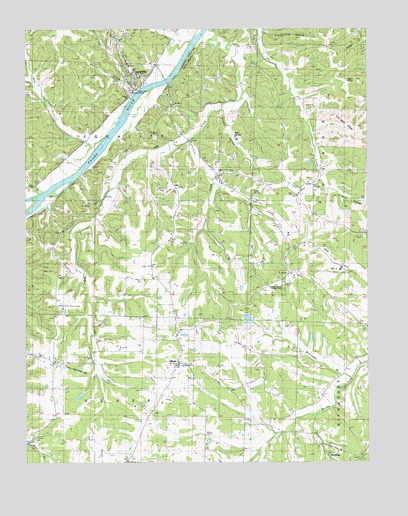
Tuscumbia, MO USGS Topographic Map
Click on map above to begin viewing in our Map Viewer.

This topographic map contains these locations and features:
Feature Name Type Latitude Longitude GNIS ID View Map
Bear SchoolSchoolN38.2292°W92.4335°713822View Map
Bear SpringSpringN38.2186°W92.4238°713824View Map
Buck KnobSummitN38.2348°W92.3788°714972View Map
Cattail CreekStreamN38.2167°W92.4393°715505View Map
Cave SpringSpringN38.2028°W92.4168°715539View Map
Cedar BluffsCliffN38.2411°W92.4402°715571View Map
Daggett Church (historical)ChurchN38.2498°W92.4699°744538View Map
Dog CreekStreamN38.2495°W92.4332°716953View Map
Dog Creek School (historical)SchoolN38.1550°W92.4757°716955View Map
Gum CreekStreamN38.2181°W92.4716°718922View Map
Helton Lake DamDamN38.1650°W92.4185°764897View Map
Hickory Point SchoolSchoolN38.1295°W92.3755°719489View Map
Hopewell ChurchChurchN38.2017°W92.4024°729515View Map
Howell BranchStreamN38.1283°W92.4150°2761779View Map
Howell School (historical)SchoolN38.1339°W92.4341°719932View Map
Keyes School (historical)SchoolN38.1528°W92.3985°720561View Map
Lake LottawatchReservoirN38.2116°W92.3964°765454View Map
Lick CreekStreamN38.2031°W92.4921°721026View Map
Lurton School (historical)SchoolN38.2467°W92.3893°721679View Map
Miller CountyCivilN38.2145°W92.4284°758520View Map
Miller County HomeBuildingN38.2059°W92.4291°744539View Map
Miller County Sheriff's OfficeBuildingN38.2406°W92.4624°2752268View Map
Mount Zion ChurchChurchN38.2084°W92.4271°729570View Map
Number Four SchoolSchoolN38.1875°W92.4524°723388View Map
Pisgah SchoolSchoolN38.1948°W92.3946°724441View Map
Pleasant Farm (historical)LocaleN38.1795°W92.4041°744720View Map
Prairie HollowValleyN38.2023°W92.3880°724865View Map
Procks DamDamN38.2117°W92.3952°765453View Map
Shoestring HollowValleyN38.2492°W92.4121°726401View Map
Shutin CreekStreamN38.2311°W92.4588°726427View Map
Topping School (historical)SchoolN38.1909°W92.4468°744540View Map
Town of TuscumbiaCivilN38.2371°W92.4600°2397702View Map
Township of EqualityCivilN38.2229°W92.4903°767016View Map
Truman Helton DamDamN38.1984°W92.4668°763928View Map
Truman Helton LakeReservoirN38.1984°W92.4668°763929View Map
Turn Back RidgeRidgeN38.2256°W92.3838°727890View Map
TuscumbiaPopulated PlaceN38.2331°W92.4585°727917View Map
Tuscumbia Fire Protection DistrictBuildingN38.2296°W92.4472°2620365View Map
Tuscumbia Post OfficePost OfficeN38.2369°W92.4618°2783022View Map
UlmanPopulated PlaceN38.1531°W92.4441°727950View Map
Ulman Post OfficePost OfficeN38.1532°W92.4453°2783086View Map
Ulman State Tower SiteLocaleN38.1750°W92.4063°741849View Map
Wilson HollowValleyN38.2261°W92.4260°728973View Map

Note: Coordinates in the location and feature list above are referenced to NAD83 datum.


Copyright (C) 2008-2025 Ryan Niemi / Sunset Dynamics ... All Rights Reserved