TopoQuest Logo
Do you find TopoQuest useful?
Help keep TopoQuest running and adding new maps/features by donating!
Bitcoin:  19c7KJd3qBynnjoSw5npx9KScwjBe4ifkT
Litecoin:  LXs6TkuXGGXo1vDsWCkWVdjQX94eUKd6ui
Home View Maps Find Maps Find Places Resources & Links


Brundidge NW, Alabama Topographic Map

USGS Map Title: Brundidge NW, AL
USGS Map MRC: 31085F8
DRG (GeoTIFF) Download: o31085f8.tif


Neighboring USGS Topographic Map Quads:


  Youngblood, AL  
31086G1
 

  Troy, AL  
31085G8
 

  Banks, AL  
31085G7
 

  Goshen, AL  
31086F1
 

  Brundidge NW, AL  
31085F8
 

  Brundidge, AL  
31085F7
 

  Bluff Springs, AL  
31086E1
 

  Victoria, AL  
31085E8
 

  Brundidge SE, AL  
31085E7


Map MRC Location:

N32°
W86°
N32°
W85°
H8 H7 H6 H5 H4 H3 H2 H1
G8 G7 G6 G5 G4 G3 G2 G1
F8 F7 F6 F5 F4 F3 F2 F1
E8 E7 E6 E5 E4 E3 E2 E1
D8 D7 D6 D5 D4 D3 D2 D1
C8 C7 C6 C5 C4 C3 C2 C1
B8 B7 B6 B5 B4 B3 B2 B1
A8 A7 A6 A5 A4 A3 A2 A1
N31°
W86°
N31°
W85°

Brundidge NW, AL USGS 1:24K Topographic Map Preview:
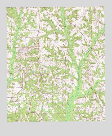
Brundidge NW, AL USGS Topographic Map
Click on map above to begin viewing in our Map Viewer.

This topographic map contains these locations and features:
Feature Name Type Latitude Longitude GNIS ID View Map
Antioch Missionary Baptist ChurchChurchN31.7460°W85.8866°113130View Map
Ballard Hill CemeteryCemeteryN31.7302°W85.9588°163504View Map
Bethlehem ChurchChurchN31.6965°W85.8758°114122View Map
Boutwell-Bundy CemeteryCemeteryN31.6660°W85.9652°163506View Map
Center Ridge ChurchChurchN31.6352°W85.9699°115867View Map
Centre Ridge (historical)Populated PlaceN31.6363°W85.9722°167960View Map
Davis CemeteryCemeteryN31.7352°W85.9916°163518View Map
Driggers CemeteryCemeteryN31.7349°W85.8752°163520View Map
Elam ChurchChurchN31.6771°W85.9561°117900View Map
Elam Elementary SchoolSchoolN31.6763°W85.9544°165413View Map
Gibson Mill BranchStreamN31.6718°W85.9958°139859View Map
Hillards Cross RoadsLocaleN31.6943°W85.8780°139872View Map
Holly Spring ChurchChurchN31.6452°W85.9758°120279View Map
Indian CreekStreamN31.6416°W85.9224°139874View Map
Johnson CemeteryCemeteryN31.7396°W85.9411°163541View Map
Milo Post Office (historical)Post OfficeN31.6905°W85.9608°166101View Map
Mims CreekStreamN31.6560°W85.9097°122860View Map
Mossy Grove EstatesPopulated PlaceN31.7243°W85.9594°139889View Map
Mossy Grove VillagePopulated PlaceN31.7335°W85.9569°163239View Map
Mount Olive ChurchChurchN31.6982°W85.8866°163240View Map
Pearsons PondReservoirN31.7153°W85.9841°139904View Map
Red RiverStreamN31.6710°W85.9086°139913View Map
Rhodes CemeteryCemeteryN31.7357°W85.9663°163558View Map
Saint John CemeteryCemeteryN31.6296°W85.8874°163559View Map
Saint Johns ChurchChurchN31.6288°W85.8874°164118View Map
Shady Grove ChurchChurchN31.7499°W85.9527°126616View Map
Simmons CemeteryCemeteryN31.7177°W85.9819°163564View Map
Smart BranchStreamN31.6996°W85.9902°126980View Map
Spring HillPopulated PlaceN31.6910°W85.9605°153530View Map
Spring Hill CemeteryCemeteryN31.6910°W85.9597°139925View Map
Spring Hill ChurchChurchN31.6910°W85.9611°139926View Map
Spring Hill ChurchChurchN31.6554°W85.9544°163567View Map
Spring Hill ChurchChurchN31.6913°W85.9594°163568View Map
Spring Hill Elementary SchoolSchoolN31.6832°W85.9580°165546View Map
Spring Hill Volunteer Fire DepartmentBuildingN31.7155°W85.9617°2691386View Map
Star Muskogee Creek State Designated Tribal Statistical AreaCensusN31.7268°W85.9693°2419231View Map
TarentumPopulated PlaceN31.6393°W85.8788°127693View Map
Tarentum SchoolSchoolN31.6410°W85.8769°150048View Map
Turner ChapelChurchN31.7210°W85.9416°128197View Map
Union School (historical)SchoolN31.6579°W85.9305°139934View Map
Union Springs Primitive Baptist ChurchChurchN31.6877°W85.8877°153804View Map
Walnut CreekStreamN31.6818°W85.9080°128549View Map
White Rock ChurchChurchN31.6663°W85.9930°150025View Map
Whiteheads PondReservoirN31.7104°W85.9657°139936View Map
Whitewater ChurchChurchN31.7057°W85.8941°139937View Map
Whitewater School (historical)SchoolN31.7057°W85.8927°157668View Map
Wilson CemeteryCemeteryN31.6321°W85.9816°163579View Map

Note: Coordinates in the location and feature list above are referenced to NAD83 datum.


Copyright (C) 2008-2024 Ryan Niemi / Sunset Dynamics ... All Rights Reserved