TopoQuest Logo
Do you find TopoQuest useful?
Help keep TopoQuest running and adding new maps/features by donating!
Bitcoin:  19c7KJd3qBynnjoSw5npx9KScwjBe4ifkT
Litecoin:  LXs6TkuXGGXo1vDsWCkWVdjQX94eUKd6ui
Home View Maps Find Maps Find Places Resources & Links


Brushart, Kentucky Topographic Map

USGS Map Title: Brushart, KY
USGS Map MRC: 38083E1
DRG (GeoTIFF) Download: o38083e1.tif


Neighboring USGS Topographic Map Quads:


  Pond Run, OH  
38083F2
 

  Friendship, OH  
38083F1
 

  Portsmouth, OH  
38082F8
 

  Garrison, KY  
38083E2
 

  Brushart, KY  
38083E1
 

  Load, KY  
38082E8
 

  Wesleyville, KY  
38083D2
 

  Tygarts Valley, KY  
38083D1
 

  Oldtown, KY  
38082D8


Map MRC Location:

N39°
W84°
N39°
W83°
H8 H7 H6 H5 H4 H3 H2 H1
G8 G7 G6 G5 G4 G3 G2 G1
F8 F7 F6 F5 F4 F3 F2 F1
E8 E7 E6 E5 E4 E3 E2 E1
D8 D7 D6 D5 D4 D3 D2 D1
C8 C7 C6 C5 C4 C3 C2 C1
B8 B7 B6 B5 B4 B3 B2 B1
A8 A7 A6 A5 A4 A3 A2 A1
N38°
W84°
N38°
W83°

Brushart, KY USGS 1:24K Topographic Map Preview:
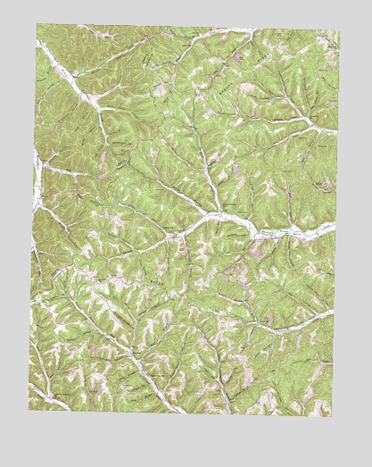
Brushart, KY USGS Topographic Map
Click on map above to begin viewing in our Map Viewer.

This topographic map contains these locations and features:
Feature Name Type Latitude Longitude GNIS ID View Map
Allen CemeteryCemeteryN38.5723°W83.0738°485864View Map
Anderson HollowValleyN38.5797°W83.0529°485943View Map
Annis BranchStreamN38.5526°W83.0793°485965View Map
Bark HollowValleyN38.5100°W83.1164°486343View Map
Barn HollowValleyN38.5628°W83.0473°486374View Map
Bee HollowValleyN38.5917°W83.0072°486670View Map
Big HollowValleyN38.5328°W83.0062°487188View Map
Birch HollowValleyN38.5632°W83.0357°487332View Map
Black John HollowValleyN38.6078°W83.1132°487370View Map
Bradley CemeteryCemeteryN38.5651°W83.0402°487799View Map
Bradley HollowValleyN38.5362°W83.0366°487801View Map
Briery ForkStreamN38.6204°W83.0588°487906View Map
Brown HollowValleyN38.5209°W83.1228°488008View Map
BrushartPopulated PlaceN38.5190°W83.0827°507601View Map
Brushart HollowValleyN38.5272°W83.0821°488099View Map
Brushy BranchStreamN38.5929°W83.0974°488105View Map
Buck LickStreamN38.6215°W83.0360°488233View Map
Buckner BranchStreamN38.5145°W83.0785°488282View Map
Burnt House HollowValleyN38.5981°W83.0981°488460View Map
Buzzard Roost ForkStreamN38.5206°W83.0835°488549View Map
Carr ChurchChurchN38.5579°W83.0257°488973View Map
Chimney HollowValleyN38.5797°W83.1196°489476View Map
Clark BranchStreamN38.5140°W83.0782°489529View Map
Clay HollowValleyN38.5865°W83.0955°489575View Map
Davis CemeteryCemeteryN38.5573°W83.0288°490656View Map
Dog HollowValleyN38.5298°W83.0319°490982View Map
Drumm BranchStreamN38.5095°W83.0746°491131View Map
Dry ForkStreamN38.6245°W83.0355°491199View Map
Dry HollowValleyN38.5571°W83.0333°491222View Map
Fisher ForkStreamN38.5367°W83.1096°492118View Map
Fitch BranchStreamN38.5529°W83.1243°492146View Map
Frank HollowValleyN38.5111°W83.0470°492439View Map
Gillem CemeteryCemeteryN38.5870°W83.0077°492839View Map
Grizzle HollowValleyN38.5180°W83.0833°493413View Map
Gunnel HollowValleyN38.5527°W83.0826°493499View Map
Hackworth HollowValleyN38.6012°W83.1059°493524View Map
Hale HollowValleyN38.5265°W83.0231°493556View Map
Ham BranchStreamN38.5065°W83.0718°493608View Map
Hammerhill HollowValleyN38.5862°W83.0939°493634View Map
Hampshire SchoolSchoolN38.5965°W83.0121°493648View Map
Hickory HollowValleyN38.5576°W83.0226°494136View Map
Holy CemeteryCemeteryN38.5792°W83.0182°494447View Map
Horn SchoolSchoolN38.6195°W83.0007°494560View Map
Horner ForkStreamN38.5037°W83.1160°494563View Map
Horse HollowValleyN38.5647°W83.0530°494579View Map
Hurricane HollowValleyN38.5990°W83.0116°494840View Map
Jameson ForkStreamN38.5367°W83.1096°495164View Map
Kenton-Furnace SchoolSchoolN38.5676°W83.0463°495663View Map
Kotcamp HollowValleyN38.5298°W83.0808°495873View Map
Laney HollowValleyN38.6027°W83.0265°495978View Map
Leatherwood SchoolSchoolN38.5115°W83.0746°496128View Map
Left Fork Beechy CreekStreamN38.6184°W83.0007°485689View Map
Lettingham HollowValleyN38.6032°W83.0216°496303View Map
Lick BranchStreamN38.5990°W83.1010°496447View Map
Logan CemeteryCemeteryN38.5428°W83.0996°496978View Map
Logan SchoolSchoolN38.5298°W83.0302°496987View Map
Loper CemeteryCemeteryN38.6226°W83.0568°497168View Map
Loper SchoolSchoolN38.6190°W83.0596°497169View Map
Lowder ForkStreamN38.5579°W83.0643°497245View Map
Mill HollowValleyN38.5298°W83.0813°498288View Map
Millstone BranchStreamN38.6112°W83.1157°498387View Map
Moore HollowValleyN38.6048°W83.0681°498558View Map
Mud LickStreamN38.5604°W83.0180°498993View Map
Mudlick BranchStreamN38.5640°W83.1249°499061View Map
Negro HillSummitN38.5384°W83.1202°499240View Map
Negro HollowValleyN38.6224°W83.0570°499244View Map
Orchard HollowValleyN38.5584°W83.0351°499989View Map
Peters Cave HollowValleyN38.5559°W83.0693°500476View Map
Pigeon Roost HollowValleyN38.5042°W83.0416°500595View Map
Powder Mill HollowValleyN38.5583°W83.0189°501230View Map
Progue HollowValleyN38.5790°W83.1248°501359View Map
Puncheon HollowValleyN38.5091°W83.0446°501452View Map
Raccoon ForkStreamN38.5937°W83.0096°501508View Map
Red Fox BranchStreamN38.6187°W83.1232°501649View Map
RextonPopulated PlaceN38.5687°W83.1221°508925View Map
Rexton Post Office (historical)Post OfficeN38.5682°W83.1219°2363054View Map
Rhoden CemeteryCemeteryN38.5081°W83.0860°501754View Map
River ForkStreamN38.5967°W83.0135°501980View Map
River HollowValleyN38.5791°W83.0542°501982View Map
Rocky BranchValleyN38.5892°W83.0948°502237View Map
Royster HollowValleyN38.5262°W83.0973°502442View Map
Ruggles SchoolSchoolN38.5598°W83.0710°502463View Map
Schultz ForkStreamN38.6073°W83.1116°503069View Map
Sexton HollowValleyN38.6130°W83.0671°503198View Map
Shop HollowValleyN38.5076°W83.1244°503428View Map
Shupe HollowValleyN38.5732°W83.0496°503476View Map
Sparks CemeteryCemeteryN38.5898°W83.0121°504029View Map
State Road ForkStreamN38.5795°W83.1235°504280View Map
Stockholm CreekStreamN38.5648°W83.0466°504439View Map
Stone Coal HollowValleyN38.5345°W83.0023°504452View Map
Sugarcamp CreekStreamN38.6245°W83.0435°504695View Map
Surrey HollowValleyN38.5289°W83.0309°504813View Map
Thomas CemeteryCemeteryN38.5667°W83.0999°505165View Map
Thompson SchoolSchoolN38.5581°W83.0193°505215View Map
TruittPopulated PlaceN38.5751°W83.0085°509239View Map
Turkeypen HollowValleyN38.6014°W83.1006°505643View Map
Two Lick HollowValleyN38.5573°W83.0620°505727View Map
Tygarts Valley DivisionCivilN38.5803°W83.0202°1937297View Map
Upper Three Prong SchoolSchoolN38.5037°W83.1152°505907View Map
Veach CemeteryCemeteryN38.6092°W83.1082°506010View Map
Walnut Grove HollowValleyN38.5070°W83.0698°506180View Map
Watson HollowValleyN38.6066°W83.0685°506284View Map
Whitt CemeteryCemeteryN38.5590°W83.0174°506698View Map
Willis BranchStreamN38.5667°W83.1230°506846View Map
YorkPopulated PlaceN38.5656°W83.0463°509422View Map
Zion Hill SchoolSchoolN38.5420°W83.0977°507298View Map
Zion RidgeRidgeN38.5429°W83.0818°507300View Map

Note: Coordinates in the location and feature list above are referenced to NAD83 datum.


Copyright (C) 2008-2025 Ryan Niemi / Sunset Dynamics ... All Rights Reserved