TopoQuest Logo
Do you find TopoQuest useful?
Help keep TopoQuest running and adding new maps/features by donating!
Bitcoin:  19c7KJd3qBynnjoSw5npx9KScwjBe4ifkT
Litecoin:  LXs6TkuXGGXo1vDsWCkWVdjQX94eUKd6ui
Home View Maps Find Maps Find Places Resources & Links


Norwood, Missouri Topographic Map

USGS Map Title: Norwood, MO
USGS Map MRC: 37092A4
DRG (GeoTIFF) Download: o37092a4.tif


Neighboring USGS Topographic Map Quads:


  Mansfield NE, MO  
37092B5
 

  Owens, MO  
37092B4
 

  Mountain Grove North, MO  
37092B3
 

  Mansfield, MO  
37092A5
 

  Norwood, MO  
37092A4
 

  Mountain Grove South, MO  
37092A3
 

  Sweden, MO  
36092H5
 

  Brushyknob, MO  
36092H4
 

  Vanzant, MO  
36092H3


Map MRC Location:

N38°
W93°
N38°
W92°
H8 H7 H6 H5 H4 H3 H2 H1
G8 G7 G6 G5 G4 G3 G2 G1
F8 F7 F6 F5 F4 F3 F2 F1
E8 E7 E6 E5 E4 E3 E2 E1
D8 D7 D6 D5 D4 D3 D2 D1
C8 C7 C6 C5 C4 C3 C2 C1
B8 B7 B6 B5 B4 B3 B2 B1
A8 A7 A6 A5 A4 A3 A2 A1
N37°
W93°
N37°
W92°

Norwood, MO USGS 1:24K Topographic Map Preview:
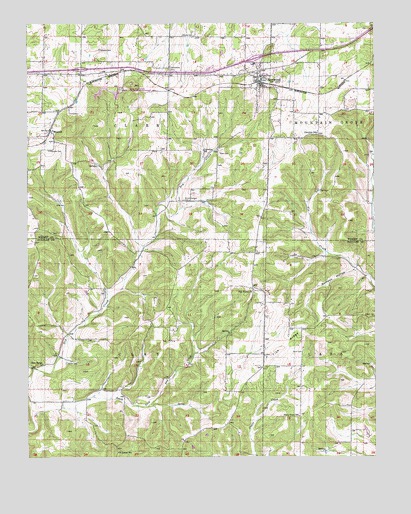
Norwood, MO USGS Topographic Map
Click on map above to begin viewing in our Map Viewer.

This topographic map contains these locations and features:
Feature Name Type Latitude Longitude GNIS ID View Map
Brutons (historical)LocaleN37.1087°W92.3857°740505View Map
Calhoun CemeteryCemeteryN37.1175°W92.4735°715195View Map
City of NorwoodCivilN37.1072°W92.4189°2395276View Map
Cornelius SchoolSchoolN37.0884°W92.4357°716325View Map
Fairview ChurchChurchN37.0934°W92.3960°735068View Map
Fairview SchoolSchoolN37.0931°W92.3952°717800View Map
FilerPopulated PlaceN37.0298°W92.4146°740504View Map
Filer Post Office (historical)Post OfficeN37.0298°W92.4146°759934View Map
Forest Home School (historical)SchoolN37.0448°W92.4107°733865View Map
Hickory Flat School (historical)SchoolN37.0445°W92.4582°733864View Map
MacombPopulated PlaceN37.0942°W92.4918°721734View Map
Macomb CemeteryCemeteryN37.0884°W92.4921°721735View Map
Macomb Post OfficePost OfficeN37.1103°W92.4817°2783150View Map
Macomb SchoolSchoolN37.0914°W92.4910°735070View Map
Mary Gray HillSummitN37.1064°W92.4616°735069View Map
McIntosh Lake DamDamN37.0034°W92.4418°765442View Map
Mount Harmon CemeteryCemeteryN37.0739°W92.4432°722757View Map
New Haven ChurchChurchN37.0270°W92.4946°723216View Map
NorwoodPopulated PlaceN37.1084°W92.4149°723525View Map
Norwood Post OfficePost OfficeN37.1074°W92.4158°2782721View Map
Norwood Volunteer Fire DepartmentBuildingN37.1089°W92.4157°2621229View Map
Oak Forest ChurchChurchN37.0484°W92.4182°723559View Map
Rutherford CemeteryCemeteryN37.1120°W92.4474°725691View Map
Ryan CemeteryCemeteryN37.0873°W92.4299°725696View Map
Saint James SchoolSchoolN37.0012°W92.4677°725756View Map
Samson HollowValleyN37.0539°W92.3821°725993View Map
Shiloh CemeteryCemeteryN37.0273°W92.4860°726360View Map
Shores CemeteryCemeteryN37.1214°W92.4429°726412View Map
Stark CemeteryCemeteryN37.0300°W92.4013°727030View Map
Stony Point SchoolSchoolN37.0117°W92.4021°727155View Map
Tick RidgeRidgeN37.0323°W92.4074°727642View Map
Township of ClarkCivilN37.1067°W92.4667°767547View Map
Township of ClayCivilN37.0192°W92.4695°766621View Map

Note: Coordinates in the location and feature list above are referenced to NAD83 datum.


Copyright (C) 2008-2024 Ryan Niemi / Sunset Dynamics ... All Rights Reserved