TopoQuest Logo
Do you find TopoQuest useful?
Help keep TopoQuest running and adding new maps/features by donating!
Bitcoin:  19c7KJd3qBynnjoSw5npx9KScwjBe4ifkT
Litecoin:  LXs6TkuXGGXo1vDsWCkWVdjQX94eUKd6ui
Home View Maps Find Maps Find Places Resources & Links


Ball Mountain, California Topographic Map

USGS Map Title: Ball Mountain, CA
USGS Map MRC: 39122H7
DRG (GeoTIFF) Download: o39122h7.tif


Neighboring USGS Topographic Map Quads:


  South Yolla Bolly, CA  
40122A7
 

  Raglin Ridge, CA  
40122A6
 

  Buck Rock, CA  
39122H8
 

  Ball Mountain, CA  
39122H7
 

  Riley Ridge, CA  
39122H6
 

  Mendocino Pass, CA  
39122G8
 

  Log Spring, CA  
39122G7
 

  Hall Ridge, CA  
39122G6


Map MRC Location:

N40°
W123°
N40°
W122°
H8 H7 H6 H5 H4 H3 H2 H1
G8 G7 G6 G5 G4 G3 G2 G1
F8 F7 F6 F5 F4 F3 F2 F1
E8 E7 E6 E5 E4 E3 E2 E1
D8 D7 D6 D5 D4 D3 D2 D1
C8 C7 C6 C5 C4 C3 C2 C1
B8 B7 B6 B5 B4 B3 B2 B1
A8 A7 A6 A5 A4 A3 A2 A1
N39°
W123°
N39°
W122°

Ball Mountain, CA USGS 1:24K Topographic Map Preview:
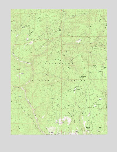
Ball Mountain, CA USGS Topographic Map
Click on map above to begin viewing in our Map Viewer.

This topographic map contains these locations and features:
Feature Name Type Latitude Longitude GNIS ID View Map
Auger CreekStreamN39.9213°W122.8603°218459View Map
Ball MountainSummitN39.9315°W122.7847°1657990View Map
Berry CreekStreamN39.9652°W122.8031°256845View Map
Berry RidgeRidgeN39.9454°W122.7819°256852View Map
Big Stump CampLocaleN39.9429°W122.7653°257031View Map
Black FlatFlatN39.9785°W122.8133°257116View Map
Boswell RidgeRidgeN39.9940°W122.8372°257367View Map
Bull FlatFlatN39.9813°W122.8614°220107View Map
Cold Spring CreekStreamN39.9713°W122.8133°258556View Map
Cold Spring RidgeRidgeN39.9604°W122.7567°258565View Map
Cold Springs Forest Service FacilityLocaleN39.9596°W122.7558°276330View Map
Croney CreekStreamN39.9777°W122.8681°258928View Map
Eury GladeFlatN39.8757°W122.8233°259981View Map
Fish CreekStreamN39.9454°W122.8489°260149View Map
Flood CreekStreamN39.9357°W122.8453°260211View Map
Foreman GladeFlatN39.9357°W122.8636°260249View Map
Griffin CreekStreamN39.9660°W122.7819°260893View Map
Griffin PlacePopulated PlaceN39.9693°W122.7864°1658673View Map
Hensley GladeFlatN39.9104°W122.7600°261276View Map
Howell CampLocaleN39.9407°W122.7547°1666618View Map
Howell GapGapN39.9377°W122.7636°261579View Map
Johnson CabinLocaleN39.9688°W122.8525°261968View Map
Kingsley GladeFlatN39.9032°W122.7678°262191View Map
Mason CampLocaleN39.9052°W122.7642°263256View Map
Maxim Cabin (historical)BuildingN39.9132°W122.8661°1666623View Map
McClure CreekStreamN39.9554°W122.8733°228304View Map
Middle RidgeRidgeN39.9452°W122.8053°263547View Map
Onion SpringsSpringN39.9107°W122.8222°264373View Map
Peterson PlacePopulated PlaceN39.8782°W122.7639°1659377View Map
Pollard CorralLocaleN39.8960°W122.7728°264915View Map
Russell CabinLocaleN39.9368°W122.7744°265686View Map
Snake CreekStreamN39.9899°W122.8039°267288View Map
Snake RidgeRidgeN39.9835°W122.7661°267296View Map
South RidgeRidgeN39.9165°W122.8061°267529View Map
Stockton CabinLocaleN39.8860°W122.8178°267757View Map
Straight Arrow CampLocaleN39.8790°W122.7750°267800View Map
Sugarfoot GladeFlatN39.8813°W122.7792°267859View Map
Sugarfoot Recreation SiteLocaleN39.8865°W122.7761°276326View Map
Telephone CampLocaleN39.9021°W122.7767°268125View Map
Telephone RidgeRidgeN39.8932°W122.7933°268132View Map
Three Prong CampgroundLocaleN39.9204°W122.7911°268257View Map
Three Prong ValleyBasinN39.9196°W122.7933°268258View Map

Note: Coordinates in the location and feature list above are referenced to NAD83 datum.


Copyright (C) 2008-2024 Ryan Niemi / Sunset Dynamics ... All Rights Reserved