TopoQuest Logo
Do you find TopoQuest useful?
Help keep TopoQuest running and adding new maps/features by donating!
Bitcoin:  19c7KJd3qBynnjoSw5npx9KScwjBe4ifkT
Litecoin:  LXs6TkuXGGXo1vDsWCkWVdjQX94eUKd6ui
Home View Maps Find Maps Find Places Resources & Links


Bucklin, Missouri Topographic Map

USGS Map Title: Bucklin, MO
USGS Map MRC: 39092G8
DRG (GeoTIFF) Download: o39092g8.tif


Neighboring USGS Topographic Map Quads:


  Shelby, MO  
39093H1
 

  Bucklin NW, MO  
39092H8
 

  New Boston, MO  
39092H7
 

  Brookfield, MO  
39093G1
 

  Bucklin, MO  
39092G8
 

  New Cambria West, MO  
39092G7
 

  Rothville, MO  
39093F1
 

  Marceline, MO  
39092F8
 

  Wien, MO  
39092F7


Map MRC Location:

N40°
W93°
N40°
W92°
H8 H7 H6 H5 H4 H3 H2 H1
G8 G7 G6 G5 G4 G3 G2 G1
F8 F7 F6 F5 F4 F3 F2 F1
E8 E7 E6 E5 E4 E3 E2 E1
D8 D7 D6 D5 D4 D3 D2 D1
C8 C7 C6 C5 C4 C3 C2 C1
B8 B7 B6 B5 B4 B3 B2 B1
A8 A7 A6 A5 A4 A3 A2 A1
N39°
W93°
N39°
W92°

Bucklin, MO USGS 1:24K Topographic Map Preview:
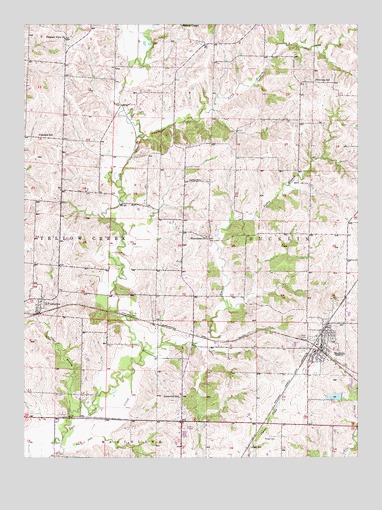
Bucklin, MO USGS Topographic Map
Click on map above to begin viewing in our Map Viewer.

This topographic map contains these locations and features:
Feature Name Type Latitude Longitude GNIS ID View Map
Black Horse DamDamN39.7500°W92.9585°762262View Map
Boone School (historical)SchoolN39.7559°W92.8758°733988View Map
Brownlee SchoolSchoolN39.8589°W92.8910°714800View Map
BucklinPopulated PlaceN39.7817°W92.8902°735539View Map
Bucklin City Lake DamDamN39.7684°W92.8819°760281View Map
Bucklin Police DepartmentBuildingN39.7823°W92.8890°2752525View Map
Bucklin Post OfficePost OfficeN39.7829°W92.8878°2783167View Map
Bucklin ReservoirReservoirN39.7675°W92.8838°760282View Map
Bucklin Volunteer Fire DepartmentBuildingN39.7831°W92.8890°2620349View Map
Carpenter SchoolSchoolN39.7675°W92.9421°715418View Map
Carter SchoolSchoolN39.8303°W92.9338°715450View Map
Cash CemeteryCemeteryN39.7556°W92.9099°715471View Map
Cash SchoolSchoolN39.7531°W92.9158°715472View Map
City of BucklinCivilN39.7837°W92.8879°2393448View Map
Hahn Lake DamDamN39.7567°W92.9402°760490View Map
Larrys LakeReservoirN39.7567°W92.9402°760491View Map
Long BranchStreamN39.8423°W92.9581°721517View Map
Oakdale SchoolSchoolN39.8431°W92.9946°723661View Map
Onion BranchStreamN39.7639°W92.9830°723825View Map
Osage School (historical)SchoolN39.8084°W92.8788°733986View Map
Pin Oak BranchStreamN39.7528°W92.9855°724356View Map
Pleasant View Baptist CemeteryCemeteryN39.8699°W92.9847°2702420View Map
Pleasant View ChurchChurchN39.8709°W92.9849°729799View Map
Pleasant View School (historical)SchoolN39.8011°W92.8949°733987View Map
Saint CatharinePopulated PlaceN39.7959°W92.9938°725735View Map
Saint Catharine Census Designated PlaceCensusN39.7988°W92.9937°2587111View Map
Saint Catherine School (historical)SchoolN39.7947°W92.9910°733989View Map
Sights BranchStreamN39.7753°W92.9596°726434View Map
Sights School (historical)SchoolN39.8022°W92.9416°733985View Map
Switzer ChapelChurchN39.8747°W92.9410°727398View Map
Township of BucklinCivilN39.8120°W92.9015°766915View Map
Township of Yellow CreekCivilN39.8197°W92.9920°766925View Map
Wyandotte ChurchChurchN39.8139°W92.9319°729173View Map

Note: Coordinates in the location and feature list above are referenced to NAD83 datum.


Copyright (C) 2008-2025 Ryan Niemi / Sunset Dynamics ... All Rights Reserved