TopoQuest Logo
Do you find TopoQuest useful?
Help keep TopoQuest running and adding new maps/features by donating!
Bitcoin:  19c7KJd3qBynnjoSw5npx9KScwjBe4ifkT
Litecoin:  LXs6TkuXGGXo1vDsWCkWVdjQX94eUKd6ui
Home View Maps Find Maps Find Places Resources & Links


Burlington, West Virginia Topographic Map

USGS Map Title: Burlington, WV
USGS Map MRC: 39078C8
DRG (GeoTIFF) Download: o39078c8.tif


Neighboring USGS Topographic Map Quads:


  Westernport, MD  
39079D1
 

  Keyser, WV  
39078D8
 

  Headsville, WV  
39078D7
 

  Antioch, WV  
39079C1
 

  Burlington, WV  
39078C8
 

  Romney, WV  
39078C7
 

  Medley, WV  
39079B1
 

  Old Fields, WV  
39078B8
 

  Sector, WV  
39078B7


Map MRC Location:

N40°
W79°
N40°
W78°
H8 H7 H6 H5 H4 H3 H2 H1
G8 G7 G6 G5 G4 G3 G2 G1
F8 F7 F6 F5 F4 F3 F2 F1
E8 E7 E6 E5 E4 E3 E2 E1
D8 D7 D6 D5 D4 D3 D2 D1
C8 C7 C6 C5 C4 C3 C2 C1
B8 B7 B6 B5 B4 B3 B2 B1
A8 A7 A6 A5 A4 A3 A2 A1
N39°
W79°
N39°
W78°

Burlington, WV USGS 1:24K Topographic Map Preview:
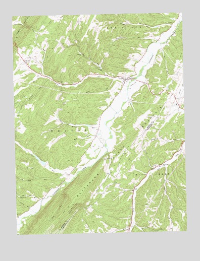
Burlington, WV USGS Topographic Map
Click on map above to begin viewing in our Map Viewer.

This topographic map contains these locations and features:
Feature Name Type Latitude Longitude GNIS ID View Map
Anderson Farm SpringSpringN39.2848°W78.9575°1677633View Map
Arnold CemeteryCemeteryN39.2859°W78.9650°1936062View Map
Bane Brothers SpringSpringN39.3434°W78.9342°1677631View Map
Bane CemeteryCemeteryN39.2998°W78.9431°1936723View Map
BurlingtonPopulated PlaceN39.3376°W78.9181°1536745View Map
Burlington Census Designated PlaceCensusN39.3370°W78.9222°2586776View Map
Burlington CenterSchoolN39.3374°W78.9208°2631551View Map
Burlington Post OfficePost OfficeN39.3369°W78.9176°1717846View Map
Burlington Primary SchoolSchoolN39.3362°W78.9188°1717847View Map
Burlington Public LibraryBuildingN39.3367°W78.9183°2727348View Map
Burlington Volunteer Fire Department Company 44BuildingN39.3361°W78.9051°2577750View Map
Buskirk RunStreamN39.2595°W78.9973°1536784View Map
Camp RunStreamN39.2876°W78.8903°1536958View Map
Canon CemeteryCemeteryN39.2879°W78.9881°1936844View Map
Cave Gap SpringSpringN39.2687°W78.9664°1677636View Map
Cave RunStreamN39.2754°W78.9681°1537115View Map
Clints RunStreamN39.2623°W78.9859°1537420View Map
Cundiff CemeteryCemeteryN39.3470°W78.9853°1937333View Map
Delawder CemeteryCemeteryN39.3673°W78.9395°1937336View Map
District 1CivilN39.3029°W78.9981°1928209View Map
Dry RunStreamN39.3390°W78.9314°1538378View Map
Dry RunStreamN39.2837°W78.9656°1538387View Map
Dry Run ChurchChurchN39.3526°W78.9497°1538390View Map
Elijah High CemeteryCemeteryN39.2884°W78.8920°1538599View Map
Elliber RunStreamN39.2965°W78.9325°1538666View Map
Elmlick RunStreamN39.2532°W78.9150°1538691View Map
Hampshire County SpringSpringN39.2576°W78.9503°1677897View Map
Harness RunStreamN39.2559°W78.9995°1539985View Map
Harness Run ChurchChurchN39.2609°W78.9995°1539986View Map
High Farm SpringSpringN39.2709°W78.9442°1677634View Map
Hull-Utta CemeteryCemeteryN39.2895°W78.9911°1937355View Map
John Liller CemeteryCemeteryN39.3529°W78.9847°1937365View Map
Johnson RunStreamN39.3582°W78.8931°1540991View Map
Kelley ChapelChurchN39.2837°W78.9309°1541128View Map
Leatherman CemeteryCemeteryN39.3715°W78.8797°1937366View Map
Leatherman Farm SpringSpringN39.2654°W78.9470°1677635View Map
Liller RunStreamN39.3401°W78.9747°1541958View Map
Lone Star ChurchChurchN39.3451°W78.9361°1542329View Map
Manorland Post Motel SpringSpringN39.3220°W78.8939°1677632View Map
MarkwoodPopulated PlaceN39.3354°W78.9639°1717889View Map
Markwood ChurchChurchN39.3362°W78.9653°1542768View Map
Michaels CemeteryCemeteryN39.3448°W78.9395°1937377View Map
Mikes RunStreamN39.2820°W78.9570°1543248View Map
Mill CreekStreamN39.3357°W78.9145°1543326View Map
Mill Creek Country Club Golf CourseLocaleN39.3401°W78.9827°2634137View Map
Mill Creek DistrictCivilN39.2827°W78.8806°1928314View Map
Mount Olive United Methodist ChurchChurchN39.2870°W78.8972°1543720View Map
Mud RunStreamN39.3115°W78.9331°1543917View Map
Mud RunStreamN39.3579°W78.8909°1543918View Map
Paige School (historical)SchoolN39.3682°W78.8936°1557054View Map
Parrill RunStreamN39.3401°W78.9728°1544594View Map
Patterson Creek Structure 15 DamDamN39.2918°W78.9781°1559094View Map
Patterson Creek Structure 20 DamDamN39.3484°W78.9781°1559095View Map
Patterson Creek Structure 22 DamDamN39.3118°W78.9431°1559096View Map
Patterson Creek Structure 24 DamDamN39.3151°W78.9147°1559107View Map
Patterson Creek Structure 25 DamDamN39.3601°W78.8931°1559109View Map
Patterson Creek Structure 26 DamDamN39.3668°W78.8814°1559097View Map
Patterson Creek Structure 47 DamDamN39.2984°W78.9397°1559105View Map
Patterson Creek Structure 48 DamDamN39.2718°W78.9781°1559111View Map
Patterson Creek Structure 52 DamDamN39.3534°W78.8847°1559106View Map
Peerce CemeteryCemeteryN39.2965°W78.9353°1937384View Map
Pursley RunStreamN39.2693°W78.9811°1545326View Map
RadaPopulated PlaceN39.2740°W78.9134°1545370View Map
Rawlings CemeteryCemeteryN39.3618°W78.9786°1937387View Map
Red Star School (historical)SchoolN39.3004°W78.9936°1557055View Map
RidgevillePopulated PlaceN39.3484°W78.9906°1545581View Map
Roderick CemeteryCemeteryN39.3570°W78.9264°1937392View Map
RusselldalePopulated PlaceN39.2926°W78.9300°1555543View Map
Sandy Hollow School (historical)SchoolN39.2884°W78.8928°1556798View Map
Schoemaker CemeteryCemeteryN39.3287°W78.8822°1937394View Map
Sloan CemeteryCemeteryN39.3093°W78.9400°1937395View Map
Stone Chapel CemeteryCemeteryN39.3409°W78.9745°1937398View Map
Sugar RunStreamN39.3384°W78.9267°1547649View Map
Thrush CemeteryCemeteryN39.3715°W78.9506°1937404View Map
Welton School (historical)SchoolN39.2709°W78.9800°1557062View Map
Whipps RunStreamN39.3670°W78.8784°1549012View Map
Wild Meadow RunStreamN39.3120°W78.9336°1549129View Map

Note: Coordinates in the location and feature list above are referenced to NAD83 datum.


Copyright (C) 2008-2024 Ryan Niemi / Sunset Dynamics ... All Rights Reserved