TopoQuest Logo
Do you find TopoQuest useful?
Help keep TopoQuest running and adding new maps/features by donating!
Bitcoin:  19c7KJd3qBynnjoSw5npx9KScwjBe4ifkT
Litecoin:  LXs6TkuXGGXo1vDsWCkWVdjQX94eUKd6ui
Home View Maps Find Maps Find Places Resources & Links


Burnett Peak, California Topographic Map

USGS Map Title: Burnett Peak, CA
USGS Map MRC: 35121G2
DRG (GeoTIFF) Download: o35121g2.tif


Neighboring USGS Topographic Map Quads:


  Alder Peak, CA  
35121H3
 

  Jolon, CA  
35121H2
 

  Williams Hill, CA  
35121H1
 

  Burro Mountain, CA  
35121G3
 

  Burnett Peak, CA  
35121G2
 

  Bryson, CA  
35121G1
 

  Piedras Blancas, CA  
35121F3
 

  San Simeon, CA  
35121F2
 

  Pebblestone Shut-in, CA  
35121F1


Map MRC Location:

N36°
W122°
N36°
W121°
H8 H7 H6 H5 H4 H3 H2 H1
G8 G7 G6 G5 G4 G3 G2 G1
F8 F7 F6 F5 F4 F3 F2 F1
E8 E7 E6 E5 E4 E3 E2 E1
D8 D7 D6 D5 D4 D3 D2 D1
C8 C7 C6 C5 C4 C3 C2 C1
B8 B7 B6 B5 B4 B3 B2 B1
A8 A7 A6 A5 A4 A3 A2 A1
N35°
W122°
N35°
W121°

Burnett Peak, CA USGS 1:24K Topographic Map Preview:
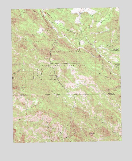
Burnett Peak, CA USGS Topographic Map
Click on map above to begin viewing in our Map Viewer.

This topographic map contains these locations and features:
Feature Name Type Latitude Longitude GNIS ID View Map
Beartrap FlatFlatN35.8633°W121.1438°269767View Map
Bull CanyonValleyN35.8125°W121.1333°270075View Map
Burnett PeakSummitN35.7564°W121.1602°1660392View Map
Crystal KnobSummitN35.8100°W121.1641°1660526View Map
Davis Ranch (historical)LocaleN35.8030°W121.1760°1670124View Map
El Piojo CreekStreamN35.8302°W121.1485°271036View Map
El Piojo Reservoir DamDamN35.8750°W121.1760°1664561View Map
Italian FlatFlatN35.8525°W121.2188°271743View Map
Little Oak FlatFlatN35.8425°W121.1699°1670140View Map
Los Burros CreekStreamN35.8744°W121.2188°272216View Map
Oak FlatFlatN35.8600°W121.1969°272734View Map
Piedras AltasRidgeN35.8680°W121.2088°272960View Map
Pozo Hondo CreekStreamN35.8358°W121.2066°273113View Map
Quicksilver MineMineN35.8525°W121.1396°1670151View Map
Salmon CreekStreamN35.8477°W121.1941°273409View Map
South Fork Waller CreekStreamN35.8386°W121.1405°273843View Map
Steve CreekStreamN35.8452°W121.2008°273898View Map
Sycamore CreekStreamN35.8408°W121.1563°274004View Map
Sycamore Reservoir DamDamN35.8333°W121.1344°1664567View Map
The PallsadesRidgeN35.8658°W121.2138°274094View Map
The Shut-inValleyN35.8302°W121.1488°274722View Map
Twin Valley CreekStreamN35.8702°W121.1741°274256View Map
Waller CreekStreamN35.8361°W121.1541°274373View Map

Note: Coordinates in the location and feature list above are referenced to NAD83 datum.


Copyright (C) 2008-2025 Ryan Niemi / Sunset Dynamics ... All Rights Reserved