TopoQuest Logo
Do you find TopoQuest useful?
Help keep TopoQuest running and adding new maps/features by donating!
Bitcoin:  19c7KJd3qBynnjoSw5npx9KScwjBe4ifkT
Litecoin:  LXs6TkuXGGXo1vDsWCkWVdjQX94eUKd6ui
Home View Maps Find Maps Find Places Resources & Links


San Simeon, California Topographic Map

USGS Map Title: San Simeon, CA
USGS Map MRC: 35121F2
DRG (GeoTIFF) Download: o35121f2.tif


Neighboring USGS Topographic Map Quads:


  Burro Mountain, CA  
35121G3
 

  Burnett Peak, CA  
35121G2
 

  Bryson, CA  
35121G1
 

  Piedras Blancas, CA  
35121F3
 

  San Simeon, CA  
35121F2
 

  Pebblestone Shut-in, CA  
35121F1


  Pico Creek, CA  
35121E2
 

  Cambria, CA  
35121E1


Map MRC Location:

N36°
W122°
N36°
W121°
H8 H7 H6 H5 H4 H3 H2 H1
G8 G7 G6 G5 G4 G3 G2 G1
F8 F7 F6 F5 F4 F3 F2 F1
E8 E7 E6 E5 E4 E3 E2 E1
D8 D7 D6 D5 D4 D3 D2 D1
C8 C7 C6 C5 C4 C3 C2 C1
B8 B7 B6 B5 B4 B3 B2 B1
A8 A7 A6 A5 A4 A3 A2 A1
N35°
W122°
N35°
W121°

San Simeon, CA USGS 1:24K Topographic Map Preview:
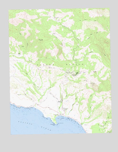
San Simeon, CA USGS Topographic Map
Click on map above to begin viewing in our Map Viewer.

This topographic map contains these locations and features:
Feature Name Type Latitude Longitude GNIS ID View Map
Adobe CreekStreamN35.6522°W121.2224°238425View Map
Arroyo del PuertoStreamN35.6430°W121.1885°238741View Map
Arroyo LagunaStreamN35.6633°W121.2119°238756View Map
Broken Bridge CreekStreamN35.6419°W121.1827°239707View Map
Burnett CampLocaleN35.7405°W121.1952°239854View Map
Burnett CreekStreamN35.7500°W121.1933°270088View Map
Burnett PeakSummitN35.7316°W121.1413°253329View Map
Chileno CampLocaleN35.7055°W121.2374°240538View Map
Garrity PeakSummitN35.7191°W121.2110°242635View Map
Green CanyonValleyN35.7039°W121.2335°242984View Map
Hearst AirportAirportN35.6632°W121.1984°2786936View Map
Hearst CastleBuildingN35.6852°W121.1677°243322View Map
Hearst Castle Fire DepartmentBuildingN35.6860°W121.1659°2665387View Map
Hearst ParkParkN35.6439°W121.1871°243323View Map
Hearst RanchLocaleN35.6569°W121.1883°243324View Map
Hearst San Simeon State Historical MonumentParkN35.6850°W121.1705°243325View Map
Little Pico CreekStreamN35.6339°W121.1638°244938View Map
Lone Tree HillSummitN35.6858°W121.1780°1660940View Map
Long CanyonValleyN35.6991°W121.1913°245061View Map
Marmolejo CreekStreamN35.6989°W121.1719°245544View Map
North Entrance RockBarN35.6355°W121.1921°246602View Map
Oak KnollSummitN35.6647°W121.2396°1661128View Map
Oak Knoll CreekStreamN35.6511°W121.2196°246739View Map
Old Castro House (historical)BuildingN35.6544°W121.2210°1667677View Map
Piedra BlancaCivilN35.6944°W121.1885°247450View Map
Pine MountainSummitN35.7102°W121.1574°253334View Map
Red RockSummitN35.6861°W121.1455°248069View Map
Rocky ButteSummitN35.6797°W121.1546°253333View Map
San SimeonPopulated PlaceN35.6439°W121.1908°248966View Map
San Simeon BayBayN35.6397°W121.1888°248967View Map
San Simeon PointCapeN35.6361°W121.1949°248970View Map
San Simeon Post OfficePost OfficeN35.6436°W121.1917°2780991View Map
Spanish Cabin CreekStreamN35.7164°W121.1630°249784View Map
Three TroughsSpringN35.6752°W121.1521°250478View Map
Three Troughs FallsFallsN35.6736°W121.1489°2559802View Map
Tortuga CreekStreamN35.6468°W121.2125°2787874View Map
West Fork Burnett CreekStreamN35.7397°W121.1966°251339View Map
William Randolph Hearst Memorial Beach (historical)ParkN35.6431°W121.1875°2612170View Map

Note: Coordinates in the location and feature list above are referenced to NAD83 datum.


Copyright (C) 2008-2024 Ryan Niemi / Sunset Dynamics ... All Rights Reserved