TopoQuest Logo
Do you find TopoQuest useful?
Help keep TopoQuest running and adding new maps/features by donating!
Bitcoin:  19c7KJd3qBynnjoSw5npx9KScwjBe4ifkT
Litecoin:  LXs6TkuXGGXo1vDsWCkWVdjQX94eUKd6ui
Home View Maps Find Maps Find Places Resources & Links


Calhoun, Louisiana Topographic Map

USGS Map Title: Calhoun, LA
USGS Map MRC: 32092E3
DRG (GeoTIFF) Download: o32092e3.tif


Neighboring USGS Topographic Map Quads:


  Downsville North, LA  
32092F4
 

  Point, LA  
32092F3
 

  Rocky Branch, LA  
32092F2
 

  Downsville South, LA  
32092E4
 

  Calhoun, LA  
32092E3
 

  West Monroe North, LA  
32092E2
 

  Eros, LA  
32092D4
 

  Cadeville, LA  
32092D3
 

  West Monroe South, LA  
32092D2


Map MRC Location:

N33°
W93°
N33°
W92°
H8 H7 H6 H5 H4 H3 H2 H1
G8 G7 G6 G5 G4 G3 G2 G1
F8 F7 F6 F5 F4 F3 F2 F1
E8 E7 E6 E5 E4 E3 E2 E1
D8 D7 D6 D5 D4 D3 D2 D1
C8 C7 C6 C5 C4 C3 C2 C1
B8 B7 B6 B5 B4 B3 B2 B1
A8 A7 A6 A5 A4 A3 A2 A1
N32°
W93°
N32°
W92°

Calhoun, LA USGS 1:24K Topographic Map Preview:
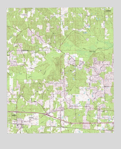
Calhoun, LA USGS Topographic Map
Click on map above to begin viewing in our Map Viewer.

This topographic map contains these locations and features:
Feature Name Type Latitude Longitude GNIS ID View Map
Aulds ChapelChurchN32.5807°W92.3426°553328View Map
Bluff Springs ChurchChurchN32.5426°W92.3074°553729View Map
Browntee CreekStreamN32.5143°W92.3199°533442View Map
Butler CemeteryCemeteryN32.5660°W92.2951°533588View Map
CalhounPopulated PlaceN32.5126°W92.3585°533624View Map
Calhoun Census Designated PlaceCensusN32.5153°W92.3539°2583532View Map
Calhoun Elementary SchoolSchoolN32.5087°W92.3627°548298View Map
Calhoun Gas and Oil FieldOilfieldN32.5015°W92.3738°540909View Map
Calhoun Middle SchoolSchoolN32.5142°W92.3537°548299View Map
Calhoun Post OfficePost OfficeN32.5107°W92.3588°1630678View Map
Camp Ch-Yo-CaLocaleN32.5621°W92.3026°540914View Map
Camp Road ChurchChurchN32.5140°W92.2693°540918View Map
CarltonPopulated PlaceN32.5374°W92.3596°540912View Map
Carlton ChurchChurchN32.5382°W92.3604°533767View Map
Carlton Gas FieldOilfieldN32.5615°W92.3468°548302View Map
Center SchoolSchoolN32.6154°W92.3240°533849View Map
Cockerel CreekStreamN32.5607°W92.3688°534014View Map
Curry CreekStreamN32.5138°W92.3268°534307View Map
Drew Gas FieldOilfieldN32.5913°W92.2515°548710View Map
EurekaPopulated PlaceN32.5682°W92.3549°540913View Map
Eureka SchoolSchoolN32.5688°W92.3568°534843View Map
ForksvillePopulated PlaceN32.5076°W92.3238°535045View Map
Interchange 101CrossingN32.5215°W92.3638°541488View Map
Interchange 103CrossingN32.5188°W92.3299°541503View Map
Jerusalem Baptist ChurchChurchN32.5054°W92.3132°554876View Map
Lejeune PondReservoirN32.6000°W92.2828°556849View Map
Lejeune Pond DamDamN32.6001°W92.2801°556848View Map
Liberty Baptist ChurchChurchN32.5246°W92.3018°555035View Map
Louisiana Delta Community College West Monroe CampusSchoolN32.5086°W92.2825°2462967View Map
McCormick CemeteryCemeteryN32.5593°W92.2685°536974View Map
Mill CreekStreamN32.5790°W92.3215°537117View Map
Mount Zion CemeteryCemeteryN32.5210°W92.3224°537425View Map
New Chapel Hill Baptist ChurchChurchN32.5465°W92.2601°555468View Map
North Louisiana Experimental StationLocaleN32.5157°W92.3446°540910View Map
Ouachita Parish Fire Protection District 1 Station 16 CarltonBuildingN32.5366°W92.3605°2673114View Map
Ouachita Parish Fire Protection District 1 Station 8 CalhounBuildingN32.5198°W92.3250°2673115View Map
Ouachita Valley Council Scout ReservationLocaleN32.6182°W92.3546°540919View Map
Pine Hills Golf ClubLocaleN32.5151°W92.3121°540915View Map
Pipe CreekStreamN32.5885°W92.2963°538211View Map
Pleasant Grove ChurchChurchN32.6157°W92.3232°540920View Map
Roselawn Memorial GardensCemeteryN32.5182°W92.3674°540911View Map
Saint Francis ChurchChurchN32.5240°W92.3018°556579View Map
Spillers CemeteryCemeteryN32.5871°W92.3626°556110View Map
Spring Hill ChurchChurchN32.5990°W92.3207°539600View Map
Trace EstatesPopulated PlaceN32.5696°W92.2546°548621View Map
Twin Cities Memorial GardensCemeteryN32.5215°W92.2599°540917View Map
United Pentecostal ChurchChurchN32.5235°W92.2668°540916View Map
Walnut Lane (historical)Populated PlaceN32.6057°W92.3490°548734View Map
Ward SixCivilN32.5465°W92.3251°545148View Map
West Ouachita Industrial ParkLocaleN32.5121°W92.2751°548637View Map
WilhitePopulated PlaceN32.6168°W92.2804°541215View Map
Wilhite CemeteryCemeteryN32.6187°W92.2849°544070View Map

Note: Coordinates in the location and feature list above are referenced to NAD83 datum.


Copyright (C) 2008-2024 Ryan Niemi / Sunset Dynamics ... All Rights Reserved