TopoQuest Logo
Do you find TopoQuest useful?
Help keep TopoQuest running and adding new maps/features by donating!
Bitcoin:  19c7KJd3qBynnjoSw5npx9KScwjBe4ifkT
Litecoin:  LXs6TkuXGGXo1vDsWCkWVdjQX94eUKd6ui
Home View Maps Find Maps Find Places Resources & Links


Caledonia, Mississippi Topographic Map

USGS Map Title: Caledonia, MS
USGS Map MRC: 33088F3
DRG (GeoTIFF) Download: o33088f3.tif


Neighboring USGS Topographic Map Quads:


  Amory SW, MS  
33088G4
 

  Amory SE, MS  
33088G3
 

  Sulligent SW, AL  
33088G2
 

  Hamilton, MS  
33088F4
 

  Caledonia, MS  
33088F3
 

  Millport NW, AL  
33088F2
 

  Columbus North, MS  
33088E4
 

  Steens, MS  
33088E3
 

  Fernbank, AL  
33088E2


Map MRC Location:

N34°
W89°
N34°
W88°
H8 H7 H6 H5 H4 H3 H2 H1
G8 G7 G6 G5 G4 G3 G2 G1
F8 F7 F6 F5 F4 F3 F2 F1
E8 E7 E6 E5 E4 E3 E2 E1
D8 D7 D6 D5 D4 D3 D2 D1
C8 C7 C6 C5 C4 C3 C2 C1
B8 B7 B6 B5 B4 B3 B2 B1
A8 A7 A6 A5 A4 A3 A2 A1
N33°
W89°
N33°
W88°

Caledonia, MS USGS 1:24K Topographic Map Preview:
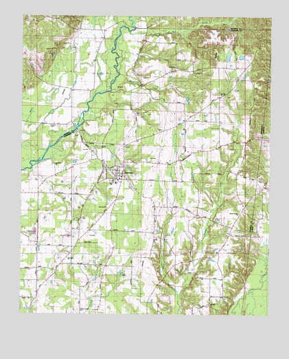
Caledonia, MS USGS Topographic Map
Click on map above to begin viewing in our Map Viewer.

This topographic map contains these locations and features:
Feature Name Type Latitude Longitude GNIS ID View Map
Ambrose Lake DamDamN33.7334°W88.2550°682318View Map
Baxters Store (historical)LocaleN33.6534°W88.2734°687736View Map
Bethlehem ChurchChurchN33.6879°W88.3584°667015View Map
Bluff CreekStreamN33.7259°W88.3261°667329View Map
Border Springs (historical)Populated PlaceN33.6626°W88.2684°687744View Map
Border Springs ChurchChurchN33.6676°W88.2659°667450View Map
Brown Lee ChurchChurchN33.6696°W88.3317°667630View Map
Buttahatchee Gas FieldOilfieldN33.7362°W88.3556°690767View Map
CaledoniaPopulated PlaceN33.6829°W88.3245°667916View Map
Caledonia Elementary SchoolSchoolN33.6801°W88.3275°687754View Map
Caledonia Gas FieldOilfieldN33.7084°W88.3125°690826View Map
Caledonia High SchoolSchoolN33.6807°W88.3286°690827View Map
Caledonia Post OfficePost OfficeN33.6828°W88.3261°2768572View Map
Cannons School (historical)SchoolN33.7243°W88.3078°687758View Map
Cut Bank CreekStreamN33.6471°W88.2514°116983View Map
Dowdle School (historical)SchoolN33.6493°W88.3100°687788View Map
Egger CemeteryCemeteryN33.7243°W88.3161°669693View Map
Flint HillPopulated PlaceN33.7162°W88.2756°687814View Map
Flint Hill ChurchChurchN33.7176°W88.2756°670040View Map
Gallagher Ferry (historical)CrossingN33.7029°W88.3478°710090View Map
Honnoll Mill CreekStreamN33.7437°W88.3209°671385View Map
Kolbs Ferry (historical)CrossingN33.6887°W88.3678°687845View Map
Liberty ChurchChurchN33.6898°W88.2645°672453View Map
Lone Oak ChurchChurchN33.6296°W88.2800°672781View Map
Lowndes County District 1 Volunteer Fire and Rescue Department Border Springs StationBuildingN33.6712°W88.2628°2665699View Map
Lowndes County District 1 Volunteer Fire and Rescue Department Caledonia StationBuildingN33.6823°W88.3253°2665712View Map
Mayhew CreekStreamN33.6332°W88.2959°673267View Map
Military Chapel CemeteryCemeteryN33.6271°W88.3459°690850View Map
New Salem ChurchChurchN33.6484°W88.3517°674836View Map
Rocky Valley School (historical)SchoolN33.6518°W88.2881°687906View Map
Rowan CemeteryCemeteryN33.6371°W88.3011°676929View Map
Supervisor District 1CivilN33.6343°W88.3241°711967View Map
Swanzy (historical)LocaleN33.6696°W88.2667°684806View Map
Town of CaledoniaCivilN33.6836°W88.3260°2405361View Map
Unity CemeteryCemeteryN33.6732°W88.3278°679131View Map
Washington County Court House (historical)LocaleN33.6732°W88.2886°138846View Map

Note: Coordinates in the location and feature list above are referenced to NAD83 datum.


Copyright (C) 2008-2025 Ryan Niemi / Sunset Dynamics ... All Rights Reserved