TopoQuest Logo
Do you find TopoQuest useful?
Help keep TopoQuest running and adding new maps/features by donating!
Bitcoin:  19c7KJd3qBynnjoSw5npx9KScwjBe4ifkT
Litecoin:  LXs6TkuXGGXo1vDsWCkWVdjQX94eUKd6ui
Home View Maps Find Maps Find Places Resources & Links


Fernbank, Alabama Topographic Map

USGS Map Title: Fernbank, AL
USGS Map MRC: 33088E2
DRG (GeoTIFF) Download: o33088e2.tif


Neighboring USGS Topographic Map Quads:


  Caledonia, MS  
33088F3
 

  Millport NW, AL  
33088F2
 

  Hightogy, AL  
33088F1
 

  Steens, MS  
33088E3
 

  Fernbank, AL  
33088E2
 

  Millport, AL  
33088E1
 

  New Hope, MS  
33088D3
 

  Ethelsville, AL  
33088D2
 

  Reform, AL  
33088D1


Map MRC Location:

N34°
W89°
N34°
W88°
H8 H7 H6 H5 H4 H3 H2 H1
G8 G7 G6 G5 G4 G3 G2 G1
F8 F7 F6 F5 F4 F3 F2 F1
E8 E7 E6 E5 E4 E3 E2 E1
D8 D7 D6 D5 D4 D3 D2 D1
C8 C7 C6 C5 C4 C3 C2 C1
B8 B7 B6 B5 B4 B3 B2 B1
A8 A7 A6 A5 A4 A3 A2 A1
N33°
W89°
N33°
W88°

Fernbank, AL USGS 1:24K Topographic Map Preview:
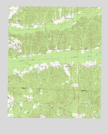
Fernbank, AL USGS Topographic Map
Click on map above to begin viewing in our Map Viewer.

This topographic map contains these locations and features:
Feature Name Type Latitude Longitude GNIS ID View Map
Anderson ChurchChurchN33.5098°W88.1761°135457View Map
Andrews Chapel CemeteryCemeteryN33.5098°W88.1761°135458View Map
Andrews Chapel Church Yard CemeteryCemeteryN33.5109°W88.1759°135459View Map
Andrews Chapel Methodist ChurchChurchN33.5109°W88.1764°113083View Map
Boggess DamDamN33.5085°W88.2300°131581View Map
Boggess LakeReservoirN33.5098°W88.2310°131580View Map
Brushy CreekStreamN33.5704°W88.1320°115063View Map
Cedar Grove ChurchChurchN33.5584°W88.1470°149427View Map
Crossroads School (historical)SchoolN33.6065°W88.2009°141335View Map
Dolan Davis DamDamN33.6068°W88.1734°131632View Map
Dolan Davis LakeReservoirN33.6068°W88.1734°131633View Map
Ebenezer Community CenterBuildingN33.6065°W88.2009°132772View Map
Ebenezer Methodist ChurchChurchN33.5937°W88.1775°117829View Map
FernbankPopulated PlaceN33.5793°W88.1417°118260View Map
Fernbank Baptist ChurchChurchN33.5793°W88.1403°132776View Map
Fernbank Gas FieldOilfieldN33.5668°W88.1298°154880View Map
Friendship CemeteryCemeteryN33.5782°W88.2478°158445View Map
Friendship ChurchChurchN33.5782°W88.2489°118696View Map
Friersons Shaft MineMineN33.5807°W88.1253°141317View Map
Liberty ChurchChurchN33.5101°W88.1720°121552View Map
MelbornePopulated PlaceN33.5729°W88.2028°132787View Map
Mount Olive ChurchChurchN33.5318°W88.2078°123314View Map
Mount Zion Church (historical)ChurchN33.5365°W88.1417°135583View Map
Mud Creek Gas FieldOilfieldN33.6154°W88.1611°154881View Map
Old Harmony CemeteryCemeteryN33.6084°W88.2373°158890View Map
Reeves ChapelChurchN33.6096°W88.2495°125542View Map
Speed DamDamN33.5101°W88.2467°131588View Map
Speeds LakeReservoirN33.5108°W88.2467°131589View Map
Spring Hill Baptist ChurchChurchN33.5582°W88.1681°153537View Map
Spring Hill CemeteryCemeteryN33.5576°W88.1656°158475View Map

Note: Coordinates in the location and feature list above are referenced to NAD83 datum.


Copyright (C) 2008-2024 Ryan Niemi / Sunset Dynamics ... All Rights Reserved