TopoQuest Logo
Do you find TopoQuest useful?
Help keep TopoQuest running and adding new maps/features by donating!
Bitcoin:  19c7KJd3qBynnjoSw5npx9KScwjBe4ifkT
Litecoin:  LXs6TkuXGGXo1vDsWCkWVdjQX94eUKd6ui
Home View Maps Find Maps Find Places Resources & Links


Millport NW, Alabama Topographic Map

USGS Map Title: Millport NW, AL
USGS Map MRC: 33088F2
DRG (GeoTIFF) Download: o33088f2.tif


Neighboring USGS Topographic Map Quads:


  Amory SE, MS  
33088G3
 

  Sulligent SW, AL  
33088G2
 

  Vernon, AL  
33088G1
 

  Caledonia, MS  
33088F3
 

  Millport NW, AL  
33088F2
 

  Hightogy, AL  
33088F1
 

  Steens, MS  
33088E3
 

  Fernbank, AL  
33088E2
 

  Millport, AL  
33088E1


Map MRC Location:

N34°
W89°
N34°
W88°
H8 H7 H6 H5 H4 H3 H2 H1
G8 G7 G6 G5 G4 G3 G2 G1
F8 F7 F6 F5 F4 F3 F2 F1
E8 E7 E6 E5 E4 E3 E2 E1
D8 D7 D6 D5 D4 D3 D2 D1
C8 C7 C6 C5 C4 C3 C2 C1
B8 B7 B6 B5 B4 B3 B2 B1
A8 A7 A6 A5 A4 A3 A2 A1
N33°
W89°
N33°
W88°

Millport NW, AL USGS 1:24K Topographic Map Preview:
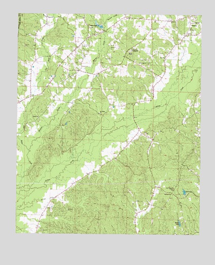
Millport NW, AL USGS Topographic Map
Click on map above to begin viewing in our Map Viewer.

This topographic map contains these locations and features:
Feature Name Type Latitude Longitude GNIS ID View Map
Antioch Church of ChristChurchN33.7257°W88.1506°113160View Map
Asbury CemeteryCemeteryN33.6398°W88.2295°158436View Map
Asbury ChurchChurchN33.6396°W88.2289°113244View Map
BaxterLocaleN33.6904°W88.2361°132764View Map
Bethlehem ChurchChurchN33.6479°W88.1448°114135View Map
Dry Creek ChurchChurchN33.6276°W88.1523°132771View Map
Ealon BranchStreamN33.7484°W88.2256°117722View Map
Furnace Hill CemeteryCemeteryN33.7473°W88.1453°158446View Map
Furnace Hill ChurchChurchN33.7471°W88.1464°118771View Map
Gault LakeReservoirN33.6493°W88.1356°118873View Map
Gault Lake DamDamN33.6484°W88.1367°131655View Map
Lamar County Training School (historical)SchoolN33.7298°W88.1736°121350View Map
Lampkin CemeteryCemeteryN33.7204°W88.2075°121362View Map
Liberty Grace ChurchChurchN33.6268°W88.1678°132781View Map
McGee DamDamN33.6284°W88.1367°131640View Map
McGee LakeReservoirN33.6315°W88.1387°122545View Map
McGee Lake Gas FieldOilfieldN33.6404°W88.1570°154876View Map
MolloyPopulated PlaceN33.7368°W88.2023°132790View Map
Molloy Gas FieldOilfieldN33.7196°W88.2292°154873View Map
Molloy Volunteer Fire DepartmentBuildingN33.7376°W88.2020°2683317View Map
Mount Nebo CemeteryCemeteryN33.7318°W88.2056°158456View Map
Mount Pleasant CemeteryCemeteryN33.6937°W88.1939°132793View Map
Mount Pleasant Free Will Baptist ChurchChurchN33.6937°W88.1945°152499View Map
Murray ChapelChurchN33.7284°W88.1753°123611View Map
Nebo CemeteryCemeteryN33.7307°W88.1734°123663View Map
Nebo United Methodist ChurchChurchN33.7318°W88.2070°152589View Map
Old Asbury CemeteryCemeteryN33.6387°W88.2150°124196View Map
Open Door ChurchChurchN33.6807°W88.1689°149433View Map
Pine Grove ChurchChurchN33.7418°W88.1336°124799View Map
Poplar Springs CemeteryCemeteryN33.6507°W88.1434°132797View Map
Poplar Springs Primitive Baptist ChurchChurchN33.6512°W88.1428°153043View Map
Prospect ChurchChurchN33.6912°W88.2359°125307View Map
Rogers DamDamN33.7418°W88.1934°131711View Map
Rogers LakeReservoirN33.7437°W88.1950°125908View Map
Sailor CemeteryCemeteryN33.7243°W88.1631°153239View Map
StarPopulated PlaceN33.6784°W88.1723°132801View Map
Star Oil and Gas FieldOilfieldN33.6876°W88.1653°154877View Map
Stillman DitchCanalN33.6448°W88.2281°127407View Map
Todd High SchoolSchoolN33.7226°W88.1684°128004View Map
Watson CreekStreamN33.7451°W88.1931°128643View Map
Westside ChurchChurchN33.7187°W88.1603°149436View Map
Wilson CreekStreamN33.6723°W88.2417°154005View Map
Yellow Creek Gas FieldOilfieldN33.6723°W88.2098°154875View Map
Yellow Creek Oil FieldOilfieldN33.6932°W88.2125°154874View Map

Note: Coordinates in the location and feature list above are referenced to NAD83 datum.


Copyright (C) 2008-2024 Ryan Niemi / Sunset Dynamics ... All Rights Reserved