TopoQuest Logo
Do you find TopoQuest useful?
Help keep TopoQuest running and adding new maps/features by donating!
Bitcoin:  19c7KJd3qBynnjoSw5npx9KScwjBe4ifkT
Litecoin:  LXs6TkuXGGXo1vDsWCkWVdjQX94eUKd6ui
Home View Maps Find Maps Find Places Resources & Links


Sulligent SW, Alabama Topographic Map

USGS Map Title: Sulligent SW, AL
USGS Map MRC: 33088G2
DRG (GeoTIFF) Download: o33088g2.tif


Neighboring USGS Topographic Map Quads:


  Greenwood Springs, MS  
33088H3
 

  Sulligent, AL  
33088H2
 

  Beaverton, AL  
33088H1
 

  Amory SE, MS  
33088G3
 

  Sulligent SW, AL  
33088G2
 

  Vernon, AL  
33088G1
 

  Caledonia, MS  
33088F3
 

  Millport NW, AL  
33088F2
 

  Hightogy, AL  
33088F1


Map MRC Location:

N34°
W89°
N34°
W88°
H8 H7 H6 H5 H4 H3 H2 H1
G8 G7 G6 G5 G4 G3 G2 G1
F8 F7 F6 F5 F4 F3 F2 F1
E8 E7 E6 E5 E4 E3 E2 E1
D8 D7 D6 D5 D4 D3 D2 D1
C8 C7 C6 C5 C4 C3 C2 C1
B8 B7 B6 B5 B4 B3 B2 B1
A8 A7 A6 A5 A4 A3 A2 A1
N33°
W89°
N33°
W88°

Sulligent SW, AL USGS 1:24K Topographic Map Preview:
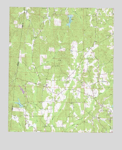
Sulligent SW, AL USGS Topographic Map
Click on map above to begin viewing in our Map Viewer.

This topographic map contains these locations and features:
Feature Name Type Latitude Longitude GNIS ID View Map
Academy ChurchChurchN33.7509°W88.2159°112898View Map
B B Box DamDamN33.7851°W88.2367°131742View Map
B B Box LakeReservoirN33.7851°W88.2367°131743View Map
Bankhead CemeteryCemeteryN33.8709°W88.1709°113442View Map
BedfordPopulated PlaceN33.7959°W88.2070°132765View Map
Bedford SchoolSchoolN33.7815°W88.1945°113787View Map
Church of GodChurchN33.8740°W88.1439°116143View Map
Corinth CemeteryCemeteryN33.7970°W88.2317°158441View Map
Corinth ChurchChurchN33.7962°W88.2306°116639View Map
County LakeReservoirN33.7783°W88.2370°116710View Map
Dry BranchStreamN33.7651°W88.1956°117503View Map
Faulkner LakeReservoirN33.7766°W88.1260°131738View Map
Faulkner Lake DamDamN33.7768°W88.1267°131737View Map
Freewill ChapelChurchN33.8251°W88.1609°132777View Map
Friendship CemeteryCemeteryN33.7798°W88.1742°158444View Map
Friendship ChurchChurchN33.7798°W88.1745°118698View Map
Herron CemeteryCemeteryN33.8693°W88.1250°120001View Map
Hillsdale DairyLocaleN33.7958°W88.2053°2611192View Map
Hilltop ChurchChurchN33.8448°W88.2189°120141View Map
Lamar County Public Lake DamDamN33.7751°W88.2334°131734View Map
Lebanon ChurchChurchN33.7851°W88.1475°121454View Map
Military Grove ChurchChurchN33.8476°W88.1295°122729View Map
Military Grove Gas FieldOilfieldN33.8379°W88.1431°154853View Map
Mount Olive CemeteryCemeteryN33.8007°W88.1800°158457View Map
Mount Olive ChurchChurchN33.8009°W88.1809°123319View Map
New ChurchChurchN33.8168°W88.1914°123740View Map
New Church CemeteryCemeteryN33.8220°W88.1873°123741View Map
New Hope CemeteryCemeteryN33.7798°W88.2117°158461View Map
New Hope United Methodist ChurchChurchN33.7798°W88.2106°152643View Map
Pleasant Ridge CemeteryCemeteryN33.8745°W88.2050°158466View Map
Pleasant Ridge ChurchChurchN33.8743°W88.2061°125039View Map
Rising Star CemeteryCemeteryN33.8629°W88.1472°158469View Map
Rising Star ChurchChurchN33.8632°W88.1475°125655View Map
Shiloh (historical)LocaleN33.7565°W88.2061°132799View Map
Shiloh Baptist ChurchChurchN33.7554°W88.2067°153425View Map
Shiloh CemeteryCemeteryN33.7568°W88.2061°158470View Map
Springfield CemeteryCemeteryN33.7645°W88.1436°158476View Map
Springfield ChurchChurchN33.7654°W88.1436°127286View Map
Sulligent DamDamN33.8684°W88.1750°131788View Map
Sulligent LakeReservoirN33.8628°W88.1778°127513View Map
Taylor CemeteryCemeteryN33.8495°W88.1278°127728View Map
Turner CemeteryCemeteryN33.7857°W88.1559°128193View Map
William Phillips Dam at BedfordDamN33.7968°W88.1967°131750View Map
William Phillips LakeReservoirN33.7968°W88.1967°131749View Map
Wofford CemeteryCemeteryN33.8059°W88.1428°158483View Map
Wofford ChurchChurchN33.8054°W88.1428°129148View Map

Note: Coordinates in the location and feature list above are referenced to NAD83 datum.


Copyright (C) 2008-2025 Ryan Niemi / Sunset Dynamics ... All Rights Reserved