TopoQuest Logo
Do you find TopoQuest useful?
Help keep TopoQuest running and adding new maps/features by donating!
Bitcoin:  19c7KJd3qBynnjoSw5npx9KScwjBe4ifkT
Litecoin:  LXs6TkuXGGXo1vDsWCkWVdjQX94eUKd6ui
Home View Maps Find Maps Find Places Resources & Links


California South, Missouri Topographic Map

USGS Map Title: California South, MO
USGS Map MRC: 38092E5
DRG (GeoTIFF) Download: o38092e5.tif


Neighboring USGS Topographic Map Quads:


  Clarksburg, MO  
38092F6
 

  California North, MO  
38092F5
 

  Centertown NW, MO  
38092F4
 

  Latham, MO  
38092E6
 

  California South, MO  
38092E5
 

  Russellville, MO  
38092E4
 

  Barnett, MO  
38092D6
 

  Olean, MO  
38092D5
 

  Enon, MO  
38092D4


Map MRC Location:

N39°
W93°
N39°
W92°
H8 H7 H6 H5 H4 H3 H2 H1
G8 G7 G6 G5 G4 G3 G2 G1
F8 F7 F6 F5 F4 F3 F2 F1
E8 E7 E6 E5 E4 E3 E2 E1
D8 D7 D6 D5 D4 D3 D2 D1
C8 C7 C6 C5 C4 C3 C2 C1
B8 B7 B6 B5 B4 B3 B2 B1
A8 A7 A6 A5 A4 A3 A2 A1
N38°
W93°
N38°
W92°

California South, MO USGS 1:24K Topographic Map Preview:
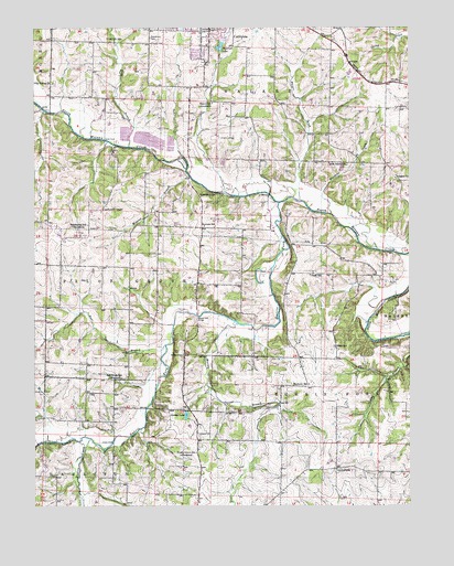
California South, MO USGS Topographic Map
Click on map above to begin viewing in our Map Viewer.

This topographic map contains these locations and features:
Feature Name Type Latitude Longitude GNIS ID View Map
Bear BranchStreamN38.5420°W92.5821°713776View Map
Boeckhaus CemeteryCemeteryN38.6226°W92.5862°714473View Map
BrantLocaleN38.6103°W92.5110°740314View Map
Burger CreekStreamN38.5798°W92.5374°729284View Map
Burris ForkStreamN38.5792°W92.5444°729285View Map
Burris Fork BridgeBridgeN38.5495°W92.5713°755021View Map
Community ChapelChurchN38.5772°W92.6027°716156View Map
CorticelliPopulated PlaceN38.5100°W92.5246°740315View Map
Corticelli ChurchChurchN38.5098°W92.5244°716333View Map
Defore CemeteryCemeteryN38.5417°W92.5252°716820View Map
Derbey LakeReservoirN38.5238°W92.5747°716845View Map
Flag Spring ChurchChurchN38.6106°W92.6191°717978View Map
Friendship ChurchChurchN38.5809°W92.5707°718241View Map
Gamble CemeteryCemeteryN38.5395°W92.5760°718323View Map
Harmony School (historical)SchoolN38.5317°W92.5338°719122View Map
Marney BranchStreamN38.5475°W92.5582°729335View Map
Marshall CreekStreamN38.5761°W92.5269°729336View Map
Mason School (historical)SchoolN38.6053°W92.5657°721954View Map
McDowell BridgeBridgeN38.5164°W92.6241°755311View Map
McMenamy Lake DamDamN38.5250°W92.5752°765329View Map
Medlen CreekStreamN38.5175°W92.6066°736173View Map
Mineral BranchStreamN38.5856°W92.5744°722422View Map
Norman School (historical)SchoolN38.5731°W92.5685°723422View Map
Number 577 DamDamN38.6067°W92.5902°762973View Map
Oak Hill School (historical)SchoolN38.6222°W92.6013°723626View Map
Pluck School (historical)SchoolN38.5603°W92.5338°724658View Map
Prairie Grove School (historical)SchoolN38.5139°W92.5716°724851View Map
Proctor Park Lake DamDamN38.6184°W92.5635°763704View Map
Railroad LakeReservoirN38.6203°W92.5630°758333View Map
Red Brush School (historical)SchoolN38.5334°W92.5963°725154View Map
Rock Island School (historical)SchoolN38.5896°W92.5269°725463View Map
Salem ChurchChurchN38.5859°W92.5038°725936View Map
Sappington School (historical)SchoolN38.5736°W92.6077°726059View Map
Scott BranchStreamN38.5939°W92.5944°726142View Map
Scott FordLocaleN38.5956°W92.6021°726148View Map
Sunnyside School (historical)SchoolN38.6186°W92.5330°743645View Map
Township of Burris ForkCivilN38.5036°W92.5126°767030View Map
Union ChurchChurchN38.5200°W92.5996°727992View Map
Union FordLocaleN38.5167°W92.5994°728007View Map
Yarnold CemeteryCemeteryN38.5189°W92.5710°729189View Map

Note: Coordinates in the location and feature list above are referenced to NAD83 datum.


Copyright (C) 2008-2025 Ryan Niemi / Sunset Dynamics ... All Rights Reserved