TopoQuest Logo
Do you find TopoQuest useful?
Help keep TopoQuest running and adding new maps/features by donating!
Bitcoin:  19c7KJd3qBynnjoSw5npx9KScwjBe4ifkT
Litecoin:  LXs6TkuXGGXo1vDsWCkWVdjQX94eUKd6ui
Home View Maps Find Maps Find Places Resources & Links


Camden, Tennessee Topographic Map

USGS Map Title: Camden, TN
USGS Map MRC: 36088A1
DRG (GeoTIFF) Download: o36088a1.tif


Neighboring USGS Topographic Map Quads:


  Manleyville, TN  
36088B2
 

  Big Sandy, TN  
36088B1
 

  Harmon Creek, TN  
36087B8
 

  Bruceton, TN  
36088A2
 

  Camden, TN  
36088A1
 

  Johnsonville, TN  
36087A8
 

  Seventeen Creek, TN  
35088H2
 

  Rockport, TN  
35088H1
 

  Hustburg, TN  
35087H8


Map MRC Location:

N37°
W89°
N37°
W88°
H8 H7 H6 H5 H4 H3 H2 H1
G8 G7 G6 G5 G4 G3 G2 G1
F8 F7 F6 F5 F4 F3 F2 F1
E8 E7 E6 E5 E4 E3 E2 E1
D8 D7 D6 D5 D4 D3 D2 D1
C8 C7 C6 C5 C4 C3 C2 C1
B8 B7 B6 B5 B4 B3 B2 B1
A8 A7 A6 A5 A4 A3 A2 A1
N36°
W89°
N36°
W88°

Camden, TN USGS 1:24K Topographic Map Preview:
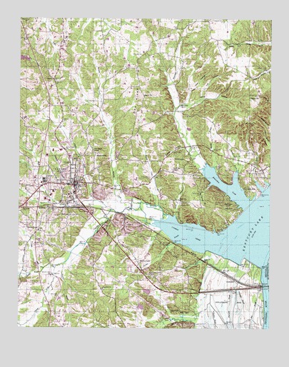
Camden, TN USGS Topographic Map
Click on map above to begin viewing in our Map Viewer.

This topographic map contains these locations and features:
Feature Name Type Latitude Longitude GNIS ID View Map
Arhold CemeteryCemeteryN36.0651°W88.0414°1275847View Map
Arnold BranchStreamN36.0584°W88.0173°1275879View Map
Arnold CemeteryCemeteryN36.0620°W88.0203°1275888View Map
Beaverdam ChurchChurchN36.0909°W88.0453°1276724View Map
Beaverdam CreekStreamN36.0506°W88.0095°1326785View Map
Beaverdam Creek Cabin AreaLocaleN36.0495°W88.0209°1276728View Map
Beaverdam Creek SubdivisionPopulated PlaceN36.0542°W88.0242°1310595View Map
Beaverdam ValleyValleyN36.0498°W88.0112°1644682View Map
Benton CountyCivilN36.0698°W88.0683°1639724View Map
Benton County AirportAirportN36.0119°W88.1245°1301389View Map
Benton County Career and Technical CenterSchoolN36.0717°W88.1081°1316794View Map
Benton County CourthouseBuildingN36.0584°W88.0970°1316790View Map
Benton County FairgroundsLocaleN36.0495°W88.0989°1316791View Map
Benton County Farm (historical)LocaleN36.0612°W88.0611°1316792View Map
Benton County Rescue SquadBuildingN36.0550°W88.0988°2653635View Map
Benton County Sheriff's DepartmentBuildingN36.0566°W88.0985°2765749View Map
BethelPopulated PlaceN36.0978°W88.0653°1647368View Map
Bethel ChurchChurchN36.0939°W88.0634°1277129View Map
Bethlehem CemeteryCemeteryN36.0623°W88.0389°1305161View Map
Big SloughStreamN36.0251°W88.0053°1277392View Map
Black CenterPopulated PlaceN36.0709°W88.0873°1277555View Map
Blackburn DamDamN36.0151°W88.0584°1302303View Map
Blackburn LakeReservoirN36.0149°W88.0612°1302302View Map
Blanchard CemeteryCemeteryN36.1103°W88.0645°1277656View Map
Briarwood Middle SchoolSchoolN36.0698°W88.1114°1316800View Map
Burnside CreekStreamN36.0509°W88.0648°1279095View Map
Burrell BranchStreamN36.0656°W88.0278°1279111View Map
Burrell BranchStreamN36.0453°W88.0075°1310600View Map
Butterworth LakeReservoirN36.0087°W88.0641°1302294View Map
Butterworth Lake DamDamN36.0084°W88.0634°1302295View Map
Calvary CemeteryCemeteryN36.0714°W88.0884°1644686View Map
CamdenPopulated PlaceN36.0589°W88.0978°1305616View Map
Camden CemeteryCemeteryN36.0556°W88.1078°1279355View Map
Camden City HallBuildingN36.0576°W88.0984°1316802View Map
Camden Dewatering AreaLocaleN36.0098°W88.0217°1279356View Map
Camden Division (historical)CensusN36.0545°W88.1000°1648603View Map
Camden Elementary SchoolSchoolN36.0689°W88.1003°1316803View Map
Camden Fire DepartmentBuildingN36.0576°W88.0987°2653692View Map
Camden General HospitalHospitalN36.0553°W88.1080°1316789View Map
Camden Police DepartmentBuildingN36.0575°W88.0984°2765710View Map
Camden Post OfficePost OfficeN36.0585°W88.0978°1650600View Map
Camden Wildlife Management AreaParkN36.0084°W88.0189°1325867View Map
Cane CreekStreamN36.0242°W88.1070°1279518View Map
Cane CreekStreamN36.0478°W88.0789°1279520View Map
Cat HollowValleyN36.0966°W88.0332°1279871View Map
Cedar HollowValleyN36.0729°W88.0425°1280079View Map
Cedar Lake Number OneReservoirN36.1088°W88.1235°1307188View Map
Central High SchoolSchoolN36.0717°W88.1042°1316809View Map
Chalk Hill Baptist ChurchChurchN36.0634°W88.0486°1305839View Map
Chalk Hill CemeteryCemeteryN36.0642°W88.0486°1644690View Map
Charlie CreekStreamN36.0514°W88.0870°1280278View Map
Chestnut HillPopulated PlaceN36.0928°W88.0056°1314830View Map
Chestnut Hill Church (historical)ChurchN36.0931°W88.0056°1316811View Map
City of CamdenCivilN36.0663°W88.1044°2403977View Map
Civilian Conservation Corps Camp Number 497 (historical)LocaleN36.0701°W88.0992°1316812View Map
Clear Lake (historical)LakeN36.0028°W88.0314°1310604View Map
Cole CemeteryCemeteryN36.0470°W88.0492°1280922View Map
Commissioner District 3CivilN36.0119°W88.1038°2464120View Map
Commissioner District 4CivilN36.1096°W88.0077°2464011View Map
Commissioner District 5CivilN36.0664°W88.1137°2464419View Map
Cowells ChapelChurchN36.0392°W88.1153°1306155View Map
Cowells Chapel CemeteryCemeteryN36.0395°W88.1145°1644693View Map
Cowells Chapel School (historical)SchoolN36.0387°W88.1150°1316816View Map
Crane Pond (historical)LakeN36.0467°W88.0114°1310838View Map
Cypress CreekStreamN36.0345°W88.0239°1281932View Map
Durdin BranchStreamN36.0348°W88.0475°1283220View Map
Eastview CemeteryCemeteryN36.0156°W88.0831°1644702View Map
Eastview ChurchChurchN36.0159°W88.0831°1283438View Map
Ebenezer SchoolSchoolN36.1212°W88.0800°1283485View Map
EvaPopulated PlaceN36.0645°W88.0042°1283888View Map
Eva Cabin AreaLocaleN36.0573°W88.0111°1283889View Map
Eva Census Designated PlaceCensusN36.0686°W88.0081°2586052View Map
Eva Fishing Camp DockLocaleN36.0556°W88.0048°1316822View Map
Eva ParkParkN36.0595°W88.0006°1316823View Map
Eva Post OfficePost OfficeN36.0640°W88.0038°1650605View Map
Eva School (historical)SchoolN36.0628°W88.0070°1316824View Map
Eva SubdivisionPopulated PlaceN36.0592°W88.0134°1310610View Map
Eva Volunteer Fire DepartmentBuildingN36.0627°W88.0071°2653917View Map
Evans BranchStreamN36.0306°W88.0323°1283895View Map
Farris SchoolSchoolN36.1220°W88.0436°1284161View Map
Flatwoods CemeteryCemeteryN36.1248°W88.0303°1284455View Map
Ford CreekStreamN36.0001°W88.0567°1303454View Map
Fourmile SloughStreamN36.0148°W88.0153°1284729View Map
Hawley CreekStreamN36.0492°W88.0575°1287196View Map
Hudson CemeteryCemeteryN36.0917°W88.0873°1288622View Map
Jordan CemeteryCemeteryN36.0184°W88.1189°1289837View Map
Lake View CampLocaleN36.0626°W88.0264°1316845View Map
Lashlee CemeteryCemeteryN36.0551°W88.0806°1290657View Map
LibertyPopulated PlaceN36.1003°W88.1084°1315385View Map
Liberty CemeteryCemeteryN36.0976°W88.1078°1644709View Map
Liberty Methodist ChurchChurchN36.0981°W88.1075°1316849View Map
Liberty School (historical)SchoolN36.1001°W88.1084°1316850View Map
Maiden CemeteryCemeteryN36.0653°W88.0264°1292511View Map
Middle BrookStreamN36.0242°W88.1128°1303499View Map
Missionary Grove Baptist ChurchChurchN36.0214°W88.0606°1294085View Map
Mitchell CemeteryCemeteryN36.0364°W88.0620°1294099View Map
Morris ChapelChurchN36.0267°W88.0645°1294423View Map
Morris Chapel CemeteryCemeteryN36.0267°W88.0634°1644715View Map
Morris Chapel SchoolSchoolN36.0195°W88.0578°1294425View Map
Morris Chapel Volunteer Fire DepartmentBuildingN36.0232°W88.0636°2654278View Map
Mount Lebannon Baptist ChurchChurchN36.0464°W88.0995°1644718View Map
Old Bethlehem CemeteryCemeteryN36.0503°W88.0275°1296276View Map
Pea RidgeRidgeN36.0912°W88.0661°1297032View Map
Pembroke SchoolSchoolN36.0648°W88.0434°1297135View Map
Prairie BranchStreamN36.0262°W88.1023°1298441View Map
Reeves BranchStreamN36.0442°W88.0467°1299182View Map
Robertson CemeteryCemeteryN36.0498°W88.0448°1299664View Map
Sales Landing (historical)LocaleN36.0301°W88.0014°1316879View Map
Sandow SloughStreamN36.0153°W88.0189°1300723View Map
Smith Grove SchoolSchoolN36.0181°W88.1036°1270671View Map
Sykes BranchStreamN36.0556°W88.0034°1272011View Map
Threemile SloughStreamN36.0167°W88.0042°1272590View Map
Tin CupPopulated PlaceN36.0456°W88.1006°1272661View Map
Toll Chapel SchoolSchoolN36.0714°W88.0889°1304127View Map
Troy Gravel PitMineN36.0431°W88.0736°1316890View Map
Umstead BranchStreamN36.0587°W88.0295°1304215View Map
Vick HollowValleyN36.0971°W88.0385°1273448View Map
WayLocaleN36.1164°W88.0064°1273953View Map
WFWL-AM (Camden)TowerN36.0528°W88.0875°1639937View Map
Whitfield CreekStreamN36.0498°W88.0956°1274476View Map
Willis HollowValleyN36.0902°W88.0419°1274747View Map
WRJB-FM (Camden)TowerN36.0570°W88.1028°1640090View Map

Note: Coordinates in the location and feature list above are referenced to NAD83 datum.


Copyright (C) 2008-2025 Ryan Niemi / Sunset Dynamics ... All Rights Reserved