TopoQuest Logo
Do you find TopoQuest useful?
Help keep TopoQuest running and adding new maps/features by donating!
Bitcoin:  19c7KJd3qBynnjoSw5npx9KScwjBe4ifkT
Litecoin:  LXs6TkuXGGXo1vDsWCkWVdjQX94eUKd6ui
Home View Maps Find Maps Find Places Resources & Links


Stephens, Arkansas Topographic Map

USGS Map Title: Stephens, AR
USGS Map MRC: 33093D1
DRG (GeoTIFF) Download: o33093d1.tif


Neighboring USGS Topographic Map Quads:


  Waterloo, AR  
33093E2
 

  Troy, AR  
33093E1
 

  Camden SW, AR  
33092E8
 

  Magnolia NW, AR  
33093D2
 

  Stephens, AR  
33093D1
 

  Buena Vista, AR  
33092D8
 

  Magnolia, AR  
33093C2
 

  Village, AR  
33093C1
 

  Mount Holly, AR  
33092C8


Map MRC Location:

N34°
W94°
N34°
W93°
H8 H7 H6 H5 H4 H3 H2 H1
G8 G7 G6 G5 G4 G3 G2 G1
F8 F7 F6 F5 F4 F3 F2 F1
E8 E7 E6 E5 E4 E3 E2 E1
D8 D7 D6 D5 D4 D3 D2 D1
C8 C7 C6 C5 C4 C3 C2 C1
B8 B7 B6 B5 B4 B3 B2 B1
A8 A7 A6 A5 A4 A3 A2 A1
N33°
W94°
N33°
W93°

Stephens, AR USGS 1:24K Topographic Map Preview:
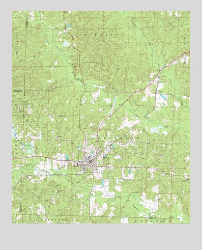
Stephens, AR USGS Topographic Map
Click on map above to begin viewing in our Map Viewer.

This topographic map contains these locations and features:
Feature Name Type Latitude Longitude GNIS ID View Map
Brigham LakeReservoirN33.4912°W93.0853°80279View Map
Brigham Lake DamDamN33.4901°W93.0868°80278View Map
Carver SchoolSchoolN33.4096°W93.0788°47505View Map
Cedar Grove ChurchChurchN33.4001°W93.0018°47607View Map
City of StephensCivilN33.4221°W93.0670°2405528View Map
Curry Oil and Gas FieldOilfieldN33.4548°W93.0979°76732View Map
Davis LakeReservoirN33.4057°W93.0423°80287View Map
Davis Lake DamDamN33.4051°W93.0418°80286View Map
Graysons DamDamN33.4151°W93.0685°80282View Map
Graysons LakeReservoirN33.4165°W93.0684°80283View Map
Hassics DamDamN33.4135°W93.0852°80284View Map
Hassics LakeReservoirN33.4140°W93.0865°80285View Map
Little Smackover CreekStreamN33.4087°W93.1082°51328View Map
New Home ChurchChurchN33.4048°W93.0199°52645View Map
New Zion Hill ChurchChurchN33.4248°W93.0938°52750View Map
OgemawPopulated PlaceN33.4626°W93.0252°58298View Map
Seminary ChurchChurchN33.4379°W93.0885°54670View Map
Sloan CreekStreamN33.3776°W93.0171°78379View Map
Smart Oil and Gas FieldOilfieldN33.4412°W93.1221°78383View Map
StephensPopulated PlaceN33.4112°W93.0696°55203View Map
Stephens AmbulanceBuildingN33.4112°W93.0711°2119041View Map
Stephens Elementary SchoolSchoolN33.4096°W93.0794°64411View Map
Stephens Fire DepartmentBuildingN33.4112°W93.0710°2117174View Map
Stephens High SchoolSchoolN33.4143°W93.0714°64412View Map
Stephens Oil and Gas FieldOilfieldN33.3960°W93.1127°55206View Map
Stephens Police DepartmentBuildingN33.4114°W93.0696°2118904View Map
Township of SmackoverCivilN33.4180°W93.0471°68924View Map
Wesson North Oil and Gas FieldOilfieldN33.4546°W93.0599°56162View Map
Wesson Oil and Gas FieldOilfieldN33.4079°W93.0621°56163View Map
Wilson AirportAirportN33.4397°W93.0566°64413View Map

Note: Coordinates in the location and feature list above are referenced to NAD83 datum.


Copyright (C) 2008-2025 Ryan Niemi / Sunset Dynamics ... All Rights Reserved