TopoQuest Logo
Do you find TopoQuest useful?
Help keep TopoQuest running and adding new maps/features by donating!
Bitcoin:  19c7KJd3qBynnjoSw5npx9KScwjBe4ifkT
Litecoin:  LXs6TkuXGGXo1vDsWCkWVdjQX94eUKd6ui
Home View Maps Find Maps Find Places Resources & Links


Brookland, Pennsylvania Topographic Map

USGS Map Title: Brookland, PA
USGS Map MRC: 41077G7
DRG (GeoTIFF) Download: o41077g7.tif


Neighboring USGS Topographic Map Quads:


  Ellisburg, PA  
41077H8
 

  Ulysses, PA  
41077H7
 

  Harrison Valley, PA  
41077H6
 

  Sweden Valley, PA  
41077G8
 

  Brookland, PA  
41077G7
 

  West Pike, PA  
41077G6
 

  Ayers Hill, PA  
41077F8
 

  Cherry Springs, PA  
41077F7
 

  Galeton, PA  
41077F6


Map MRC Location:

N42°
W78°
N42°
W77°
H8 H7 H6 H5 H4 H3 H2 H1
G8 G7 G6 G5 G4 G3 G2 G1
F8 F7 F6 F5 F4 F3 F2 F1
E8 E7 E6 E5 E4 E3 E2 E1
D8 D7 D6 D5 D4 D3 D2 D1
C8 C7 C6 C5 C4 C3 C2 C1
B8 B7 B6 B5 B4 B3 B2 B1
A8 A7 A6 A5 A4 A3 A2 A1
N41°
W78°
N41°
W77°

Brookland, PA USGS 1:24K Topographic Map Preview:
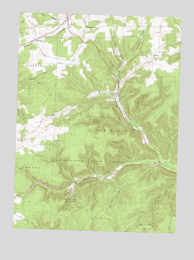
Brookland, PA USGS Topographic Map
Click on map above to begin viewing in our Map Viewer.

This topographic map contains these locations and features:
Feature Name Type Latitude Longitude GNIS ID View Map
Barn BrookStreamN41.7887°W77.7575°1168728View Map
Big Fill HollowValleyN41.7772°W77.8581°1169502View Map
Big Fill Hollow TrailTrailN41.7801°W77.8639°1205881View Map
BrooklandPopulated PlaceN41.8290°W77.7975°1203162View Map
Brown TrailTrailN41.7715°W77.7939°1170380View Map
Buckseller RunStreamN41.8117°W77.7839°1170581View Map
Buckseller Run TrailTrailN41.8134°W77.8072°1170582View Map
Commissioner RunStreamN41.7787°W77.8278°1172264View Map
Commissioner Run TrailTrailN41.7926°W77.8403°1172265View Map
Crowell HollowValleyN41.7824°W77.8113°1172774View Map
Crowell Hollow TrailTrailN41.8017°W77.8222°1205880View Map
Denton Hill Ski AreaLocaleN41.7723°W77.8317°1205827View Map
Denton Hill State ParkParkN41.7676°W77.8300°1173166View Map
Dry RunStreamN41.7840°W77.8003°1173541View Map
Ellis HollowValleyN41.7911°W77.7854°1174158View Map
Elm HollowValleyN41.7763°W77.8289°1174169View Map
Elm Hollow TrailTrailN41.7670°W77.8306°1174170View Map
Fox HillPopulated PlaceN41.8523°W77.7705°1203619View Map
Fox Hill SchoolSchoolN41.8517°W77.7705°1197785View Map
Gaffnee Post Office (historical)Post OfficeN41.7901°W77.7622°1214185View Map
GoldPopulated PlaceN41.8720°W77.8372°1203694View Map
Heath HollowValleyN41.8488°W77.7926°1176732View Map
Homestead HollowValleyN41.8481°W77.7919°1177326View Map
Jones RunStreamN41.8115°W77.7822°1178155View Map
Losey TrailTrailN41.7553°W77.7639°1179960View Map
Mill HollowValleyN41.8265°W77.7959°1181170View Map
Newfield JunctionPopulated PlaceN41.8684°W77.8222°1204284View Map
Ninemile RunStreamN41.7917°W77.7622°1182466View Map
Oak Hall SchoolSchoolN41.8284°W77.7992°1182759View Map
Pennsylvania Conservation and Natural Resources District 15 SusquehannockBuildingN41.7692°W77.8699°2645694View Map
Pennsylvania Lumber MuseumBuildingN41.7823°W77.8222°1205882View Map
Pennsylvania State Police Troop F Coudersport StationBuildingN41.7673°W77.8746°2777316View Map
Potato City Airport (historical)AirportN41.7542°W77.8747°1194281View Map
Raplee HollowValleyN41.8718°W77.8400°1184657View Map
RaymondPopulated PlaceN41.8598°W77.8619°1204465View Map
Reese HollowValleyN41.8206°W77.7785°1184847View Map
Reese HollowValleyN41.8277°W77.8175°1197885View Map
Ridge TrailTrailN41.7595°W77.8342°1185041View Map
Storey TrailTrailN41.8040°W77.7947°1206311View Map
SwedenPopulated PlaceN41.8020°W77.8708°1204784View Map
Sweden Hill ChurchChurchN41.8015°W77.8731°1189162View Map
Township of UlyssesCivilN41.8152°W77.7869°1216988View Map
Township TrailTrailN41.7526°W77.8400°1189704View Map
Triple DivideSummitN41.8467°W77.8372°1201370View Map
WaltonPopulated PlaceN41.7898°W77.7642°1204897View Map

Note: Coordinates in the location and feature list above are referenced to NAD83 datum.


Copyright (C) 2008-2025 Ryan Niemi / Sunset Dynamics ... All Rights Reserved