TopoQuest Logo
Do you find TopoQuest useful?
Help keep TopoQuest running and adding new maps/features by donating!
Bitcoin:  19c7KJd3qBynnjoSw5npx9KScwjBe4ifkT
Litecoin:  LXs6TkuXGGXo1vDsWCkWVdjQX94eUKd6ui
Home View Maps Find Maps Find Places Resources & Links


West Pike, Pennsylvania Topographic Map

USGS Map Title: West Pike, PA
USGS Map MRC: 41077G6
DRG (GeoTIFF) Download: o41077g6.tif


Neighboring USGS Topographic Map Quads:


  Ulysses, PA  
41077H7
 

  Harrison Valley, PA  
41077H6
 

  Potter Brook, PA  
41077H5
 

  Brookland, PA  
41077G7
 

  West Pike, PA  
41077G6
 

  Sabinsville, PA  
41077G5
 

  Cherry Springs, PA  
41077F7
 

  Galeton, PA  
41077F6
 

  Marshlands, PA  
41077F5


Map MRC Location:

N42°
W78°
N42°
W77°
H8 H7 H6 H5 H4 H3 H2 H1
G8 G7 G6 G5 G4 G3 G2 G1
F8 F7 F6 F5 F4 F3 F2 F1
E8 E7 E6 E5 E4 E3 E2 E1
D8 D7 D6 D5 D4 D3 D2 D1
C8 C7 C6 C5 C4 C3 C2 C1
B8 B7 B6 B5 B4 B3 B2 B1
A8 A7 A6 A5 A4 A3 A2 A1
N41°
W78°
N41°
W77°

West Pike, PA USGS 1:24K Topographic Map Preview:
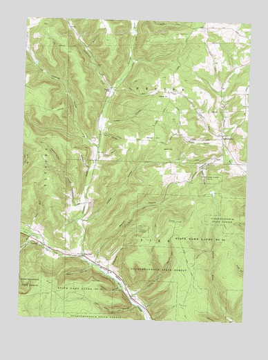
West Pike, PA USGS Topographic Map
Click on map above to begin viewing in our Map Viewer.

This topographic map contains these locations and features:
Feature Name Type Latitude Longitude GNIS ID View Map
Ansley HollowValleyN41.7603°W77.6863°1168327View Map
Baldwin HollowValleyN41.8747°W77.6891°1168657View Map
Cabin RunStreamN41.7853°W77.7447°1170856View Map
California CreekStreamN41.8456°W77.7005°1170885View Map
Crandall HollowValleyN41.7633°W77.6939°1172638View Map
Cushing HollowValleyN41.8215°W77.7080°1172864View Map
Dry Bottom TrailTrailN41.7784°W77.6494°1173495View Map
Dry RunStreamN41.8487°W77.6997°1173542View Map
Flynn HollowValleyN41.8184°W77.7059°1174924View Map
Genesee ForksStreamN41.7767°W77.7147°1198152View Map
Hardscrabble HollowValleyN41.7981°W77.7156°1176516View Map
Hartle HollowValleyN41.8274°W77.7047°1176603View Map
Hemlock TrailTrailN41.7851°W77.6739°1176817View Map
Judson HollowValleyN41.7912°W77.7159°1178184View Map
Kilbourne HollowValleyN41.7720°W77.6993°1178446View Map
Laurel RunStreamN41.8290°W77.6383°1178995View Map
Leech HillSummitN41.8220°W77.6655°1179119View Map
Lehman HollowValleyN41.8746°W77.6908°1199031View Map
Lehman RunStreamN41.8731°W77.6908°1198003View Map
Losey RunStreamN41.7831°W77.7403°1198088View Map
Loucks MillsPopulated PlaceN41.8451°W77.7011°1204066View Map
Martin HollowValleyN41.7724°W77.7102°1180490View Map
Meeker HollowValleyN41.7741°W77.7077°1180864View Map
Parker HillSummitN41.8437°W77.6742°1183315View Map
Phoenix TrailTrailN41.7915°W77.6369°1183691View Map
Rock Run VistaSummitN41.7609°W77.7439°1201388View Map
Scott HollowValleyN41.8249°W77.6389°1187165View Map
State Game Lands Number 64ParkN41.7834°W77.6469°1188523View Map
Stiles HillSummitN41.8237°W77.6833°1188667View Map
Stone HollowValleyN41.8140°W77.6496°1188723View Map
Stonylick RunStreamN41.8167°W77.6344°1188817View Map
SunderlinvillePopulated PlaceN41.8278°W77.6386°1204771View Map
TelescopePopulated PlaceN41.7815°W77.7392°1204804View Map
Thunder RunStreamN41.7506°W77.6294°1189560View Map
Tom Cabin HollowValleyN41.7562°W77.6850°1189628View Map
Tom Cabin TrailTrailN41.7534°W77.6958°1189629View Map
Township of HectorCivilN41.8647°W77.6663°1216975View Map
Township of PikeCivilN41.7733°W77.6653°1216979View Map
Tubbs HollowValleyN41.8326°W77.7042°1189900View Map
Ulysses Airport (historical)AirportN41.8737°W77.7067°1194303View Map
West PikePopulated PlaceN41.7762°W77.7139°1191093View Map

Note: Coordinates in the location and feature list above are referenced to NAD83 datum.


Copyright (C) 2008-2025 Ryan Niemi / Sunset Dynamics ... All Rights Reserved