TopoQuest Logo
Do you find TopoQuest useful?
Help keep TopoQuest running and adding new maps/features by donating!
Bitcoin:  19c7KJd3qBynnjoSw5npx9KScwjBe4ifkT
Litecoin:  LXs6TkuXGGXo1vDsWCkWVdjQX94eUKd6ui
Home View Maps Find Maps Find Places Resources & Links


Center, Kentucky Topographic Map

USGS Map Title: Center, KY
USGS Map MRC: 37085B6
DRG (GeoTIFF) Download: o37085b6.tif


Neighboring USGS Topographic Map Quads:


  Canmer, KY  
37085C7
 

  Hudgins, KY  
37085C6
 

  Summersville, KY  
37085C5
 

  Park, KY  
37085B7
 

  Center, KY  
37085B6
 

  Exie, KY  
37085B5
 

  Hiseville, KY  
37085A7
 

  Sulphur Well, KY  
37085A6
 

  East Fork, KY  
37085A5


Map MRC Location:

N38°
W86°
N38°
W85°
H8 H7 H6 H5 H4 H3 H2 H1
G8 G7 G6 G5 G4 G3 G2 G1
F8 F7 F6 F5 F4 F3 F2 F1
E8 E7 E6 E5 E4 E3 E2 E1
D8 D7 D6 D5 D4 D3 D2 D1
C8 C7 C6 C5 C4 C3 C2 C1
B8 B7 B6 B5 B4 B3 B2 B1
A8 A7 A6 A5 A4 A3 A2 A1
N37°
W86°
N37°
W85°

Center, KY USGS 1:24K Topographic Map Preview:
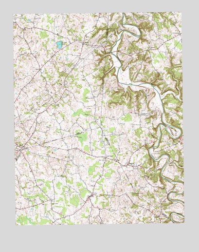
Center, KY USGS Topographic Map
Click on map above to begin viewing in our Map Viewer.

This topographic map contains these locations and features:
Feature Name Type Latitude Longitude GNIS ID View Map
Allens Grove ChurchChurchN37.1376°W85.7230°485875View Map
Asbury CemeteryCemeteryN37.2000°W85.6511°486067View Map
Bastin CemeteryCemeteryN37.2034°W85.6530°486461View Map
Bethel ChurchChurchN37.1626°W85.6744°486970View Map
Boston CemeteryCemeteryN37.1881°W85.6772°487712View Map
Cassady CemeteryCemeteryN37.1325°W85.6800°489061View Map
CenterPopulated PlaceN37.1423°W85.6930°489262View Map
Center CemeteryCemeteryN37.1475°W85.6914°489263View Map
Cook CemeteryCemeteryN37.1889°W85.6333°490000View Map
Crail HillSummitN37.1709°W85.6492°2742728View Map
CrailhopePopulated PlaceN37.1598°W85.6658°507770View Map
Davenport CemeteryCemeteryN37.2420°W85.6297°490616View Map
Dishman CemeteryCemeteryN37.2423°W85.6694°490903View Map
DonansburgPopulated PlaceN37.2373°W85.6261°507865View Map
East Fork Little Barren RiverStreamN37.1251°W85.6314°491468View Map
Ennies CemeteryCemeteryN37.1695°W85.7466°491784View Map
Fairview ChurchChurchN37.2409°W85.7420°491915View Map
Fancher BranchStreamN37.1934°W85.7077°491968View Map
Forbis CemeteryCemeteryN37.1478°W85.6444°492300View Map
Franklin CemeteryCemeteryN37.1487°W85.7316°492448View Map
Greasy CreekStreamN37.1617°W85.6361°493237View Map
Harlow CemeteryCemeteryN37.1456°W85.6561°493751View Map
Hazel CemeteryCemeteryN37.1381°W85.6405°493947View Map
Hedgespeth CemeteryCemeteryN37.1839°W85.6525°493999View Map
Hiser CemeteryCemeteryN37.1259°W85.6875°494307View Map
Hodges CemeteryCemeteryN37.1345°W85.6677°494335View Map
Horseshoe BendBendN37.1778°W85.6289°494600View Map
Houk CemeteryCemeteryN37.1698°W85.7058°494633View Map
Howell CemeteryCemeteryN37.1442°W85.6305°494690View Map
Hundred Acre PondLakeN37.2318°W85.7158°494761View Map
Jones CemeteryCemeteryN37.1406°W85.6494°495471View Map
Joseph A Altsheler Historical MarkerParkN37.1718°W85.7430°2744429View Map
Joyners Chapel Presbyterian ChurchChurchN37.1954°W85.7190°495538View Map
Kidd CemeteryCemeteryN37.1742°W85.6536°495716View Map
Ladies ChapelChurchN37.2109°W85.6966°495901View Map
Lane CemeteryCemeteryN37.1356°W85.6427°495973View Map
Liberty Union TabernacleChurchN37.1895°W85.6550°496393View Map
Macedonia ChurchChurchN37.2292°W85.6489°497413View Map
McCandless CemeteryCemeteryN37.1364°W85.6325°497772View Map
McCubbin CemeteryCemeteryN37.2000°W85.7141°497825View Map
McDonald CemeteryCemeteryN37.2014°W85.7091°497839View Map
McGlasson CemeteryCemeteryN37.1567°W85.6605°497866View Map
Mercer CemeteryCemeteryN37.2081°W85.7136°498068View Map
MonroePopulated PlaceN37.2323°W85.6977°498487View Map
Monroe BranchStreamN37.2362°W85.6697°498488View Map
Monroe ChurchChurchN37.2362°W85.6958°498490View Map
Morris CemeteryCemeteryN37.1292°W85.6589°498613View Map
Mouser BranchStreamN37.1931°W85.7397°498963View Map
NodePopulated PlaceN37.1292°W85.6439°508714View Map
North Fork Trammell CreekStreamN37.2001°W85.6311°499570View Map
North Metcalfe Fire DepartmentBuildingN37.1465°W85.6913°2636995View Map
Nunn CemeteryCemeteryN37.1250°W85.6947°499636View Map
PascalPopulated PlaceN37.2170°W85.7302°508778View Map
Pilot KnobSummitN37.1428°W85.6605°500642View Map
Pleasant Grove CemeteryCemeteryN37.2475°W85.7341°500806View Map
Riordan CemeteryCemeteryN37.2267°W85.7422°501963View Map
Robertson CemeteryCemeteryN37.1331°W85.6516°502073View Map
Rock CemeteryCemeteryN37.1687°W85.6927°502108View Map
Russell CemeteryCemeteryN37.2101°W85.6386°502512View Map
Sandidge CemeteryCemeteryN37.2256°W85.6644°502957View Map
Shady GrovePopulated PlaceN37.1645°W85.6825°509038View Map
Shady Grove Baptist ChurchChurchN37.1630°W85.6833°503214View Map
Simpson CemeteryCemeteryN37.2037°W85.6905°503535View Map
South Fork Little Barren RiverStreamN37.1251°W85.6314°503933View Map
Sydnor CemeteryCemeteryN37.2334°W85.6986°504891View Map
The NarrowsGapN37.1819°W85.6360°2742734View Map
Thompson CemeteryCemeteryN37.1906°W85.6494°505196View Map
Three SpringsPopulated PlaceN37.1717°W85.7436°505244View Map
Trammell CreekStreamN37.2001°W85.6416°505465View Map
Wallace CemeteryCemeteryN37.1834°W85.6266°506138View Map
Webb CemeteryCemeteryN37.1400°W85.7405°506331View Map
WhickervillePopulated PlaceN37.2003°W85.6905°509352View Map
Young CemeteryCemeteryN37.1392°W85.7355°507242View Map

Note: Coordinates in the location and feature list above are referenced to NAD83 datum.


Copyright (C) 2008-2025 Ryan Niemi / Sunset Dynamics ... All Rights Reserved