TopoQuest Logo
Do you find TopoQuest useful?
Help keep TopoQuest running and adding new maps/features by donating!
Bitcoin:  19c7KJd3qBynnjoSw5npx9KScwjBe4ifkT
Litecoin:  LXs6TkuXGGXo1vDsWCkWVdjQX94eUKd6ui
Home View Maps Find Maps Find Places Resources & Links


De Gonia Springs, Indiana Topographic Map

USGS Map Title: De Gonia Springs, IN
USGS Map MRC: 38087A2
DRG (GeoTIFF) Download: o38087a2.tif


Neighboring USGS Topographic Map Quads:


  Lynnville, IN  
38087B3
 

  Folsomville, IN  
38087B2
 

  Holland, IN  
38087B1
 

  Boonville, IN  
38087A3
 

  De Gonia Springs, IN  
38087A2
 

  Chrisney, IN  
38087A1
 

  Yankeetown, IN  
37087H3
 

  Richland City, IN  
37087H2
 

  Rockport, IN  
37087H1


Map MRC Location:

N39°
W88°
N39°
W87°
H8 H7 H6 H5 H4 H3 H2 H1
G8 G7 G6 G5 G4 G3 G2 G1
F8 F7 F6 F5 F4 F3 F2 F1
E8 E7 E6 E5 E4 E3 E2 E1
D8 D7 D6 D5 D4 D3 D2 D1
C8 C7 C6 C5 C4 C3 C2 C1
B8 B7 B6 B5 B4 B3 B2 B1
A8 A7 A6 A5 A4 A3 A2 A1
N38°
W88°
N38°
W87°

De Gonia Springs, IN USGS 1:24K Topographic Map Preview:
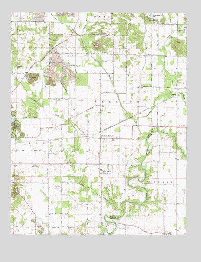
De Gonia Springs, IN USGS Topographic Map
Click on map above to begin viewing in our Map Viewer.

This topographic map contains these locations and features:
Feature Name Type Latitude Longitude GNIS ID View Map
Ash Iron SpringsPopulated PlaceN38.0353°W87.1867°430301View Map
Baker ChapelChurchN38.0539°W87.1772°430425View Map
Barren ForkStreamN38.0553°W87.1522°430529View Map
Beasley CemeteryCemeteryN38.0300°W87.1508°430657View Map
Bethabara ChurchChurchN38.1206°W87.1492°430858View Map
Daniel Huegel DitchCanalN38.0623°W87.1744°433309View Map
De Gonia SpringsPopulated PlaceN38.0556°W87.1856°433380View Map
EamesPopulated PlaceN38.0792°W87.1317°433859View Map
Ebenezer ChurchChurchN38.0400°W87.2103°433974View Map
Freedom ChurchChurchN38.0945°W87.2461°434806View Map
Hendrickson LakeReservoirN38.1241°W87.1507°436023View Map
Hendrickson Lake DamDamN38.1231°W87.1492°447758View Map
Hoskinson DrainCanalN38.0728°W87.1475°436504View Map
Kelley CemeteryCemeteryN38.1023°W87.2192°437215View Map
Little Zion ChurchChurchN38.1142°W87.1261°438182View Map
Mill CemeteryCemeteryN38.1009°W87.2058°439145View Map
Otter CreekStreamN38.0131°W87.1692°440741View Map
Otter Creek ChurchChurchN38.0950°W87.2044°440743View Map
Plainview Memorial CemeteryCemeteryN38.0395°W87.2333°441223View Map
Polk CemeteryCemeteryN38.0978°W87.1814°441406View Map
Powers DitchCanalN38.0900°W87.1281°441527View Map
Reed CemeteryCemeteryN38.1089°W87.2169°441846View Map
Roth CemeteryCemeteryN38.0664°W87.2067°442332View Map
Small CemeteryCemeteryN38.0273°W87.2186°443641View Map
Township of SkeltonCivilN38.0796°W87.1553°453850View Map
Warrick County Sheriff DeptBuildingN38.0404°W87.2484°2758421View Map

Note: Coordinates in the location and feature list above are referenced to NAD83 datum.


Copyright (C) 2008-2025 Ryan Niemi / Sunset Dynamics ... All Rights Reserved