TopoQuest Logo
Do you find TopoQuest useful?
Help keep TopoQuest running and adding new maps/features by donating!
Bitcoin:  19c7KJd3qBynnjoSw5npx9KScwjBe4ifkT
Litecoin:  LXs6TkuXGGXo1vDsWCkWVdjQX94eUKd6ui
Home View Maps Find Maps Find Places Resources & Links


Easton, Texas Topographic Map

USGS Map Title: Easton, TX
USGS Map MRC: 32094D5
DRG (GeoTIFF) Download: o32094d5.tif


Neighboring USGS Topographic Map Quads:


  Longview Heights, TX  
32094E6
 

  Hallsville, TX  
32094E5
 

  Marshall West, TX  
32094E4
 

  Lakeport, TX  
32094D6
 

  Easton, TX  
32094D5
 

  Darco, TX  
32094D4
 

  Elderville, TX  
32094C6
 

  Tatum, TX  
32094C5
 

  Harris Chapel, TX  
32094C4


Map MRC Location:

N33°
W95°
N33°
W94°
H8 H7 H6 H5 H4 H3 H2 H1
G8 G7 G6 G5 G4 G3 G2 G1
F8 F7 F6 F5 F4 F3 F2 F1
E8 E7 E6 E5 E4 E3 E2 E1
D8 D7 D6 D5 D4 D3 D2 D1
C8 C7 C6 C5 C4 C3 C2 C1
B8 B7 B6 B5 B4 B3 B2 B1
A8 A7 A6 A5 A4 A3 A2 A1
N32°
W95°
N32°
W94°

Easton, TX USGS 1:24K Topographic Map Preview:
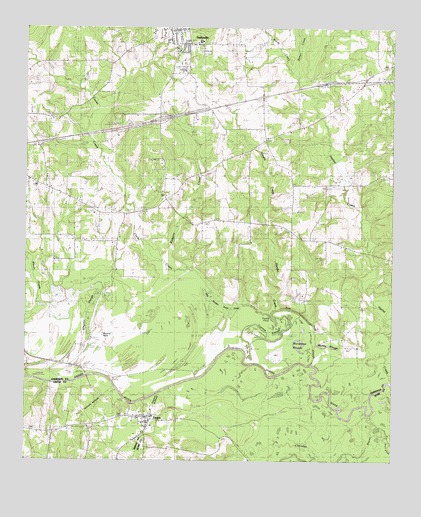
Easton, TX USGS Topographic Map
Click on map above to begin viewing in our Map Viewer.

This topographic map contains these locations and features:
Feature Name Type Latitude Longitude GNIS ID View Map
Black SloughStreamN32.3893°W94.5088°1352354View Map
Bobcat StadiumParkN32.4899°W94.5721°2027998View Map
Cherokee BayouStreamN32.3932°W94.5269°1354344View Map
City of EastonCivilN32.3819°W94.5912°2410393View Map
Clarks CreekStreamN32.4032°W94.5280°1373124View Map
EastonPopulated PlaceN32.3874°W94.5830°1356774View Map
Easton City HallBuildingN32.3875°W94.5832°2753667View Map
Easton Police DepartmentBuildingN32.3875°W94.5829°2751295View Map
Easton Post OfficePost OfficeN32.3864°W94.5841°2731591View Map
Easton Volunteer Fire DepartmentBuildingN32.3875°W94.5831°2655624View Map
Galilee SchoolSchoolN32.4971°W94.5652°1357828View Map
Golden Hill ChurchChurchN32.4577°W94.6097°1358120View Map
Hallsville DivisionCivilN32.4793°W94.5423°1938818View Map
Hardin CreekStreamN32.4188°W94.5383°1358768View Map
Hatley Memorial ChurchChurchN32.4704°W94.5344°1358897View Map
Pleasant Hill ChurchChurchN32.4385°W94.5483°1365435View Map
Rodgers CreekStreamN32.4304°W94.5699°1366812View Map
Scott CemeteryCemeteryN32.4413°W94.5913°1367881View Map
Sewell CreekStreamN32.4849°W94.5321°1372202View Map
Sewell CreekStreamN32.4835°W94.5335°1377735View Map
Sweet Home ChurchChurchN32.4835°W94.5121°1369468View Map
Wards CreekStreamN32.4843°W94.5319°1376644View Map

Note: Coordinates in the location and feature list above are referenced to NAD83 datum.


Copyright (C) 2008-2025 Ryan Niemi / Sunset Dynamics ... All Rights Reserved