TopoQuest Logo
Do you find TopoQuest useful?
Help keep TopoQuest running and adding new maps/features by donating!
Bitcoin:  19c7KJd3qBynnjoSw5npx9KScwjBe4ifkT
Litecoin:  LXs6TkuXGGXo1vDsWCkWVdjQX94eUKd6ui
Home View Maps Find Maps Find Places Resources & Links


Elk Grove, Pennsylvania Topographic Map

USGS Map Title: Elk Grove, PA
USGS Map MRC: 41076C4
DRG (GeoTIFF) Download: o41076c4.tif


Neighboring USGS Topographic Map Quads:


  Eagles Mere, PA  
41076D5
 

  Laporte, PA  
41076D4
 

  Lopez, PA  
41076D3
 

  Sonestown, PA  
41076C5
 

  Elk Grove, PA  
41076C4
 

  Red Rock, PA  
41076C3
 

  Lairdsville, PA  
41076B5
 

  Benton, PA  
41076B4
 

  Stillwater, PA  
41076B3


Map MRC Location:

N42°
W77°
N42°
W76°
H8 H7 H6 H5 H4 H3 H2 H1
G8 G7 G6 G5 G4 G3 G2 G1
F8 F7 F6 F5 F4 F3 F2 F1
E8 E7 E6 E5 E4 E3 E2 E1
D8 D7 D6 D5 D4 D3 D2 D1
C8 C7 C6 C5 C4 C3 C2 C1
B8 B7 B6 B5 B4 B3 B2 B1
A8 A7 A6 A5 A4 A3 A2 A1
N41°
W77°
N41°
W76°

Elk Grove, PA USGS 1:24K Topographic Map Preview:
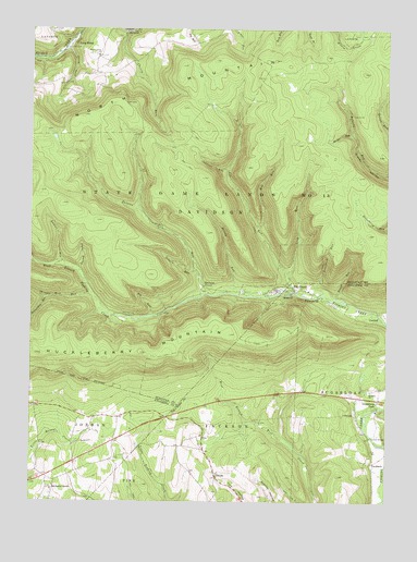
Elk Grove, PA USGS Topographic Map
Click on map above to begin viewing in our Map Viewer.

This topographic map contains these locations and features:
Feature Name Type Latitude Longitude GNIS ID View Map
Bearwallow RunStreamN41.3042°W76.4941°1192106View Map
Big RunStreamN41.2995°W76.4574°1169569View Map
Bloody RunStreamN41.3048°W76.4197°1169835View Map
Brandon ChurchChurchN41.2792°W76.3799°1170156View Map
Cherry Grove ChurchChurchN41.3676°W76.4763°1171633View Map
Cherry RunStreamN41.3742°W76.4669°1171662View Map
Deep HollowValleyN41.3119°W76.4826°1173064View Map
DividePopulated PlaceN41.2567°W76.4338°1203423View Map
Elk GrovePopulated PlaceN41.3062°W76.4069°1174112View Map
Elk RunStreamN41.3062°W76.4069°1174123View Map
EmmonsPopulated PlaceN41.3073°W76.4386°1203519View Map
Fritz CampLocaleN41.3529°W76.3866°1175276View Map
Gallows RunStreamN41.3379°W76.4305°1175399View Map
Grassmere ParkPopulated PlaceN41.2751°W76.3777°1175987View Map
Hog RunStreamN41.3226°W76.4205°1177171View Map
Huckleberry MountainSummitN41.2892°W76.4977°1177544View Map
LaubachPopulated PlaceN41.2606°W76.3788°1203987View Map
Laurel RunStreamN41.3120°W76.4866°1209307View Map
Long BrookPopulated PlaceN41.3709°W76.4852°1205063View Map
Long BrookStreamN41.3698°W76.4877°1179849View Map
Long RunStreamN41.3104°W76.4099°1179887View Map
Meeker RunStreamN41.3473°W76.3869°1180866View Map
Oxhorn RunStreamN41.3115°W76.4402°1183169View Map
Painter RunStreamN41.3048°W76.4352°1183207View Map
Peterman RunStreamN41.3042°W76.3933°1183619View Map
Richarts GrovePopulated PlaceN41.2537°W76.4916°1204498View Map
Rough RunStreamN41.3042°W76.3919°1185512View Map
RoundtopSummitN41.3390°W76.4999°1185562View Map
Shingle Mill RunStreamN41.3051°W76.4783°1193346View Map
Sugarloaf SchoolSchoolN41.2742°W76.3783°1197387View Map
Township of DavidsonCivilN41.3341°W76.4545°1217069View Map

Note: Coordinates in the location and feature list above are referenced to NAD83 datum.


Copyright (C) 2008-2025 Ryan Niemi / Sunset Dynamics ... All Rights Reserved