TopoQuest Logo
Do you find TopoQuest useful?
Help keep TopoQuest running and adding new maps/features by donating!
Bitcoin:  19c7KJd3qBynnjoSw5npx9KScwjBe4ifkT
Litecoin:  LXs6TkuXGGXo1vDsWCkWVdjQX94eUKd6ui
Home View Maps Find Maps Find Places Resources & Links


Hermansville, Michigan Topographic Map

USGS Map Title: Hermansville, MI
USGS Map MRC: 45087F5
DRG (GeoTIFF) Download: o45087f5.tif


Neighboring USGS Topographic Map Quads:


  Waucedah, MI  
45087G6
 

  Vega, MI  
45087G5
 

  Whitney, MI  
45087G4
 

  Cunard, MI  
45087F6
 

  Hermansville, MI  
45087F5
 

  Wilson, MI  
45087F4
 

  Banat, MI  
45087E6
 

  Nadeau, MI  
45087E5
 

  Gourley, MI  
45087E4


Map MRC Location:

N46°
W88°
N46°
W87°
H8 H7 H6 H5 H4 H3 H2 H1
G8 G7 G6 G5 G4 G3 G2 G1
F8 F7 F6 F5 F4 F3 F2 F1
E8 E7 E6 E5 E4 E3 E2 E1
D8 D7 D6 D5 D4 D3 D2 D1
C8 C7 C6 C5 C4 C3 C2 C1
B8 B7 B6 B5 B4 B3 B2 B1
A8 A7 A6 A5 A4 A3 A2 A1
N45°
W88°
N45°
W87°

Hermansville, MI USGS 1:24K Topographic Map Preview:
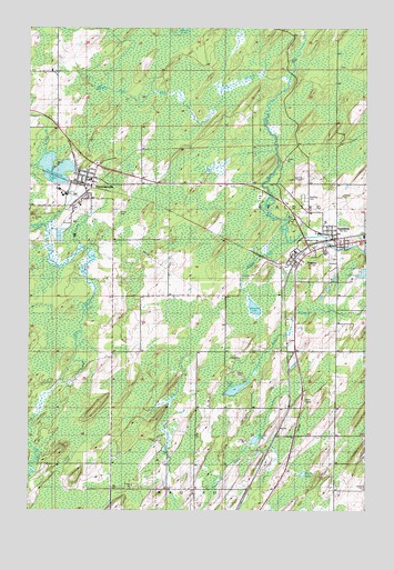
Hermansville, MI USGS Topographic Map
Click on map above to begin viewing in our Map Viewer.

This topographic map contains these locations and features:
Feature Name Type Latitude Longitude GNIS ID View Map
Alder BrookStreamN45.6947°W87.5285°619918View Map
Beaver Dam CreekStreamN45.7344°W87.5537°620919View Map
Camp Two CreekStreamN45.6986°W87.6190°622646View Map
English Post Office (historical)Post OfficeN45.6306°W87.5444°2353178View Map
English Station (historical)LeveeN45.6306°W87.5444°2353177View Map
First United Methodist ChurchChurchN45.7106°W87.6039°2353236View Map
Fisher LakeLakeN45.6345°W87.5231°626067View Map
Grace Evangelical Lutheran ChurchChurchN45.6942°W87.5211°2353220View Map
HermansvillePopulated PlaceN45.7111°W87.6021°628137View Map
Hermansville Branch LibraryBuildingN45.7097°W87.6050°2353235View Map
Hermansville Historical MarkerParkN45.7139°W87.5975°2353269View Map
Hermansville LakeReservoirN45.7135°W87.6154°628138View Map
Hermansville Post OfficePost OfficeN45.7106°W87.6056°2353232View Map
Hermansville Rescue Squad and Ambulance ServiceBuildingN45.7093°W87.6031°2662008View Map
Hermansville StationLocaleN45.7075°W87.6036°2353231View Map
IXL Historical MuseumBuildingN45.7092°W87.6072°2353234View Map
Kloman LakeLakeN45.6431°W87.5412°629797View Map
Meyer CemeteryCemeteryN45.7022°W87.5929°632178View Map
Meyer Township Volunteer Fire DepartmentBuildingN45.7103°W87.6018°2626917View Map
Nadeau Mission (historical)ChurchN45.6302°W87.5690°633204View Map
North Central Elementary SchoolSchoolN45.7108°W87.6028°2353233View Map
North Central Junior/Senior High SchoolSchoolN45.6922°W87.5153°2353219View Map
Northern Menominee Health CenterHospitalN45.6947°W87.5003°2353215View Map
OSF Medical GroupHospitalN45.6936°W87.5233°2353221View Map
PowersPopulated PlaceN45.6900°W87.5260°635379View Map
Powers Police DepartmentBuildingN45.6900°W87.5258°2353223View Map
Powers Post OfficePost OfficeN45.6900°W87.5258°2353222View Map
Powers StationLocaleN45.6878°W87.5281°2353224View Map
Reed LakeLakeN45.6562°W87.5485°635760View Map
Saint John Neumann ChurchChurchN45.6983°W87.5156°2353216View Map
SpaldingPopulated PlaceN45.6958°W87.5110°638462View Map
Spalding CemeteryCemeteryN45.7058°W87.5229°638464View Map
Spalding Lookout TowerTowerN45.7111°W87.5229°1623645View Map
Spalding Post OfficePost OfficeN45.6958°W87.5108°2353218View Map
Spalding StationLocaleN45.6958°W87.5111°2353217View Map
Spalding Township Volunteer Fire DepartmentBuildingN45.6935°W87.5163°2626916View Map
Veterans Memorial ParkParkN45.7005°W87.5271°1616990View Map
Village of PowersCivilN45.6878°W87.5267°2399014View Map
West Branch Cedar RiverStreamN45.7369°W87.5285°1616025View Map
Wheeler LakeLakeN45.6774°W87.5414°1616263View Map

Note: Coordinates in the location and feature list above are referenced to NAD83 datum.


Copyright (C) 2008-2024 Ryan Niemi / Sunset Dynamics ... All Rights Reserved