TopoQuest Logo
Do you find TopoQuest useful?
Help keep TopoQuest running and adding new maps/features by donating!
Bitcoin:  19c7KJd3qBynnjoSw5npx9KScwjBe4ifkT
Litecoin:  LXs6TkuXGGXo1vDsWCkWVdjQX94eUKd6ui
Home View Maps Find Maps Find Places Resources & Links


Cunard, Michigan Topographic Map

USGS Map Title: Cunard, MI
USGS Map MRC: 45087F6
DRG (GeoTIFF) Download: o45087f6.tif


Neighboring USGS Topographic Map Quads:


  Vulcan, MI  
45087G7
 

  Waucedah, MI  
45087G6
 

  Vega, MI  
45087G5
 

  Faithorn, MI  
45087F7
 

  Cunard, MI  
45087F6
 

  Hermansville, MI  
45087F5
 

  Miscauno Island, WI  
45087E7
 

  Banat, MI  
45087E6
 

  Nadeau, MI  
45087E5


Map MRC Location:

N46°
W88°
N46°
W87°
H8 H7 H6 H5 H4 H3 H2 H1
G8 G7 G6 G5 G4 G3 G2 G1
F8 F7 F6 F5 F4 F3 F2 F1
E8 E7 E6 E5 E4 E3 E2 E1
D8 D7 D6 D5 D4 D3 D2 D1
C8 C7 C6 C5 C4 C3 C2 C1
B8 B7 B6 B5 B4 B3 B2 B1
A8 A7 A6 A5 A4 A3 A2 A1
N45°
W88°
N45°
W87°

Cunard, MI USGS 1:24K Topographic Map Preview:
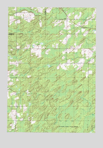
Cunard, MI USGS Topographic Map
Click on map above to begin viewing in our Map Viewer.

This topographic map contains these locations and features:
Feature Name Type Latitude Longitude GNIS ID View Map
Bird CreekStreamN45.6319°W87.7382°621428View Map
BlomPopulated PlaceN45.6511°W87.7382°1617450View Map
Brooks Post Office (historical)Post OfficeN45.6667°W87.7444°2353182View Map
Brooks Station (historical)LocaleN45.6692°W87.7444°2353181View Map
Camp CreekStreamN45.6525°W87.7187°622556View Map
Carlson CreekStreamN45.7000°W87.7407°622727View Map
CunardPopulated PlaceN45.7380°W87.6668°624214View Map
Cunard Rest AreaLocaleN45.7294°W87.6396°1616993View Map
Cunard StationLocaleN45.7383°W87.6669°2353150View Map
Malacca LakeLakeN45.6908°W87.6918°631345View Map
Mullen CreekStreamN45.7122°W87.7165°633101View Map
Nadeau CreekStreamN45.6416°W87.6273°633203View Map
Saint John Neumann ChurchChurchN45.7083°W87.6417°2353230View Map
Three Curve ParkParkN45.7475°W87.6751°1614812View Map
Township of FaithornCivilN45.6541°W87.7374°1626268View Map
Vesper Post Office (historical)Post OfficeN45.7381°W87.6667°2353151View Map

Note: Coordinates in the location and feature list above are referenced to NAD83 datum.


Copyright (C) 2008-2025 Ryan Niemi / Sunset Dynamics ... All Rights Reserved