TopoQuest Logo
Do you find TopoQuest useful?
Help keep TopoQuest running and adding new maps/features by donating!
Bitcoin:  19c7KJd3qBynnjoSw5npx9KScwjBe4ifkT
Litecoin:  LXs6TkuXGGXo1vDsWCkWVdjQX94eUKd6ui
Home View Maps Find Maps Find Places Resources & Links


Shipman, Virginia Topographic Map

USGS Map Title: Shipman, VA
USGS Map MRC: 37078F7
DRG (GeoTIFF) Download: o37078f7.tif


Neighboring USGS Topographic Map Quads:


  Horseshoe Mountain, VA  
37078G8
 

  Lovingston, VA  
37078G7
 

  Schuyler, VA  
37078G6
 

  Arrington, VA  
37078F8
 

  Shipman, VA  
37078F7
 

  Howardsville, VA  
37078F6
 

  Buffalo Ridge, VA  
37078E8
 

  Gladstone, VA  
37078E7
 

  Saint Joy, VA  
37078E6


Map MRC Location:

N38°
W79°
N38°
W78°
H8 H7 H6 H5 H4 H3 H2 H1
G8 G7 G6 G5 G4 G3 G2 G1
F8 F7 F6 F5 F4 F3 F2 F1
E8 E7 E6 E5 E4 E3 E2 E1
D8 D7 D6 D5 D4 D3 D2 D1
C8 C7 C6 C5 C4 C3 C2 C1
B8 B7 B6 B5 B4 B3 B2 B1
A8 A7 A6 A5 A4 A3 A2 A1
N37°
W79°
N37°
W78°

Shipman, VA USGS 1:24K Topographic Map Preview:
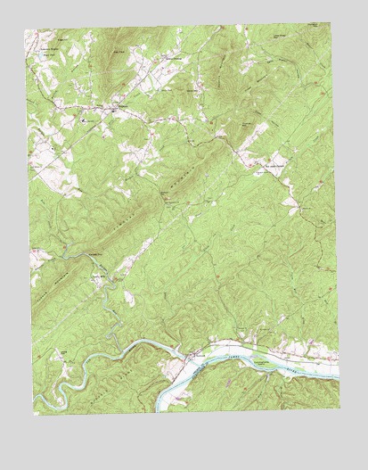
Shipman, VA USGS Topographic Map
Click on map above to begin viewing in our Map Viewer.

This topographic map contains these locations and features:
Feature Name Type Latitude Longitude GNIS ID View Map
Bethany ChurchChurchN37.6521°W78.7914°1463137View Map
Bethel ChurchChurchN37.6790°W78.8709°1463186View Map
Bobs CreekStreamN37.6801°W78.8595°1463625View Map
Canada GapGapN37.6768°W78.8517°1464391View Map
Christ ChurchChurchN37.6438°W78.8089°1464880View Map
Coon HollowValleyN37.7131°W78.7711°1465213View Map
Cunninghams IslandIslandN37.6404°W78.7809°1465533View Map
Davis PondReservoirN37.7294°W78.8203°1465658View Map
Dillard CreekStreamN37.7224°W78.8731°1483011View Map
Edge HillSummitN37.7463°W78.8620°1499377View Map
Edwards BranchStreamN37.6757°W78.8611°1466184View Map
Fairmount ChurchChurchN37.6924°W78.8170°1466401View Map
Findlay MountainSummitN37.6926°W78.8267°1499411View Map
Gleasons GapGapN37.6957°W78.8209°1467140View Map
Gordon CrossingPopulated PlaceN37.7401°W78.8170°1477365View Map
Hebron ChurchChurchN37.6896°W78.7636°1467902View Map
High PeakSummitN37.7415°W78.8395°1499553View Map
Joe CreekStreamN37.6432°W78.8139°1468753View Map
Lakeview HeightsPopulated PlaceN37.7429°W78.8692°1499639View Map
Little Joe CreekStreamN37.6749°W78.8078°1469578View Map
Little Piney MountainSummitN37.7451°W78.7736°1469617View Map
Lovingston District (historical)CivilN37.6864°W78.8537°2390691View Map
Mallorys CreekStreamN37.6365°W78.7686°1470030View Map
Meadow CreekStreamN37.6968°W78.8514°1470310View Map
Montreal ChurchChurchN37.7238°W78.8434°1470694View Map
Negro CreekStreamN37.6374°W78.7770°1471365View Map
Nero CreekStreamN37.7065°W78.8561°1471380View Map
NorwoodPopulated PlaceN37.6432°W78.8089°1499808View Map
Payne PondReservoirN37.7416°W78.8684°1472131View Map
Peavine MountainSummitN37.7288°W78.7928°1472163View Map
Piney MountainSummitN37.7276°W78.7842°1472407View Map
Pleasant Grove Baptist ChurchChurchN37.7021°W78.7822°1472485View Map
Purvis HollowValleyN37.7261°W78.8639°1472879View Map
Red Apple OrchardPopulated PlaceN37.7040°W78.7789°1499939View Map
Rucker RunStreamN37.6451°W78.8381°1486808View Map
Ryan Elementary SchoolSchoolN37.7201°W78.8517°1473667View Map
Saint Johns ChurchChurchN37.6515°W78.7778°1473773View Map
Saint Marys ChurchChurchN37.7051°W78.8736°1473832View Map
Sally Powell HollowValleyN37.7298°W78.7622°1473972View Map
ShipmanPopulated PlaceN37.7238°W78.8392°1500096View Map
Shipman Census Designated PlaceCensusN37.7272°W78.8423°2584918View Map
Shipman Post OfficePost OfficeN37.7235°W78.8402°2766292View Map
South DistrictCivilN37.6474°W78.8583°2631326View Map
Thomas MountainSummitN37.7176°W78.7872°1475647View Map
Tye RiverStreamN37.6399°W78.8067°1487087View Map
Union Hill CreekStreamN37.6371°W78.7592°1476080View Map
Variety MillsLocaleN37.6685°W78.8486°1476152View Map
Welsh MountainSummitN37.7288°W78.8089°1476447View Map

Note: Coordinates in the location and feature list above are referenced to NAD83 datum.


Copyright (C) 2008-2025 Ryan Niemi / Sunset Dynamics ... All Rights Reserved