TopoQuest Logo
Do you find TopoQuest useful?
Help keep TopoQuest running and adding new maps/features by donating!
Bitcoin:  19c7KJd3qBynnjoSw5npx9KScwjBe4ifkT
Litecoin:  LXs6TkuXGGXo1vDsWCkWVdjQX94eUKd6ui
Home View Maps Find Maps Find Places Resources & Links


Marlborough, Connecticut Topographic Map

USGS Map Title: Marlborough, CT
USGS Map MRC: 41072F4
DRG (GeoTIFF) Download: o41072f4.tif


Neighboring USGS Topographic Map Quads:


  Manchester, CT  
41072G5
 

  Rockville, CT  
41072G4
 

  Coventry, CT  
41072G3
 

  Glastonbury, CT  
41072F5
 

  Marlborough, CT  
41072F4
 

  Columbia, CT  
41072F3
 

  Middle Haddam, CT  
41072E5
 

  Moodus, CT  
41072E4
 

  Colchester, CT  
41072E3


Map MRC Location:

N42°
W73°
N42°
W72°
H8 H7 H6 H5 H4 H3 H2 H1
G8 G7 G6 G5 G4 G3 G2 G1
F8 F7 F6 F5 F4 F3 F2 F1
E8 E7 E6 E5 E4 E3 E2 E1
D8 D7 D6 D5 D4 D3 D2 D1
C8 C7 C6 C5 C4 C3 C2 C1
B8 B7 B6 B5 B4 B3 B2 B1
A8 A7 A6 A5 A4 A3 A2 A1
N41°
W73°
N41°
W72°

Marlborough, CT USGS 1:24K Topographic Map Preview:
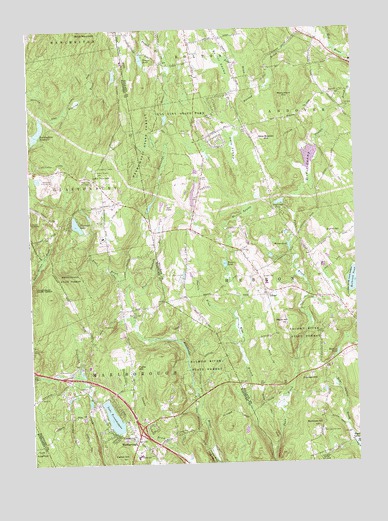
Marlborough, CT USGS Topographic Map
Click on map above to begin viewing in our Map Viewer.

This topographic map contains these locations and features:
Feature Name Type Latitude Longitude GNIS ID View Map
Andover Post OfficePost OfficeN41.7403°W72.3768°2783295View Map
Baker BrookStreamN41.7337°W72.4129°205202View Map
Bear SwampSwampN41.6453°W72.4779°1950012View Map
Birch MountainSummitN41.7495°W72.4823°205517View Map
Bishop SwampSwampN41.7054°W72.3915°205534View Map
Blish ParkParkN41.6445°W72.4737°1950030View Map
Buckingham ReservoirReservoirN41.7211°W72.4961°205797View Map
Buckingham Reservoir DamDamN41.7176°W72.4987°1770665View Map
Burnt HillSummitN41.6909°W72.3831°205858View Map
Burrows HillSummitN41.6357°W72.3918°205868View Map
Burrows Hill CemeteryCemeteryN41.6338°W72.3887°205869View Map
Carter HillSummitN41.6268°W72.4662°206049View Map
Clubhouse PondLakeN41.7001°W72.4038°206336View Map
Daly SwampSwampN41.7166°W72.4210°206576View Map
Daniels BrookStreamN41.6679°W72.4220°206587View Map
Diamond LakeLakeN41.6941°W72.4817°206682View Map
East Glastonbury Fish and Game ClubLocaleN41.6537°W72.4868°1950183View Map
Elmer Thienes SchoolSchoolN41.6268°W72.4595°211440View Map
Flat BrookStreamN41.6751°W72.4626°207107View Map
Foot Sawmill BrookStreamN41.6762°W72.4626°207129View Map
Foote Hill PondReservoirN41.7023°W72.4368°1771305View Map
Foote Hills Farm DamDamN41.7001°W72.4379°1771304View Map
Four CornersPopulated PlaceN41.6326°W72.4595°1950278View Map
Frankel HillSummitN41.6484°W72.3920°207192View Map
French BrookStreamN41.7423°W72.4454°207205View Map
Fuller HillSummitN41.6529°W72.4595°207222View Map
Gay CemeteryCemeteryN41.7207°W72.4383°207263View Map
Gay City State ParkParkN41.7262°W72.4401°207264View Map
GileadPopulated PlaceN41.6734°W72.4084°212463View Map
Gilead CemeteryCemeteryN41.6782°W72.4107°207302View Map
Glastonbury Fire TowerTowerN41.7104°W72.4726°1950289View Map
Hebron Volunteer Fire Department Station 3BuildingN41.7029°W72.4341°2420165View Map
Holbrook PondLakeN41.6775°W72.3755°207883View Map
Holman PondLakeN41.6567°W72.3824°207898View Map
Hope ValleyPopulated PlaceN41.6337°W72.3751°212480View Map
Hope Valley BrookStreamN41.6320°W72.3770°207941View Map
John Tom HillSummitN41.7086°W72.4731°208174View Map
John Tom Hill CemeteryCemeteryN41.7076°W72.4773°208175View Map
Lake TerramuggusLakeN41.6383°W72.4690°211388View Map
Mack HillSummitN41.6654°W72.4040°208662View Map
Marlboro Post Office (historical)Post OfficeN41.6318°W72.4612°1950471View Map
MarlboroughPopulated PlaceN41.6315°W72.4598°208729View Map
Marlborough Commons Shopping CenterLocaleN41.6376°W72.4568°1950472View Map
Marlborough Congregational ChurchChurchN41.6290°W72.4554°1950473View Map
Marlborough Elementary SchoolSchoolN41.6287°W72.4579°1950475View Map
Marlborough Industrial ParkLocaleN41.6465°W72.4843°1950476View Map
Marlborough Post OfficePost OfficeN41.6304°W72.4611°2783277View Map
Marlborough Town HallBuildingN41.6323°W72.4612°1950477View Map
Marlborough Volunteer Fire Department Station 1BuildingN41.6327°W72.4597°2420092View Map
Marlborough Volunteer Fire Department Station 2BuildingN41.6687°W72.4642°2420124View Map
Mary Hall SchoolSchoolN41.6323°W72.4618°208747View Map
Merrow SwampSwampN41.6969°W72.4177°208842View Map
Monument HillSummitN41.7307°W72.4015°209011View Map
New Boston HillSummitN41.7184°W72.4073°209216View Map
Old Marlborough CemeteryCemeteryN41.6694°W72.4598°209486View Map
Richmond Memorial LibraryBuildingN41.6282°W72.4587°1950619View Map
Roy B Pettengill Ambulance AssociationBuildingN41.6326°W72.4596°2660916View Map
Salmon River State ForestForestN41.6532°W72.4351°210616View Map
TerramuggusPopulated PlaceN41.6351°W72.4704°1867104View Map
Terramuggus Census Designated PlaceCensusN41.6344°W72.4692°2377871View Map
Tinker PondLakeN41.7414°W72.4561°211473View Map
Tinker Pond DamDamN41.7409°W72.4545°1771581View Map
Town of AndoverCivilN41.7331°W72.3760°213382View Map
Town of HebronCivilN41.6594°W72.3905°213445View Map
Town of MarlboroughCivilN41.6331°W72.4547°213457View Map
Townsend CemeteryCemeteryN41.7279°W72.3790°211542View Map
Warner PondLakeN41.6825°W72.4251°211817View Map
Warner SwampSwampN41.7393°W72.4240°211819View Map
West Branch Fawn BrookStreamN41.6276°W72.4087°211924View Map
Woods PondLakeN41.6877°W72.4004°212257View Map

Note: Coordinates in the location and feature list above are referenced to NAD83 datum.


Copyright (C) 2008-2024 Ryan Niemi / Sunset Dynamics ... All Rights Reserved