TopoQuest Logo
Do you find TopoQuest useful?
Help keep TopoQuest running and adding new maps/features by donating!
Bitcoin:  19c7KJd3qBynnjoSw5npx9KScwjBe4ifkT
Litecoin:  LXs6TkuXGGXo1vDsWCkWVdjQX94eUKd6ui
Home View Maps Find Maps Find Places Resources & Links


Marmon Ranch, New Mexico Topographic Map

USGS Map Title: Marmon Ranch, NM
USGS Map MRC: 34107G4
DRG (GeoTIFF) Download: o34107g4.tif


Neighboring USGS Topographic Map Quads:


  Acoma Pueblo, NM  
34107H5
 

  South Butte, NM  
34107H4
 

  Dough Mountain, NM  
34107H3
 

  East Mesa, NM  
34107G5
 

  Marmon Ranch, NM  
34107G4
 

  Cerro Verde, NM  
34107G3
 

  Broom Mountain, NM  
34107F5
 

  Cerro Del Oro, NM  
34107F4
 

  Chicken Mountain, NM  
34107F3


Map MRC Location:

N35°
W108°
N35°
W107°
H8 H7 H6 H5 H4 H3 H2 H1
G8 G7 G6 G5 G4 G3 G2 G1
F8 F7 F6 F5 F4 F3 F2 F1
E8 E7 E6 E5 E4 E3 E2 E1
D8 D7 D6 D5 D4 D3 D2 D1
C8 C7 C6 C5 C4 C3 C2 C1
B8 B7 B6 B5 B4 B3 B2 B1
A8 A7 A6 A5 A4 A3 A2 A1
N34°
W108°
N34°
W107°

Marmon Ranch, NM USGS 1:24K Topographic Map Preview:
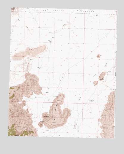
Marmon Ranch, NM USGS Topographic Map
Click on map above to begin viewing in our Map Viewer.

This topographic map contains these locations and features:
Feature Name Type Latitude Longitude GNIS ID View Map
Albert HMS Water WellWellN34.8162°W107.4653°918576View Map
Alberts HomesteadLocaleN34.8167°W107.4650°885659View Map
Alkali SpringSpringN34.8069°W107.3937°885686View Map
Badger ButteSummitN34.8295°W107.3959°885978View Map
Badger DamDamN34.8087°W107.4384°885979View Map
Badger Detention DamDamN34.8084°W107.4389°923808View Map
Badger Water WellWellN34.8117°W107.4353°918873View Map
Badger WindmillLocaleN34.8114°W107.4350°885986View Map
Caņada AnchaStreamN34.7631°W107.4195°897718View Map
Cold CanyonValleyN34.8234°W107.4709°887735View Map
Crane PlaceLocaleN34.8150°W107.3845°898538View Map
Eddlwmann SpringSpringN34.7859°W107.4041°888770View Map
Gunn WindmillLocaleN34.7631°W107.4295°889660View Map
Hiyi Water WellWellN34.7856°W107.4545°918724View Map
Hiyi WindmillLocaleN34.7859°W107.4542°890035View Map
Lucy W Detention DamDamN34.7853°W107.4792°891484View Map
Marmon HQ Water WellWellN34.8428°W107.4528°918516View Map
Marmon RanchLocaleN34.8434°W107.4528°891613View Map
Martin TankReservoirN34.7929°W107.4568°891644View Map
Middle Tsid-wezaAreaN34.7742°W107.4448°891989View Map
Mush MountainSummitN34.7698°W107.4567°892357View Map
Petoch ButteSummitN34.8745°W107.4987°899844View Map
Petoch WashStreamN34.8462°W107.4784°893220View Map
Romero PlaceLocaleN34.8700°W107.3998°898593View Map
Romero PLC Water WellWellN34.8695°W107.3998°918599View Map
Seis-wilson Detention Dam Number 1DamN34.7681°W107.4656°898125View Map
Seis-wilson Detention Dam Number 2DamN34.7895°W107.4475°898126View Map
Seis-wilson Dike and Pit Number 2MineN34.7562°W107.4520°898127View Map
Thompsom WindmillLocaleN34.8739°W107.4195°895627View Map

Note: Coordinates in the location and feature list above are referenced to NAD83 datum.


Copyright (C) 2008-2025 Ryan Niemi / Sunset Dynamics ... All Rights Reserved