TopoQuest Logo
Do you find TopoQuest useful?
Help keep TopoQuest running and adding new maps/features by donating!
Bitcoin:  19c7KJd3qBynnjoSw5npx9KScwjBe4ifkT
Litecoin:  LXs6TkuXGGXo1vDsWCkWVdjQX94eUKd6ui
Home View Maps Find Maps Find Places Resources & Links


Canton, Kentucky Topographic Map

USGS Map Title: Canton, KY
USGS Map MRC: 36087G8
DRG (GeoTIFF) Download: o36087g8.tif


Neighboring USGS Topographic Map Quads:


  Mont, KY  
36088H1
 

  Lamasco, KY  
36087H8
 

  Cobb, KY  
36087H7
 

  Fenton, KY  
36088G1
 

  Canton, KY  
36087G8
 

  Cadiz, KY  
36087G7
 

  Rushing Bay, TN  
36088F1
 

  Linton, KY  
36087F8
 

  Johnson Hollow, KY  
36087F7


Map MRC Location:

N37°
W88°
N37°
W87°
H8 H7 H6 H5 H4 H3 H2 H1
G8 G7 G6 G5 G4 G3 G2 G1
F8 F7 F6 F5 F4 F3 F2 F1
E8 E7 E6 E5 E4 E3 E2 E1
D8 D7 D6 D5 D4 D3 D2 D1
C8 C7 C6 C5 C4 C3 C2 C1
B8 B7 B6 B5 B4 B3 B2 B1
A8 A7 A6 A5 A4 A3 A2 A1
N36°
W88°
N36°
W87°

Canton, KY USGS 1:24K Topographic Map Preview:
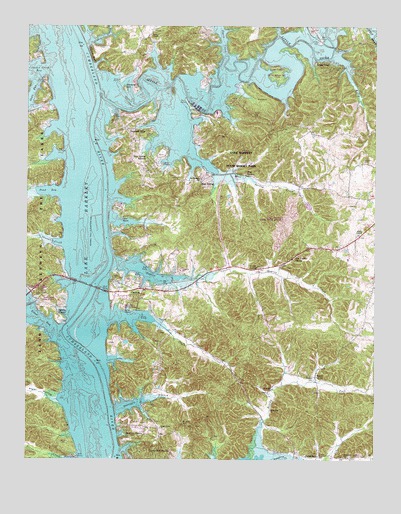
Canton, KY USGS Topographic Map
Click on map above to begin viewing in our Map Viewer.

This topographic map contains these locations and features:
Feature Name Type Latitude Longitude GNIS ID View Map
Bacon CreekStreamN36.7503°W87.9856°486196View Map
Barkley ShoresPopulated PlaceN36.7576°W87.9642°507454View Map
Barkley Shores Census Designated PlaceCensusN36.7554°W87.9601°2629570View Map
Beechy ForkStreamN36.7506°W87.9197°486758View Map
Blue SpringPopulated PlaceN36.8289°W87.9375°507535View Map
Blue SpringSpringN36.8318°W87.9207°487542View Map
Blue Spring CreekStreamN36.8326°W87.9311°487554View Map
Blue Spring EstatesPopulated PlaceN36.8370°W87.9564°507536View Map
Bridges CemeteryCemeteryN36.7739°W87.8964°487892View Map
CantonPopulated PlaceN36.7989°W87.9609°507647View Map
Canton Census Designated PlaceCensusN36.7985°W87.9611°2629584View Map
Canton DivisionCivilN36.7631°W87.8831°1936906View Map
Carr CemeteryCemeteryN36.7656°W87.9559°488968View Map
Cedar PointPopulated PlaceN36.8648°W87.8920°507676View Map
Cumberland ShoresPopulated PlaceN36.7523°W87.9478°507795View Map
Devils ElbowBayN36.7934°W87.9884°490840View Map
Dixon CemeteryCemeteryN36.7550°W87.9872°490925View Map
DonaldsonPopulated PlaceN36.7514°W87.8947°507864View Map
Donaldson Creek ChurchChurchN36.7512°W87.8859°491001View Map
Dyers ChapelChurchN36.8162°W87.8792°491395View Map
Dyers CreekStreamN36.8670°W87.9278°491396View Map
East Golden Pond Volunteer Fire DepartmentBuildingN36.8110°W87.8845°2636958View Map
Elbow BayBayN36.7912°W87.9959°491608View Map
Forrest vs Gunboat Conestoga Fight Historical MarkerParkN36.7982°W87.9685°2744747View Map
Goose CreekStreamN36.8695°W87.9786°493007View Map
Hillman BluffCliffN36.8667°W87.9764°494266View Map
Hopson CreekStreamN36.8067°W87.9684°494553View Map
Jefferson CemeteryCemeteryN36.8362°W87.8795°495188View Map
Kelly BranchStreamN36.8592°W87.8831°495618View Map
Lake BarkleyReservoirN36.8287°W87.9835°486356View Map
Lake Barkley State ParkParkN36.8448°W87.9231°495909View Map
Lake Barkley State Park AirportAirportN36.8231°W87.9051°517347View Map
Lawrence Memorial BridgeBridgeN36.8001°W87.9772°496080View Map
Lester SpringSpringN36.8050°W87.9200°496299View Map
Liberty Point CemeteryCemeteryN36.8631°W87.8872°496386View Map
Lick CreekStreamN36.7909°W87.9695°496464View Map
Little RiverStreamN36.8556°W87.9736°496838View Map
Long CemeteryCemeteryN36.7975°W87.9967°497086View Map
Maple GrovePopulated PlaceN36.7751°W87.8959°508537View Map
McIntire CemeteryCemeteryN36.7606°W87.9439°497883View Map
Mineral HillIslandN36.8573°W87.9647°498403View Map
Mount Pleasant Baptist ChurchChurchN36.8310°W87.9375°498831View Map
Peals ChapelChurchN36.8720°W87.9547°500330View Map
Pete Light SpringSpringN36.8089°W87.9034°500452View Map
Pond BayBayN36.8278°W87.9914°501027View Map
Pond CreekStreamN36.8276°W87.9972°501041View Map
Pryor HollowValleyN36.7670°W87.9885°501404View Map
Shanklin CreekStreamN36.8126°W87.9867°503237View Map
Shaw BayBayN36.8562°W87.9986°503270View Map
Shawnee HillsPopulated PlaceN36.8442°W87.9567°509044View Map
South Union ChurchChurchN36.7595°W87.9511°503982View Map
Terrapin BranchStreamN36.7645°W87.9684°505076View Map

Note: Coordinates in the location and feature list above are referenced to NAD83 datum.


Copyright (C) 2008-2024 Ryan Niemi / Sunset Dynamics ... All Rights Reserved