TopoQuest Logo
Do you find TopoQuest useful?
Help keep TopoQuest running and adding new maps/features by donating!
Bitcoin:  19c7KJd3qBynnjoSw5npx9KScwjBe4ifkT
Litecoin:  LXs6TkuXGGXo1vDsWCkWVdjQX94eUKd6ui
Home View Maps Find Maps Find Places Resources & Links


Peosta, Iowa Topographic Map

USGS Map Title: Peosta, IA
USGS Map MRC: 42090D7
DRG (GeoTIFF) Download: o42090d7.tif


Neighboring USGS Topographic Map Quads:


  Holy Cross, IA  
42090E8
 

  Sherrill, IA  
42090E7
 

  Dubuque North, IA  
42090E6
 

  Epworth, IA  
42090D8
 

  Peosta, IA  
42090D7
 

  Dubuque South, IA  
42090D6
 

  Fillmore, IA  
42090C8
 

  Bernard, IA  
42090C7
 

  Zwingle, IA  
42090C6


Map MRC Location:

N43°
W91°
N43°
W90°
H8 H7 H6 H5 H4 H3 H2 H1
G8 G7 G6 G5 G4 G3 G2 G1
F8 F7 F6 F5 F4 F3 F2 F1
E8 E7 E6 E5 E4 E3 E2 E1
D8 D7 D6 D5 D4 D3 D2 D1
C8 C7 C6 C5 C4 C3 C2 C1
B8 B7 B6 B5 B4 B3 B2 B1
A8 A7 A6 A5 A4 A3 A2 A1
N42°
W91°
N42°
W90°

Peosta, IA USGS 1:24K Topographic Map Preview:
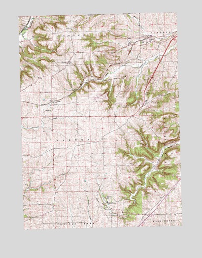
Peosta, IA USGS Topographic Map
Click on map above to begin viewing in our Map Viewer.

This topographic map contains these locations and features:
Feature Name Type Latitude Longitude GNIS ID View Map
Burton Payne LibraryBuildingN42.4458°W90.8501°2001312View Map
CentraliaPopulated PlaceN42.4722°W90.8371°455332View Map
Centralia ChurchChurchN42.4922°W90.8335°455333View Map
Centralia Peosta Emergency Services Station 1BuildingN42.4485°W90.8512°2001307View Map
Centralia Peosta Emergency Services Station 2BuildingN42.4718°W90.8374°2577486View Map
Centralia Post Office (historical)Post OfficeN42.4722°W90.8371°2001395View Map
Centralia Presbyterian CemeteryCemeteryN42.4923°W90.8325°2001476View Map
City of CentraliaCivilN42.4724°W90.8366°2393788View Map
City of GrafCivilN42.4939°W90.8732°2394942View Map
City of PeostaCivilN42.4481°W90.8467°2396179View Map
Derrinane Post Office (historical)Post OfficeN42.3972°W90.8393°2001398View Map
Dubuque County FairgroundsLocaleN42.4833°W90.7710°2001202View Map
Dubuque County HomeBuildingN42.4861°W90.7751°463626View Map
GrafPopulated PlaceN42.4931°W90.8712°457010View Map
Graf (historical)LocaleN42.4931°W90.8712°2001397View Map
Graf Post Office (historical)Post OfficeN42.4931°W90.8712°2001396View Map
Heritage TrailTrailN42.4950°W90.8687°2001090View Map
Holy Family Catholic CemeteryCemeteryN42.3866°W90.8102°2001470View Map
Holy Family ChurchChurchN42.4506°W90.8504°2001308View Map
Holy Family ChurchChurchN42.3864°W90.8115°457582View Map
Ice Harbor EmporiumLocaleN42.4953°W90.7643°463958View Map
JulianLocaleN42.4819°W90.7793°2001393View Map
Julian Post Office (historical)Post OfficeN42.4819°W90.7793°2001394View Map
JulienPopulated PlaceN42.4811°W90.7796°464598View Map
Julien Post Office (historical)Post OfficeN42.4811°W90.7796°2001392View Map
Lost Canyon Mobile Home ParkPopulated PlaceN42.4486°W90.7801°2001263View Map
McCants Post Office (historical)Post OfficeN42.4403°W90.7849°2001399View Map
Michael Schmitt CemeteryCemeteryN42.4417°W90.8501°2001473View Map
New Melleray AbbeyChurchN42.3900°W90.8090°459482View Map
New Melleray Abbey CemeteryCemeteryN42.3889°W90.8085°2001471View Map
Northeast Iowa Community College Peosta CampusSchoolN42.4446°W90.8452°2001304View Map
Paramount Emergency Medical Services Station 1BuildingN42.4803°W90.7881°2599674View Map
Paramount Emergency Medical Services West CampusBuildingN42.4533°W90.8272°2599896View Map
PeostaPopulated PlaceN42.4506°W90.8504°460080View Map
PeostaLocaleN42.4497°W90.8507°2001311View Map
Peosta Elementary SchoolSchoolN42.4464°W90.8414°2719812View Map
Peosta Post OfficePost OfficeN42.4506°W90.8504°2001305View Map
Peosta Protestant CemeteryCemeteryN42.4553°W90.8508°2001474View Map
Reeds ChapelChurchN42.4511°W90.7626°460574View Map
Reeds Chapel Methodist CemeteryCemeteryN42.4511°W90.7621°2001472View Map
Saint John the Baptist Catholic CemeteryCemeteryN42.4706°W90.8340°2001475View Map
Saint John the Baptist ChurchChurchN42.4506°W90.8504°2001306View Map
Saint Johns SchoolSchoolN42.4447°W90.8512°461079View Map
Seton Catholic School Peosta CenterSchoolN42.4501°W90.8324°2720063View Map
Sniffea CemeteryCemeteryN42.4889°W90.7779°2001450View Map
Swiss Valley Nature CenterLocaleN42.4222°W90.7585°2001313View Map
Swiss Valley ParkParkN42.4222°W90.7585°2001314View Map
Thunderhills Golf and Country ClubLocaleN42.4514°W90.8168°2001310View Map
Timberline Golf CourseLocaleN42.3894°W90.8746°2001309View Map
Township of VernonCivilN42.4262°W90.8401°468861View Map

Note: Coordinates in the location and feature list above are referenced to NAD83 datum.


Copyright (C) 2008-2024 Ryan Niemi / Sunset Dynamics ... All Rights Reserved