TopoQuest Logo
Do you find TopoQuest useful?
Help keep TopoQuest running and adding new maps/features by donating!
Bitcoin:  19c7KJd3qBynnjoSw5npx9KScwjBe4ifkT
Litecoin:  LXs6TkuXGGXo1vDsWCkWVdjQX94eUKd6ui
Home View Maps Find Maps Find Places Resources & Links


Pulaski, Mississippi Topographic Map

USGS Map Title: Pulaski, MS
USGS Map MRC: 32089C5
DRG (GeoTIFF) Download: o32089c5.tif


Neighboring USGS Topographic Map Quads:


  Forkville, MS  
32089D6
 

  Hillsboro, MS  
32089D5
 

  Harperville, MS  
32089D4
 

  Morton, MS  
32089C6
 

  Pulaski, MS  
32089C5
 

  Forest, MS  
32089C4
 

  Polkville, MS  
32089B6
 

  Homewood, MS  
32089B5
 

  Pineville, MS  
32089B4


Map MRC Location:

N33°
W90°
N33°
W89°
H8 H7 H6 H5 H4 H3 H2 H1
G8 G7 G6 G5 G4 G3 G2 G1
F8 F7 F6 F5 F4 F3 F2 F1
E8 E7 E6 E5 E4 E3 E2 E1
D8 D7 D6 D5 D4 D3 D2 D1
C8 C7 C6 C5 C4 C3 C2 C1
B8 B7 B6 B5 B4 B3 B2 B1
A8 A7 A6 A5 A4 A3 A2 A1
N32°
W90°
N32°
W89°

Pulaski, MS USGS 1:24K Topographic Map Preview:
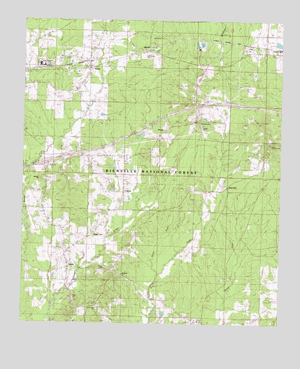
Pulaski, MS USGS Topographic Map
Click on map above to begin viewing in our Map Viewer.

This topographic map contains these locations and features:
Feature Name Type Latitude Longitude GNIS ID View Map
Base Camp OneLocaleN32.3657°W89.5617°704940View Map
Bienville National ForestForestN32.2643°W89.5051°711540View Map
Brassel CemeteryCemeteryN32.2723°W89.5852°692693View Map
Buster Lackey Pond DamDamN32.3668°W89.5034°695450View Map
Central By-Products Sewage Lagoon DamDamN32.3635°W89.5334°695448View Map
Central By-Products Sewage Lagoon DamDamN32.3635°W89.5351°695449View Map
Concord Methodist ChurchChurchN32.3549°W89.5948°705669View Map
Faulkner CemeteryCemeteryN32.3324°W89.5390°704960View Map
FrogtownPopulated PlaceN32.3043°W89.5756°704969View Map
Green BarnLocaleN32.3065°W89.5259°704971View Map
Hunter TownPopulated PlaceN32.2863°W89.5912°704977View Map
Interchange 80CrossingN32.3160°W89.6148°691389View Map
KalemPopulated PlaceN32.3551°W89.5928°704979View Map
Luther Chapel CemeteryCemeteryN32.2571°W89.5884°704987View Map
Moore Fire TowerTowerN32.3240°W89.5053°711278View Map
Morehead CreekStreamN32.2796°W89.6248°693547View Map
Mount Moriah ChurchChurchN32.2696°W89.5753°694065View Map
New ChapelChurchN32.2582°W89.5881°694158View Map
New Zion ChurchChurchN32.3301°W89.5565°694181View Map
North Morton CemeteryCemeteryN32.3621°W89.5651°704994View Map
PulaskiPopulated PlaceN32.2721°W89.6023°694486View Map
Pulaski Baptist ChurchChurchN32.2746°W89.6028°704998View Map
Pulaski Post OfficePost OfficeN32.2729°W89.6025°2768810View Map
RaworthPopulated PlaceN32.3632°W89.5645°694516View Map
Saint Johns ChurchChurchN32.3568°W89.6123°694648View Map
Saint Peter ChurchChurchN32.3310°W89.5387°705000View Map
Saint Peter ChurchChurchN32.3340°W89.5401°694675View Map
Saint Peter SchoolSchoolN32.3329°W89.5403°711528View Map
Saint Peter SchoolSchoolN32.3307°W89.5398°694676View Map
Searcy CemeteryCemeteryN32.2608°W89.6005°705003View Map
Shockaloe Base Camp Recreation SiteLocaleN32.3657°W89.5623°711541View Map
Sims CemeteryCemeteryN32.3149°W89.6120°705006View Map
Spencer HillSummitN32.3096°W89.6156°694852View Map
Wicker BranchStreamN32.2701°W89.5576°695168View Map

Note: Coordinates in the location and feature list above are referenced to NAD83 datum.


Copyright (C) 2008-2024 Ryan Niemi / Sunset Dynamics ... All Rights Reserved