TopoQuest Logo
Do you find TopoQuest useful?
Help keep TopoQuest running and adding new maps/features by donating!
Bitcoin:  19c7KJd3qBynnjoSw5npx9KScwjBe4ifkT
Litecoin:  LXs6TkuXGGXo1vDsWCkWVdjQX94eUKd6ui
Home View Maps Find Maps Find Places Resources & Links


Homewood, Mississippi Topographic Map

USGS Map Title: Homewood, MS
USGS Map MRC: 32089B5
DRG (GeoTIFF) Download: o32089b5.tif


Neighboring USGS Topographic Map Quads:


  Morton, MS  
32089C6
 

  Pulaski, MS  
32089C5
 

  Forest, MS  
32089C4
 

  Polkville, MS  
32089B6
 

  Homewood, MS  
32089B5
 

  Pineville, MS  
32089B4
 

  White Oak, MS  
32089A6
 

  Raleigh, MS  
32089A5
 

  Louin SW, MS  
32089A4


Map MRC Location:

N33°
W90°
N33°
W89°
H8 H7 H6 H5 H4 H3 H2 H1
G8 G7 G6 G5 G4 G3 G2 G1
F8 F7 F6 F5 F4 F3 F2 F1
E8 E7 E6 E5 E4 E3 E2 E1
D8 D7 D6 D5 D4 D3 D2 D1
C8 C7 C6 C5 C4 C3 C2 C1
B8 B7 B6 B5 B4 B3 B2 B1
A8 A7 A6 A5 A4 A3 A2 A1
N32°
W90°
N32°
W89°

Homewood, MS USGS 1:24K Topographic Map Preview:
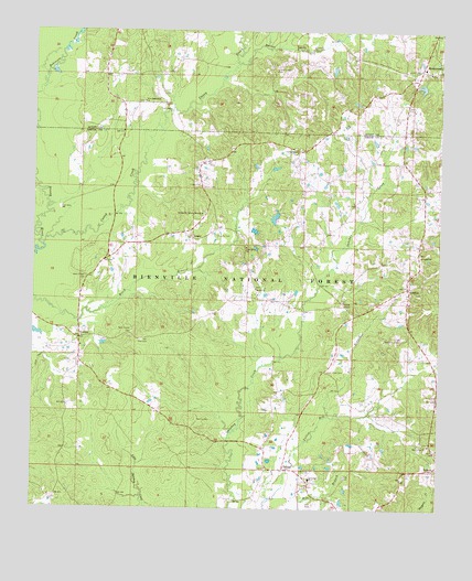
Homewood, MS USGS Topographic Map
Click on map above to begin viewing in our Map Viewer.

This topographic map contains these locations and features:
Feature Name Type Latitude Longitude GNIS ID View Map
Barber CemeteryCemeteryN32.1322°W89.5386°2766923View Map
Barber CreekStreamN32.2415°W89.5634°692456View Map
Bethel Baptist Church CemeteryCemeteryN32.1831°W89.5565°2766929View Map
Bethel ChurchChurchN32.1826°W89.5565°692560View Map
Black CemeteryCemeteryN32.2091°W89.5732°692626View Map
BurnsPopulated PlaceN32.1354°W89.5478°692775View Map
Burns Baptist CemeteryCemeteryN32.1322°W89.5384°2766922View Map
Burns Methodist CemeteryCemeteryN32.1310°W89.5399°2766921View Map
Burns PitMineN32.1390°W89.5209°707241View Map
Burns SchoolSchoolN32.1332°W89.5398°692776View Map
Caney CreekStreamN32.1935°W89.6226°692837View Map
Derrick CemeteryCemeteryN32.1484°W89.5742°693086View Map
E Y Mangum Lake DamDamN32.2168°W89.5584°695426View Map
Ellen Tadlock Pond DamDamN32.2335°W89.5034°695429View Map
Evangelist Temple MissionChurchN32.2021°W89.5734°693188View Map
Gasque ChapelChurchN32.1793°W89.5295°693285View Map
Gasque Chapel CemeteryCemeteryN32.1793°W89.5299°2766919View Map
Good Hope CemeteryCemeteryN32.1614°W89.5345°693317View Map
Good Hope ChurchChurchN32.1935°W89.5598°693321View Map
Good Hope Church (historical)ChurchN32.2226°W89.5984°704925View Map
Goodwater Baptist Church CemeteryCemeteryN32.1416°W89.5028°2766932View Map
Goodwater ChurchChurchN32.1421°W89.5028°693326View Map
HomewoodPopulated PlaceN32.2401°W89.5062°693515View Map
Homewood Volunteer Fire DepartmentBuildingN32.2344°W89.5140°2667979View Map
LemonPopulated PlaceN32.1360°W89.5015°693709View Map
LinglePopulated PlaceN32.1957°W89.5773°693734View Map
Lingle CemeteryCemeteryN32.2098°W89.5739°693735View Map
LorenaPopulated PlaceN32.1829°W89.5095°693828View Map
Lorena Baptist Church CemeteryCemeteryN32.1919°W89.5061°2766918View Map
Lorena Baptist Church Extension CemeteryCemeteryN32.1975°W89.5059°2766917View Map
Lorena ChurchChurchN32.1913°W89.5056°693829View Map
Luther ChapelChurchN32.2185°W89.5442°693847View Map
Luther Chapel CemeteryCemeteryN32.2405°W89.5513°693848View Map
Luther Chapel Lutheran Church CemeteryCemeteryN32.2183°W89.5444°2766916View Map
New Chapel CemeteryCemeteryN32.1709°W89.5947°694159View Map
New Chapel CemeteryCemeteryN32.1854°W89.6092°694160View Map
New Good Hope CemeteryCemeteryN32.2314°W89.5920°2766928View Map
New Good Hope ChurchChurchN32.2315°W89.5915°694164View Map
Pitt BranchStreamN32.1493°W89.5337°694413View Map
Providence CemeteryCemeteryN32.1356°W89.5529°2766920View Map
Roberts CemeteryCemeteryN32.1968°W89.5686°694577View Map
Spinola School (historical)SchoolN32.1424°W89.5101°704935View Map
TrentonPopulated PlaceN32.1693°W89.6109°695003View Map
Wallace Epting Lake DamDamN32.2018°W89.5517°695425View Map
WickerPopulated PlaceN32.2188°W89.5431°707281View Map
Zion Lutheran CemeteryCemeteryN32.1689°W89.5919°695234View Map

Note: Coordinates in the location and feature list above are referenced to NAD83 datum.


Copyright (C) 2008-2025 Ryan Niemi / Sunset Dynamics ... All Rights Reserved