TopoQuest Logo
Do you find TopoQuest useful?
Help keep TopoQuest running and adding new maps/features by donating!
Bitcoin:  19c7KJd3qBynnjoSw5npx9KScwjBe4ifkT
Litecoin:  LXs6TkuXGGXo1vDsWCkWVdjQX94eUKd6ui
Home View Maps Find Maps Find Places Resources & Links


Forest, Mississippi Topographic Map

USGS Map Title: Forest, MS
USGS Map MRC: 32089C4
DRG (GeoTIFF) Download: o32089c4.tif


Neighboring USGS Topographic Map Quads:


  Hillsboro, MS  
32089D5
 

  Harperville, MS  
32089D4
 

  Conehatta, MS  
32089D3
 

  Pulaski, MS  
32089C5
 

  Forest, MS  
32089C4
 

  Lake, MS  
32089C3
 

  Homewood, MS  
32089B5
 

  Pineville, MS  
32089B4
 

  Clear Springs, MS  
32089B3


Map MRC Location:

N33°
W90°
N33°
W89°
H8 H7 H6 H5 H4 H3 H2 H1
G8 G7 G6 G5 G4 G3 G2 G1
F8 F7 F6 F5 F4 F3 F2 F1
E8 E7 E6 E5 E4 E3 E2 E1
D8 D7 D6 D5 D4 D3 D2 D1
C8 C7 C6 C5 C4 C3 C2 C1
B8 B7 B6 B5 B4 B3 B2 B1
A8 A7 A6 A5 A4 A3 A2 A1
N32°
W90°
N32°
W89°

Forest, MS USGS 1:24K Topographic Map Preview:
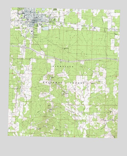
Forest, MS USGS Topographic Map
Click on map above to begin viewing in our Map Viewer.

This topographic map contains these locations and features:
Feature Name Type Latitude Longitude GNIS ID View Map
Assembly of God ChurchChurchN32.3679°W89.4740°704939View Map
Bienville District Ranger OfficeBuildingN32.3163°W89.4876°711525View Map
Bienville Pines Scenic AreaParkN32.3490°W89.4709°704944View Map
Bienville Work CenterBuildingN32.3549°W89.4670°711526View Map
Calvary Baptist ChurchChurchN32.3699°W89.4765°704947View Map
Caney Creek State Wildlife Management AreaParkN32.3335°W89.4417°704948View Map
City of ForestCivilN32.3595°W89.4761°2403632View Map
City of Forest Fire DepartmentBuildingN32.3626°W89.4715°2667696View Map
Covenant Presbyterian ChurchChurchN32.3718°W89.4840°704953View Map
Crout CreekStreamN32.2846°W89.4159°693019View Map
DonohoePopulated PlaceN32.3515°W89.3826°693098View Map
Eastern CemeteryCemeteryN32.3649°W89.4565°704958View Map
FikestownPopulated PlaceN32.3035°W89.4037°693213View Map
ForestPopulated PlaceN32.3646°W89.4742°693243View Map
Forest Baptist ChurchChurchN32.3615°W89.4701°685097View Map
Forest City HallBuildingN32.3632°W89.4723°704966View Map
Forest City Police DepartmentBuildingN32.3596°W89.4863°2754255View Map
Forest Country Club Lake DamDamN32.3135°W89.4934°695435View Map
Forest Elementary SchoolSchoolN32.3710°W89.4853°707289View Map
Forest High SchoolSchoolN32.3699°W89.4853°707290View Map
Forest Methodist ChurchChurchN32.3629°W89.4698°704967View Map
Forest Post OfficePost OfficeN32.3629°W89.4721°712612View Map
Forest Presbyterian ChurchChurchN32.3615°W89.4717°704968View Map
Forest SchoolSchoolN32.3685°W89.4376°693246View Map
Forest Sewage Lagoon DamDamN32.3551°W89.4767°695443View Map
Forest Sewage Lagoon DamDamN32.3701°W89.4617°695451View Map
G V Montgomery AirportAirportN32.3554°W89.4873°695268View Map
Gatewood CemeteryCemeteryN32.2800°W89.4548°704970View Map
George Gatewood Catfish Pond DamDamN32.3001°W89.4084°695433View Map
Green Grove ChurchChurchN32.2588°W89.4673°693353View Map
Harrell Prairie Botanical AreaParkN32.3357°W89.4398°711527View Map
Harrell Prairie HillSummitN32.3351°W89.4409°693420View Map
Hawkins Middle SchoolSchoolN32.3590°W89.4648°704974View Map
High Hill ChurchChurchN32.2921°W89.4359°693476View Map
Hopewell ChurchChurchN32.2771°W89.4498°693526View Map
Interchange 88CrossingN32.3363°W89.4837°691390View Map
Jones ChapelChurchN32.3046°W89.4203°693633View Map
Jones CreekStreamN32.2871°W89.4167°693636View Map
Kingdom HallChurchN32.3551°W89.4726°704980View Map
Magnolia Heights ChurchChurchN32.3585°W89.4134°685102View Map
Mars Hill ChurchChurchN32.2968°W89.4895°694043View Map
Mathes HillSummitN32.3071°W89.4534°693889View Map
Moore SchoolSchoolN32.2690°W89.4951°694031View Map
Mount Zion ChurchChurchN32.2574°W89.4448°705588View Map
Mount Zion SchoolSchoolN32.2576°W89.4437°694122View Map
New Bethal ChurchChurchN32.3468°W89.4742°705592View Map
New Bethel ChurchChurchN32.3468°W89.4751°693873View Map
NorrisPopulated PlaceN32.2940°W89.4359°694204View Map
Oak Grove ChurchChurchN32.3057°W89.3992°694232View Map
Pinkston HillSummitN32.2688°W89.3928°694405View Map
Pleasant Valley ChurchChurchN32.2674°W89.3795°705593View Map
S E Lackey Memorial HospitalHospitalN32.3660°W89.4702°704983View Map
Scott County CourthouseBuildingN32.3626°W89.4737°705002View Map
Scott County Sheriff's OfficeBuildingN32.3545°W89.4826°2754072View Map
Sherman HillSummitN32.2763°W89.3856°694763View Map
Sherman Hill SchoolSchoolN32.2688°W89.3803°694764View Map
Supervisor District 2CivilN32.2953°W89.4321°712056View Map
Walk HillSummitN32.2515°W89.3765°695080View Map
Whiteway Farms Lake DamDamN32.3585°W89.4417°695446View Map
WJYV-AM (Forest)TowerN32.3629°W89.4192°695249View Map
WQST-FM (Forest)TowerN32.3607°W89.4203°695252View Map

Note: Coordinates in the location and feature list above are referenced to NAD83 datum.


Copyright (C) 2008-2025 Ryan Niemi / Sunset Dynamics ... All Rights Reserved