TopoQuest Logo
Do you find TopoQuest useful?
Help keep TopoQuest running and adding new maps/features by donating!
Bitcoin:  19c7KJd3qBynnjoSw5npx9KScwjBe4ifkT
Litecoin:  LXs6TkuXGGXo1vDsWCkWVdjQX94eUKd6ui
Home View Maps Find Maps Find Places Resources & Links


Redbay, Florida Topographic Map

USGS Map Title: Redbay, FL
USGS Map MRC: 30085E8
DRG (GeoTIFF) Download: o30085e8.tif


Neighboring USGS Topographic Map Quads:


  De Funiak Springs East, FL  
30086F1
 

  Ponce de Leon, FL  
30085F8
 

  Hinsons Crossroads, FL  
30085F7
 

  Rock Hill, FL  
30086E1
 

  Redbay, FL  
30085E8
 

  Millers Ferry, FL  
30085E7
 

  Bunker, FL  
30086D1


  Red Head, FL  
30085D7


Map MRC Location:

N31°
W86°
N31°
W85°
H8 H7 H6 H5 H4 H3 H2 H1
G8 G7 G6 G5 G4 G3 G2 G1
F8 F7 F6 F5 F4 F3 F2 F1
E8 E7 E6 E5 E4 E3 E2 E1
D8 D7 D6 D5 D4 D3 D2 D1
C8 C7 C6 C5 C4 C3 C2 C1
B8 B7 B6 B5 B4 B3 B2 B1
A8 A7 A6 A5 A4 A3 A2 A1
N30°
W86°
N30°
W85°

Redbay, FL USGS 1:24K Topographic Map Preview:
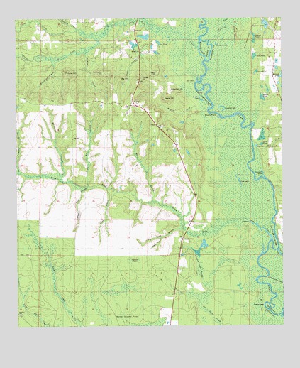
Redbay, FL USGS Topographic Map
Click on map above to begin viewing in our Map Viewer.

This topographic map contains these locations and features:
Feature Name Type Latitude Longitude GNIS ID View Map
Antioch CemeteryCemeteryN30.5055°W85.9994°277908View Map
Battle Ground ForksPopulated PlaceN30.5046°W85.9497°295112View Map
Bear HammockIslandN30.6152°W85.8919°278316View Map
Big Head BranchStreamN30.5396°W85.9213°278683View Map
Big HillSummitN30.6005°W85.9508°278686View Map
Boggy HeadValleyN30.5357°W85.9322°279172View Map
Bruce CreekStreamN30.6132°W85.9138°279503View Map
Bruce Creek SchoolSchoolN30.6155°W85.9416°279504View Map
Brushy PointCapeN30.5852°W85.9047°279523View Map
Buzzard Roost SwampSwampN30.5258°W85.9154°279773View Map
Carlisle LakeStreamN30.6146°W85.9080°280035View Map
Carter BranchStreamN30.5546°W85.9522°280081View Map
Chub PondLakeN30.5731°W85.8874°280441View Map
Crawford HillSummitN30.5957°W85.9263°281013View Map
Crawford LakeLakeN30.5893°W85.9032°281015View Map
Crooked CreekStreamN30.6166°W85.9613°281066View Map
Cypress PondLakeN30.6225°W85.8826°281233View Map
Cypress PondSwampN30.5269°W85.9471°281236View Map
Dave McCloud PondLakeN30.5330°W85.9427°298141View Map
Dead River CemeteryCemeteryN30.5355°W85.9216°281389View Map
Duck PondSwampN30.5739°W85.8848°281829View Map
Dykes HillSummitN30.6032°W85.9758°281909View Map
Endless LakeLakeN30.5917°W85.9127°282215View Map
Gannet PondLakeN30.6190°W85.8894°282900View Map
Gar PondLakeN30.6154°W85.9330°282914View Map
Grape Head BranchStreamN30.5566°W85.9660°283288View Map
Gum PondLakeN30.6099°W85.8878°283540View Map
Hogan HillSummitN30.6027°W85.9335°284113View Map
Horseshoe LakeLakeN30.6144°W85.9054°284313View Map
Hughes DitchStreamN30.5882°W85.9099°284385View Map
Hunter BranchStreamN30.6224°W85.9483°284398View Map
Hunter HillSummitN30.6007°W85.9408°284403View Map
Lassiter LakeLakeN30.5620°W85.8840°285358View Map
Laurel HillSummitN30.5921°W85.9297°285398View Map
Little Lost LakeLakeN30.5609°W85.8968°285732View Map
Lost LakeLakeN30.5586°W85.8948°286111View Map
McCallum BranchStreamN30.6082°W85.9833°286572View Map
McKinnon BranchStreamN30.5602°W85.9785°286634View Map
McKinnon BranchStreamN30.6110°W85.9674°286635View Map
McKinnon HillSummitN30.6027°W85.9580°286636View Map
Menge PondLakeN30.6032°W85.8870°286958View Map
Mill BranchStreamN30.5507°W85.9360°286857View Map
Mill CreekStreamN30.5702°W85.8880°286878View Map
Mount HammockIslandN30.6182°W85.8960°287221View Map
New Ground PondSwampN30.5774°W85.8846°287614View Map
Oakle BendBendN30.5083°W85.8827°288021View Map
Palmetto BranchStreamN30.5621°W85.9985°288433View Map
RedbayPopulated PlaceN30.5924°W85.9449°289556View Map
Redbay CemeteryCemeteryN30.6124°W85.9408°289557View Map
Redbay TowerTowerN30.5819°W85.9344°301683View Map
Roaring CutoffChannelN30.6119°W85.9133°289771View Map
Seven RunsStreamN30.5352°W85.8802°290869View Map
Spears BranchStreamN30.6227°W85.9749°291489View Map
Story LandingLocaleN30.5996°W85.9152°295652View Map
Sugar Mill BranchStreamN30.5571°W85.9663°291775View Map
Walton County Fire Rescue Station 8 - Red Bay Fire StationBuildingN30.5891°W85.9435°2644246View Map
Watson PondLakeN30.5929°W85.8841°292945View Map
White CreekStreamN30.6199°W85.9769°293201View Map

Note: Coordinates in the location and feature list above are referenced to NAD83 datum.


Copyright (C) 2008-2025 Ryan Niemi / Sunset Dynamics ... All Rights Reserved