TopoQuest Logo
Do you find TopoQuest useful?
Help keep TopoQuest running and adding new maps/features by donating!
Bitcoin:  19c7KJd3qBynnjoSw5npx9KScwjBe4ifkT
Litecoin:  LXs6TkuXGGXo1vDsWCkWVdjQX94eUKd6ui
Home View Maps Find Maps Find Places Resources & Links


Ponce de Leon, Florida Topographic Map

USGS Map Title: Ponce de Leon, FL
USGS Map MRC: 30085F8
DRG (GeoTIFF) Download: o30085f8.tif


Neighboring USGS Topographic Map Quads:


  Glendale, FL  
30086G1
 

  Prosperity, FL  
30085G8
 

  Caryville, FL  
30085G7
 

  De Funiak Springs East, FL  
30086F1
 

  Ponce de Leon, FL  
30085F8
 

  Hinsons Crossroads, FL  
30085F7
 

  Rock Hill, FL  
30086E1
 

  Redbay, FL  
30085E8
 

  Millers Ferry, FL  
30085E7


Map MRC Location:

N31°
W86°
N31°
W85°
H8 H7 H6 H5 H4 H3 H2 H1
G8 G7 G6 G5 G4 G3 G2 G1
F8 F7 F6 F5 F4 F3 F2 F1
E8 E7 E6 E5 E4 E3 E2 E1
D8 D7 D6 D5 D4 D3 D2 D1
C8 C7 C6 C5 C4 C3 C2 C1
B8 B7 B6 B5 B4 B3 B2 B1
A8 A7 A6 A5 A4 A3 A2 A1
N30°
W86°
N30°
W85°

Ponce de Leon, FL USGS 1:24K Topographic Map Preview:
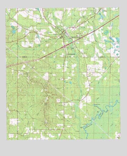
Ponce de Leon, FL USGS Topographic Map
Click on map above to begin viewing in our Map Viewer.

This topographic map contains these locations and features:
Feature Name Type Latitude Longitude GNIS ID View Map
Beech Grove SchoolSchoolN30.6271°W85.9877°278395View Map
Big Reedy CreekStreamN30.7316°W85.9022°278733View Map
Black BranchStreamN30.7446°W85.9955°278879View Map
Black PondLakeN30.7467°W85.8929°278936View Map
Blue CreekStreamN30.7249°W85.9347°279015View Map
Bonds BranchStreamN30.7346°W85.9835°279200View Map
Camp BranchStreamN30.6382°W85.9199°279874View Map
Clear PondLakeN30.7416°W85.8942°280539View Map
Coosada Old Town (historical)Populated PlaceN30.6335°W85.8999°294501View Map
Cow BranchStreamN30.7349°W85.9602°280916View Map
Douglass CrossroadsPopulated PlaceN30.6877°W85.9766°294749View Map
Forhan PondLakeN30.7194°W85.8831°282668View Map
Hardy CemeteryCemeteryN30.6269°W85.8772°1994526View Map
Hog CreekStreamN30.7421°W85.9938°284078View Map
Holiness ChurchChurchN30.6291°W85.9822°284150View Map
Hughes DitchStreamN30.6824°W85.9205°284386View Map
Jack BayBayN30.7046°W85.9952°300944View Map
Jackson SpringSpringN30.7116°W85.9277°284689View Map
Jenkins BaySwampN30.7445°W85.9538°284743View Map
John PondLakeN30.7267°W85.9537°284843View Map
Knox HillPopulated PlaceN30.6416°W85.9577°285168View Map
Knox Hill ChurchChurchN30.6349°W85.9513°285169View Map
Knox Hill SchoolSchoolN30.6419°W85.9558°285170View Map
Little Reedy CreekStreamN30.7319°W85.9022°285777View Map
Long PondLakeN30.7235°W85.9641°286060View Map
Long Pond HillSummitN30.7271°W85.9694°286070View Map
Magnolia ChurchChurchN30.6305°W85.9877°286295View Map
Mill CreekStreamN30.7213°W85.9324°286882View Map
Morrison SpringSpringN30.6580°W85.9041°287152View Map
Morrison Spring RunStreamN30.6524°W85.8947°287153View Map
Mount Zion SchoolSchoolN30.7221°W85.8835°287367View Map
Oak Grove BranchStreamN30.6910°W85.9224°287935View Map
Oak Grove ChurchChurchN30.7469°W85.9022°287952View Map
Oak Grove SchoolSchoolN30.6882°W85.9497°287962View Map
Peavey CreekStreamN30.6371°W85.9797°288646View Map
Pleasant Valley ChurchChurchN30.6602°W85.9366°289079View Map
Ponce de LeonPopulated PlaceN30.7230°W85.9374°289171View Map
Ponce de Leon CemeteryCemeteryN30.7327°W85.9460°289172View Map
Ponce de Leon Elementary SchoolSchoolN30.7269°W85.9324°298501View Map
Ponce de Leon High SchoolSchoolN30.7445°W85.9606°298500View Map
Ponce De Leon Post OfficePost OfficeN30.7276°W85.9384°2759177View Map
Ponce de Leon SpringSpringN30.7211°W85.9309°289174View Map
Ponce de Leon Springs State ParkParkN30.7085°W85.9269°307404View Map
Ponce De Leon Volunteer Fire and RescueBuildingN30.7214°W85.9511°2644383View Map
Poplar Spring SchoolSchoolN30.6913°W85.9833°289210View Map
Ray HillSummitN30.6605°W85.9572°289517View Map
Redbay DivisionCivilN30.6358°W85.9899°1935913View Map
Reedy CreekStreamN30.6460°W85.9049°289608View Map
Saint John ChurchChurchN30.6827°W85.9733°290208View Map
Saint Johns ChurchChurchN30.6463°W85.9708°290227View Map
Saint Paul HillSummitN30.6816°W85.9419°290334View Map
Sand PondLakeN30.7094°W85.8801°290575View Map
Sandy CreekStreamN30.6307°W85.9124°290612View Map
Sheep HillSummitN30.7252°W85.9183°290956View Map
Tobacco Bed PondLakeN30.7157°W85.8824°292323View Map
Town of Ponce de LeonCivilN30.7233°W85.9374°2407146View Map
Wolf BaySwampN30.7315°W85.9148°293449View Map

Note: Coordinates in the location and feature list above are referenced to NAD83 datum.


Copyright (C) 2008-2024 Ryan Niemi / Sunset Dynamics ... All Rights Reserved