TopoQuest Logo
Do you find TopoQuest useful?
Help keep TopoQuest running and adding new maps/features by donating!
Bitcoin:  19c7KJd3qBynnjoSw5npx9KScwjBe4ifkT
Litecoin:  LXs6TkuXGGXo1vDsWCkWVdjQX94eUKd6ui
Home View Maps Find Maps Find Places Resources & Links


Robbins, Texas Topographic Map

USGS Map Title: Robbins, TX
USGS Map MRC: 31096C1
DRG (GeoTIFF) Download: o31096c1.tif


Neighboring USGS Topographic Map Quads:


  Donie, TX  
31096D2
 

  Buffalo, TX  
31096D1
 

  Flo, TX  
31095D8
 

  Jewett, TX  
31096C2
 

  Robbins, TX  
31096C1
 

  Centerville, TX  
31095C8
 

  Margie, TX  
31096B2
 

  Spring Seat, TX  
31096B1
 

  Leona, TX  
31095B8


Map MRC Location:

N32°
W97°
N32°
W96°
H8 H7 H6 H5 H4 H3 H2 H1
G8 G7 G6 G5 G4 G3 G2 G1
F8 F7 F6 F5 F4 F3 F2 F1
E8 E7 E6 E5 E4 E3 E2 E1
D8 D7 D6 D5 D4 D3 D2 D1
C8 C7 C6 C5 C4 C3 C2 C1
B8 B7 B6 B5 B4 B3 B2 B1
A8 A7 A6 A5 A4 A3 A2 A1
N31°
W97°
N31°
W96°

Robbins, TX USGS 1:24K Topographic Map Preview:
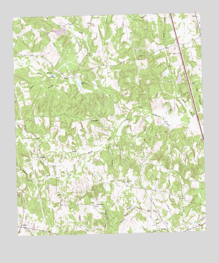
Robbins, TX USGS Topographic Map
Click on map above to begin viewing in our Map Viewer.

This topographic map contains these locations and features:
Feature Name Type Latitude Longitude GNIS ID View Map
Alligator HollowValleyN31.3064°W96.0596°1351016View Map
CorinthPopulated PlaceN31.3730°W96.0030°1379589View Map
Crews Lake Number 1ReservoirN31.3665°W96.0944°1862601View Map
Crews Lake Number 1 DamDamN31.3668°W96.0902°1862600View Map
Curtiss CemeteryCemeteryN31.2641°W96.0516°1355490View Map
Curtiss Spring BranchStreamN31.2643°W96.0444°1355491View Map
Ely BranchStreamN31.3171°W96.0336°1356999View Map
FriendshipPopulated PlaceN31.2946°W96.1091°1379806View Map
Hogpen BranchStreamN31.3407°W96.0952°1359386View Map
Liberty CemeteryCemeteryN31.3343°W96.0072°1361144View Map
Lime BranchStreamN31.2516°W96.0230°1361200View Map
Little Keechi CreekStreamN31.3205°W96.0472°1361394View Map
Lower Flag PondLakeN31.3363°W96.0802°1361912View Map
Madison BranchStreamN31.2810°W96.1141°1362062View Map
Mount Lily ChurchChurchN31.2796°W96.0516°1363264View Map
North Fork Lower Keechi CreekStreamN31.3335°W96.0641°1364060View Map
North SalemPopulated PlaceN31.3143°W96.0739°1380267View Map
Old Union CemeteryCemeteryN31.3705°W96.0705°1364496View Map
Reed CreekStreamN31.2968°W96.0716°1366302View Map
RobbinsPopulated PlaceN31.2555°W96.1227°1380445View Map
Simpson BranchStreamN31.2510°W96.0775°1368305View Map
Smith BranchStreamN31.3113°W96.0036°1368461View Map
South SalemPopulated PlaceN31.2680°W96.0716°1380576View Map
Tularosa Farms LakeReservoirN31.3376°W96.0151°1864217View Map
Tularosa Farms Lake DamDamN31.3368°W96.0169°1864216View Map
Upper Flag PondLakeN31.3421°W96.0981°1370507View Map
Whites BranchStreamN31.3630°W96.0002°1376770View Map

Note: Coordinates in the location and feature list above are referenced to NAD83 datum.


Copyright (C) 2008-2024 Ryan Niemi / Sunset Dynamics ... All Rights Reserved