TopoQuest Logo
Do you find TopoQuest useful?
Help keep TopoQuest running and adding new maps/features by donating!
Bitcoin:  19c7KJd3qBynnjoSw5npx9KScwjBe4ifkT
Litecoin:  LXs6TkuXGGXo1vDsWCkWVdjQX94eUKd6ui
Home View Maps Find Maps Find Places Resources & Links


Spring Seat, Texas Topographic Map

USGS Map Title: Spring Seat, TX
USGS Map MRC: 31096B1
DRG (GeoTIFF) Download: o31096b1.tif


Neighboring USGS Topographic Map Quads:


  Jewett, TX  
31096C2
 

  Robbins, TX  
31096C1
 

  Centerville, TX  
31095C8
 

  Margie, TX  
31096B2
 

  Spring Seat, TX  
31096B1
 

  Leona, TX  
31095B8
 

  Hilltop Lakes, TX  
31096A2
 

  Normangee, TX  
31096A1
 

  Leona SW, TX  
31095A8


Map MRC Location:

N32°
W97°
N32°
W96°
H8 H7 H6 H5 H4 H3 H2 H1
G8 G7 G6 G5 G4 G3 G2 G1
F8 F7 F6 F5 F4 F3 F2 F1
E8 E7 E6 E5 E4 E3 E2 E1
D8 D7 D6 D5 D4 D3 D2 D1
C8 C7 C6 C5 C4 C3 C2 C1
B8 B7 B6 B5 B4 B3 B2 B1
A8 A7 A6 A5 A4 A3 A2 A1
N31°
W97°
N31°
W96°

Spring Seat, TX USGS 1:24K Topographic Map Preview:
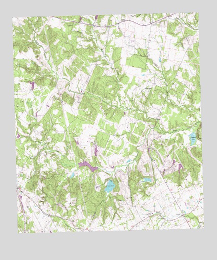
Spring Seat, TX USGS Topographic Map
Click on map above to begin viewing in our Map Viewer.

This topographic map contains these locations and features:
Feature Name Type Latitude Longitude GNIS ID View Map
Bethanna ChurchChurchN31.1688°W96.1158°1351934View Map
Boyd BranchStreamN31.2443°W96.0708°1352777View Map
Buzzard BranchStreamN31.2349°W96.0691°1353441View Map
Cryar LakeReservoirN31.2135°W96.1069°1859053View Map
Easterling LakeReservoirN31.1713°W96.0715°1864225View Map
Easterling Lake DamDamN31.1702°W96.0702°1864224View Map
Evans ChapelChurchN31.1313°W96.0275°1357101View Map
FlynnPopulated PlaceN31.1510°W96.1244°1357519View Map
Flynn CemeteryCemeteryN31.1410°W96.1111°1357520View Map
Flynn Post OfficePost OfficeN31.1470°W96.1248°2731469View Map
Flynn Volunteer Fire DepartmentBuildingN31.1507°W96.1245°2552650View Map
Greer BranchStreamN31.2438°W96.0088°1358417View Map
Hayden LakeLakeN31.1775°W96.0062°1358931View Map
Hayden MountainSummitN31.1843°W96.0002°1358932View Map
Herbert Cryar DamDamN31.2135°W96.1069°1859052View Map
Keith LakeReservoirN31.1540°W96.0378°1859049View Map
Keith Lake DamDamN31.1552°W96.0402°1859048View Map
Lake ReedReservoirN31.1510°W96.0626°1366307View Map
Lake Reed DamDamN31.1552°W96.0619°1859050View Map
McDaniel CreekStreamN31.1963°W96.0525°1362414View Map
Nixon BranchStreamN31.1285°W96.0033°1363920View Map
RedlandPopulated PlaceN31.2446°W96.0316°1380425View Map
Redland ChurchChurchN31.2463°W96.0516°1366282View Map
Seale CemeteryCemeteryN31.2493°W96.0513°1367908View Map
Simms LakeReservoirN31.1631°W96.0767°1864223View Map
Simms Lake DamDamN31.1618°W96.0719°1864222View Map
Smith LakeReservoirN31.1608°W96.0154°1864227View Map
Smith Lake DamDamN31.1635°W96.0136°1864226View Map
Spring CreekStreamN31.1813°W96.0247°1368973View Map
Spring Creek CemeteryCemeteryN31.1882°W96.0405°1368993View Map
Spring SeatPopulated PlaceN31.2071°W96.0372°1380589View Map
Yellow BranchStreamN31.1593°W96.0611°1372031View Map

Note: Coordinates in the location and feature list above are referenced to NAD83 datum.


Copyright (C) 2008-2024 Ryan Niemi / Sunset Dynamics ... All Rights Reserved