TopoQuest Logo
Do you find TopoQuest useful?
Help keep TopoQuest running and adding new maps/features by donating!
Bitcoin:  19c7KJd3qBynnjoSw5npx9KScwjBe4ifkT
Litecoin:  LXs6TkuXGGXo1vDsWCkWVdjQX94eUKd6ui
Home View Maps Find Maps Find Places Resources & Links


Skene, Mississippi Topographic Map

USGS Map Title: Skene, MS
USGS Map MRC: 33090F7
DRG (GeoTIFF) Download: o33090f7.tif


Neighboring USGS Topographic Map Quads:


  Beulah, MS  
33090G8
 

  Pace, MS  
33090G7
 

  Merigold, MS  
33090G6
 

  Lobdell, MS  
33090F8
 

  Skene, MS  
33090F7
 

  Cleveland, MS  
33090F6
 

  Stringtown, MS  
33090E8
 

  Shaw, MS  
33090E7
 

  Boyer, MS  
33090E6


Map MRC Location:

N34°
W91°
N34°
W90°
H8 H7 H6 H5 H4 H3 H2 H1
G8 G7 G6 G5 G4 G3 G2 G1
F8 F7 F6 F5 F4 F3 F2 F1
E8 E7 E6 E5 E4 E3 E2 E1
D8 D7 D6 D5 D4 D3 D2 D1
C8 C7 C6 C5 C4 C3 C2 C1
B8 B7 B6 B5 B4 B3 B2 B1
A8 A7 A6 A5 A4 A3 A2 A1
N33°
W91°
N33°
W90°

Skene, MS USGS 1:24K Topographic Map Preview:
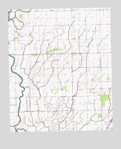
Skene, MS USGS Topographic Map
Click on map above to begin viewing in our Map Viewer.

This topographic map contains these locations and features:
Feature Name Type Latitude Longitude GNIS ID View Map
Bear Pen CanalCanalN33.6937°W90.7804°666661View Map
Bear Pen ParkParkN33.7376°W90.7584°687957View Map
Brushy BayouStreamN33.6782°W90.8476°667676View Map
Camp Slough CanalCanalN33.7357°W90.8440°667988View Map
Chesterfield ChurchChurchN33.6751°W90.8412°668373View Map
Cleveland CrossingPopulated PlaceN33.7473°W90.7976°691771View Map
Damascus ChurchChurchN33.7040°W90.8282°669088View Map
Ditch Number E-3CanalN33.6457°W90.8737°688029View Map
Ditch Number E-5CanalN33.6598°W90.8737°688031View Map
Ditch Number E-7CanalN33.6748°W90.8737°688033View Map
Ditch Number FourCanalN33.7196°W90.8629°688041View Map
Ditch Number FourCanalN33.6471°W90.7715°688042View Map
Ditch Number NineCanalN33.7084°W90.8187°690121View Map
Ditch Number OneCanalN33.6543°W90.7529°688050View Map
Ditch Number SeventeenCanalN33.7390°W90.8126°688057View Map
Ditch Number TenCanalN33.6334°W90.7568°688064View Map
Ditch Number ThreeCanalN33.6968°W90.8484°688067View Map
Ditch Number TwentyCanalN33.7418°W90.8084°688073View Map
Ditch Number TwentyeightCanalN33.7057°W90.7698°688074View Map
Ditch Number TwentynineCanalN33.7171°W90.7682°688075View Map
Ditch Number TwentysixCanalN33.6859°W90.8115°688076View Map
East Bogue HastyStreamN33.6343°W90.8348°669560View Map
El Bethel ChurchChurchN33.6896°W90.7693°669706View Map
Gospel TempleChurchN33.7040°W90.8715°670551View Map
Grassy LakeStreamN33.7121°W90.8548°670607View Map
Icy BayouStreamN33.6671°W90.8390°671651View Map
Judge Brizzell Pond DamDamN33.7368°W90.8668°682322View Map
LaughlinPopulated PlaceN33.7184°W90.7979°672320View Map
LittonPopulated PlaceN33.6459°W90.8373°692007View Map
Mission Bautista MexicanaChurchN33.7479°W90.8232°673687View Map
Mount Olive ChurchChurchN33.7476°W90.8748°674155View Map
Mount Pilgrim ChurchChurchN33.7332°W90.8332°674191View Map
Mount Zion CemeteryCemeteryN33.6415°W90.8634°674323View Map
Mount Zion ChurchChurchN33.6462°W90.8534°674389View Map
New Saint James ChurchChurchN33.7412°W90.7973°674824View Map
Pecan BayouStreamN33.6259°W90.8282°675559View Map
Pleasant Grove ChurchChurchN33.6276°W90.7562°676026View Map
Poplar Grove ChurchChurchN33.6457°W90.8182°676226View Map
Saint John ChurchChurchN33.6457°W90.7809°677063View Map
Saint Paul ChurchChurchN33.6604°W90.7965°677201View Map
Sandy SloughStreamN33.6829°W90.8509°677396View Map
SkenePopulated PlaceN33.7037°W90.7943°677862View Map
Skene SchoolSchoolN33.7043°W90.7984°688095View Map
Snake CreekStreamN33.7390°W90.8737°677958View Map
Supervisor District 5CivilN33.6547°W90.7682°711787View Map
West Bogue HastyStreamN33.6343°W90.8348°679471View Map

Note: Coordinates in the location and feature list above are referenced to NAD83 datum.


Copyright (C) 2008-2025 Ryan Niemi / Sunset Dynamics ... All Rights Reserved