TopoQuest Logo
Do you find TopoQuest useful?
Help keep TopoQuest running and adding new maps/features by donating!
Bitcoin:  19c7KJd3qBynnjoSw5npx9KScwjBe4ifkT
Litecoin:  LXs6TkuXGGXo1vDsWCkWVdjQX94eUKd6ui
Home View Maps Find Maps Find Places Resources & Links


Pace, Mississippi Topographic Map

USGS Map Title: Pace, MS
USGS Map MRC: 33090G7
DRG (GeoTIFF) Download: o33090g7.tif


Neighboring USGS Topographic Map Quads:


  Gunnison, MS  
33090H8
 

  Shelby, MS  
33090H7
 

  Mound Bayou, MS  
33090H6
 

  Beulah, MS  
33090G8
 

  Pace, MS  
33090G7
 

  Merigold, MS  
33090G6
 

  Lobdell, MS  
33090F8
 

  Skene, MS  
33090F7
 

  Cleveland, MS  
33090F6


Map MRC Location:

N34°
W91°
N34°
W90°
H8 H7 H6 H5 H4 H3 H2 H1
G8 G7 G6 G5 G4 G3 G2 G1
F8 F7 F6 F5 F4 F3 F2 F1
E8 E7 E6 E5 E4 E3 E2 E1
D8 D7 D6 D5 D4 D3 D2 D1
C8 C7 C6 C5 C4 C3 C2 C1
B8 B7 B6 B5 B4 B3 B2 B1
A8 A7 A6 A5 A4 A3 A2 A1
N33°
W91°
N33°
W90°

Pace, MS USGS 1:24K Topographic Map Preview:
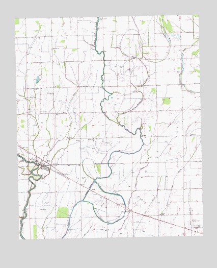
Pace, MS USGS Topographic Map
Click on map above to begin viewing in our Map Viewer.

This topographic map contains these locations and features:
Feature Name Type Latitude Longitude GNIS ID View Map
Aycock CemeteryCemeteryN33.7668°W90.8707°666437View Map
Bellamy Chapel CemeteryCemeteryN33.8737°W90.8174°666786View Map
Big Bradford BayouStreamN33.8140°W90.8048°667081View Map
Bolivar County Correctional FacilityBuildingN33.7691°W90.8054°2739793View Map
Bolivar County FarmLocaleN33.7687°W90.8037°687961View Map
Bolivar County Fire Department District 1 Station 3 PaceBuildingN33.7926°W90.8598°2666046View Map
Bolivar County Sheriff's OfficeBuildingN33.7690°W90.8055°2754174View Map
Bright Star ChurchChurchN33.8498°W90.7673°667572View Map
Cleveland Municipal AirportAirportN33.7598°W90.7562°680403View Map
Ditch Number EightCanalN33.8223°W90.8226°688036View Map
Ditch Number EighteenCanalN33.8543°W90.8626°688037View Map
Ditch Number FiveCanalN33.8362°W90.8626°688038View Map
Ditch Number FiveCanalN33.8668°W90.7845°688039View Map
Ditch Number FourCanalN33.8576°W90.7848°688043View Map
Ditch Number FourCanalN33.7968°W90.7612°688044View Map
Ditch Number NineCanalN33.8046°W90.8334°688047View Map
Ditch Number OneCanalN33.8590°W90.7890°688049View Map
Ditch Number SevenCanalN33.8540°W90.7862°688053View Map
Ditch Number SevenCanalN33.8251°W90.8401°688054View Map
Ditch Number SixCanalN33.8140°W90.8554°688060View Map
Ditch Number ThreeCanalN33.8040°W90.7709°688068View Map
Ditch Number TwoCanalN33.8215°W90.7612°688077View Map
Dry BayouStreamN33.8584°W90.7698°669395View Map
El Bethel CemeteryCemeteryN33.7921°W90.8515°669705View Map
Howarth FarmLocaleN33.7772°W90.8094°2708725View Map
J R Taylor Catfish Ponds DamDamN33.8401°W90.8584°682362View Map
Kimball LakeLakeN33.7626°W90.8037°672125View Map
Kimball LakePopulated PlaceN33.7654°W90.8001°672126View Map
Laban BayouStreamN33.7623°W90.8718°672236View Map
Little Bradford BayouStreamN33.8504°W90.7904°672556View Map
Macedonia ChurchChurchN33.8323°W90.8501°673018View Map
Macedonia Church (historical)ChurchN33.8209°W90.8509°687995View Map
Merigold BrakeSwampN33.8418°W90.7504°687998View Map
Morrison Chapel Baptist ChurchChurchN33.7626°W90.7787°673854View Map
New Hope CemeteryCemeteryN33.8068°W90.8051°674663View Map
New Hope ChurchChurchN33.8068°W90.7907°674724View Map
New Salem ChurchChurchN33.8504°W90.7970°674838View Map
PacePopulated PlaceN33.7915°W90.8570°675367View Map
Pace Center SchoolSchoolN33.8357°W90.8493°675368View Map
Pace ChurchChurchN33.8054°W90.8323°675369View Map
Pace Elementary SchoolSchoolN33.7898°W90.8590°710137View Map
Pace Post OfficePost OfficeN33.7927°W90.8600°2768850View Map
Pilgrim Rest ChurchChurchN33.8068°W90.7573°675759View Map
Pleasant Grove ChurchChurchN33.8062°W90.8232°676031View Map
Rising Star ChurchChurchN33.8573°W90.8495°676671View Map
Saint Peter CemeteryCemeteryN33.7843°W90.8320°677226View Map
Sixmile LakeLakeN33.8681°W90.8194°677858View Map
Smith and Williams CemeteryCemeteryN33.8687°W90.8184°677889View Map
Supervisor District 2CivilN33.7735°W90.7717°711784View Map
Sutter Pond DamDamN33.7968°W90.8701°682345View Map
Tommie BayouStreamN33.7862°W90.8609°678811View Map
Town of PaceCivilN33.7922°W90.8593°2407062View Map
VictorPopulated PlaceN33.7771°W90.8251°692295View Map
Victor CutoffChannelN33.7773°W90.8270°679218View Map

Note: Coordinates in the location and feature list above are referenced to NAD83 datum.


Copyright (C) 2008-2025 Ryan Niemi / Sunset Dynamics ... All Rights Reserved