TopoQuest Logo
Do you find TopoQuest useful?
Help keep TopoQuest running and adding new maps/features by donating!
Bitcoin:  19c7KJd3qBynnjoSw5npx9KScwjBe4ifkT
Litecoin:  LXs6TkuXGGXo1vDsWCkWVdjQX94eUKd6ui
Home View Maps Find Maps Find Places Resources & Links


Cutler Dam, Utah Topographic Map

USGS Map Title: Cutler Dam, UT
USGS Map MRC: 41112G1
DRG (GeoTIFF) Download: o41112g1.tif


Neighboring USGS Topographic Map Quads:


  Portage, UT  
41112H2
 

  Clarkston, UT  
41112H1
 

  Trenton, UT  
41111H8
 

  Riverside, UT  
41112G2
 

  Cutler Dam, UT  
41112G1
 

  Newton, UT  
41111G8
 

  Tremonton, UT  
41112F2
 

  Honeyville, UT  
41112F1
 

  Wellsville, UT  
41111F8


Map MRC Location:

N42°
W113°
N42°
W112°
H8 H7 H6 H5 H4 H3 H2 H1
G8 G7 G6 G5 G4 G3 G2 G1
F8 F7 F6 F5 F4 F3 F2 F1
E8 E7 E6 E5 E4 E3 E2 E1
D8 D7 D6 D5 D4 D3 D2 D1
C8 C7 C6 C5 C4 C3 C2 C1
B8 B7 B6 B5 B4 B3 B2 B1
A8 A7 A6 A5 A4 A3 A2 A1
N41°
W113°
N41°
W112°

Cutler Dam, UT USGS 1:24K Topographic Map Preview:
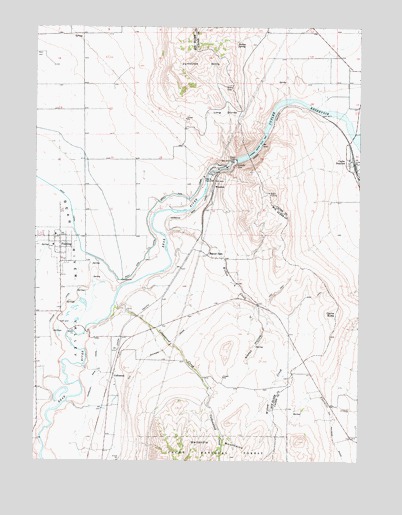
Cutler Dam, UT USGS Topographic Map
Click on map above to begin viewing in our Map Viewer.

This topographic map contains these locations and features:
Feature Name Type Latitude Longitude GNIS ID View Map
Beaver DamLocaleN41.8094°W112.0588°1438527View Map
Beaver Dam CemeteryCemeteryN41.8041°W112.0477°1449889View Map
Bishop SpringSpringN41.8708°W112.0482°1438821View Map
Black RockSummitN41.7944°W112.0008°1425712View Map
Cache ButteSummitN41.7930°W112.0091°1439419View Map
Cache Census Designated PlaceCensusN41.8309°W112.0053°2407937View Map
Cache JunctionPopulated PlaceN41.8355°W112.0027°1439421View Map
CollinstonPopulated PlaceN41.7746°W112.0950°1439895View Map
Cottonwood CreekStreamN41.7944°W112.0955°1440019View Map
Cutler DamDamN41.8366°W112.0475°1440214View Map
East Garland CemeteryCemeteryN41.7677°W112.1194°1435486View Map
FieldingPopulated PlaceN41.8146°W112.1161°1441035View Map
Fielding Elementary SchoolSchoolN41.8150°W112.1174°1448394View Map
Fielding Fire DepartmentBuildingN41.8123°W112.1186°2627434View Map
Fielding Post OfficePost OfficeN41.8143°W112.1165°2769058View Map
Hammond Main CanalCanalN41.7919°W112.0938°1441564View Map
Historical Monument Stage StationParkN41.7863°W112.1052°1454769View Map
Junction HillsSummitN41.8658°W112.0644°1442252View Map
Long DivideRidgeN41.8505°W112.0525°1442901View Map
Poulsen Family CemeteryCemeteryN41.7768°W112.0198°2769280View Map
Sleepy HollowValleyN41.7908°W112.0352°1445673View Map
The Church of Jesus Christ of Latter Day SaintsChurchN41.8005°W112.0486°1450670View Map
The Church of Jesus Christ of Latter Day SaintsChurchN41.8119°W112.1188°1449452View Map
The SloughStreamN41.8446°W112.0011°1446504View Map
Town of FieldingCivilN41.8126°W112.1170°2412625View Map
West Side CanalCanalN41.8230°W112.0800°1447176View Map
WheelonPopulated PlaceN41.8291°W112.0561°1447218View Map
Willow CreekStreamN41.8146°W112.0758°1447412View Map

Note: Coordinates in the location and feature list above are referenced to NAD83 datum.


Copyright (C) 2008-2025 Ryan Niemi / Sunset Dynamics ... All Rights Reserved